MyTopo
Classic USGS Canaan Arkansas 7.5'x7.5' Topo Map
Couldn't load pickup availability
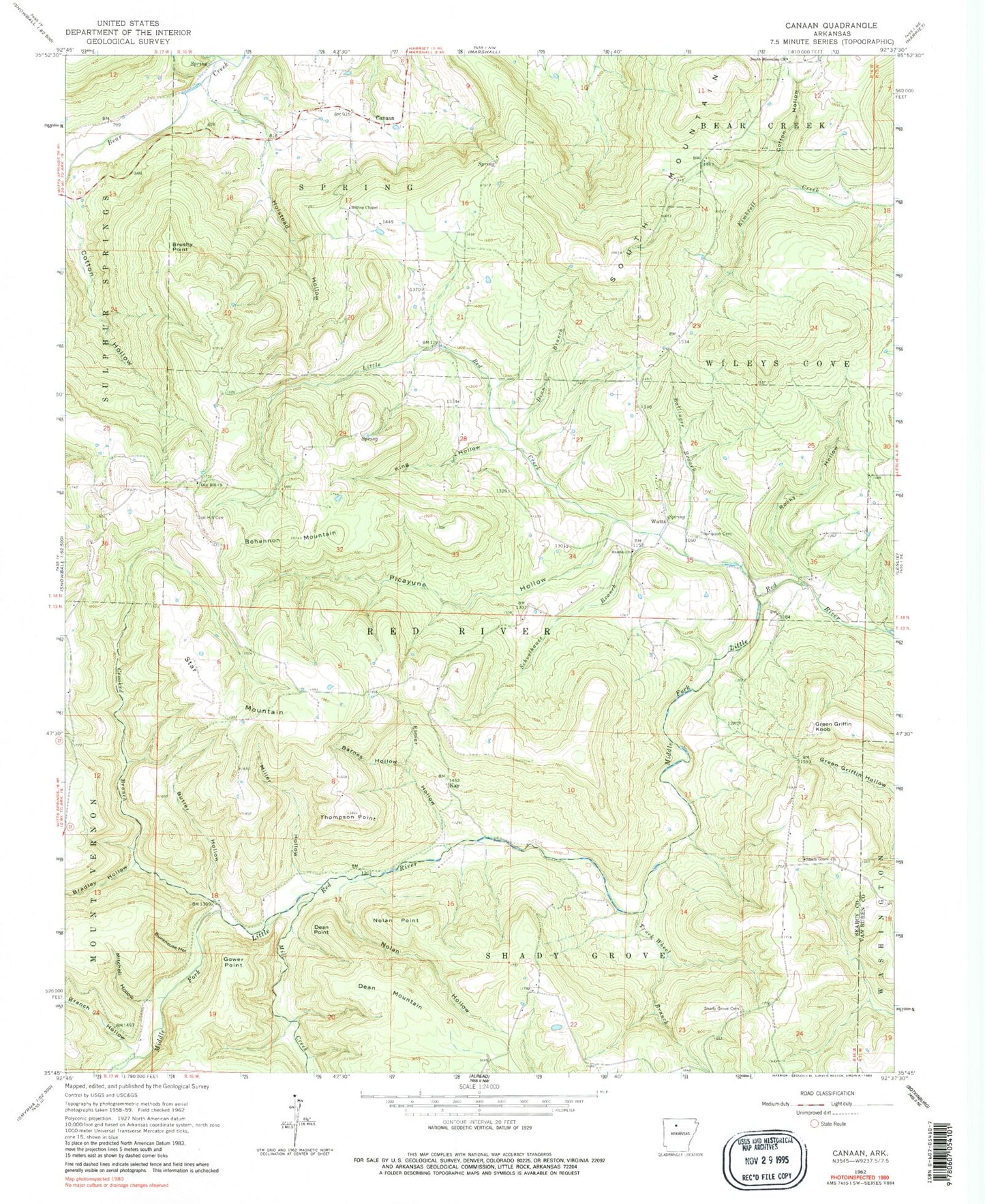
Historical USGS topographic quad map of Canaan in the state of Arkansas. Map scale may vary for some years, but is generally around 1:24,000. Print size is approximately 24" x 27"
This quadrangle is in the following counties: Searcy, Van Buren.
The map contains contour lines, roads, rivers, towns, and lakes. Printed on high-quality waterproof paper with UV fade-resistant inks, and shipped rolled.
Contains the following named places: Ballinger Branch, Barnes Hollow, Bohannon Mountain, Bradley Hollow, Branch Hollow, Brushy Point, Bryan Hollow, Bunkhouse Hollow, Butler Hollow, Canaan, Chimes - Shady Grove Volunteer Fire Department Substation, Cotton Hollow, Crooked Branch, Dean Branch, Dean Mountain, Dean Point, Elmer Hollow, Gower Point, Green Griffin Knob, Hilltop Chapel, Holstead Hollow, Housley Mountain, Kay, King Hollow, KSNE-FM (Marshall), Little Red Creek, Mill Creek, Miller Hollow, Mitchell Hollow, Nolan Hollow, Nolan Point, Oak Hill Cemetery, Oak Hill Church, Picayune Hollow, Rambo Church, Rocky Hollow, Schoolhouse Branch, Shady Grove Cemetery, Shady Grove Church, South Mountain, South Mountain Church, South Mountain Fire Department, Star Mountain, Thompson Cemetery, Thompson Point, Township of Red River, Township of Shady Grove, Truck Wheel Branch, Watts, Welcome Home Fire Department