MyTopo
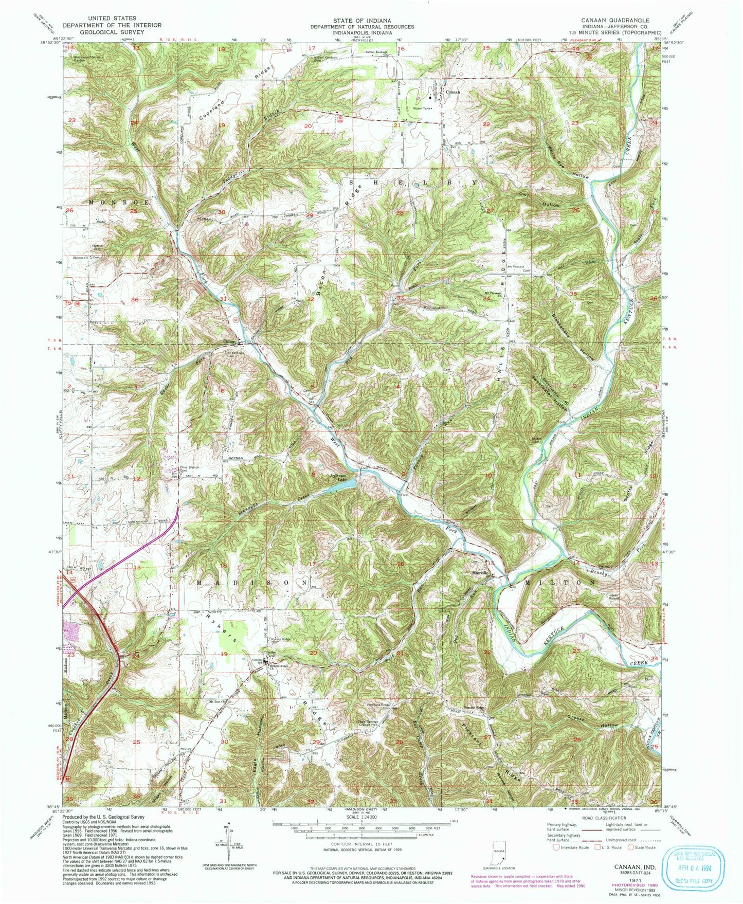
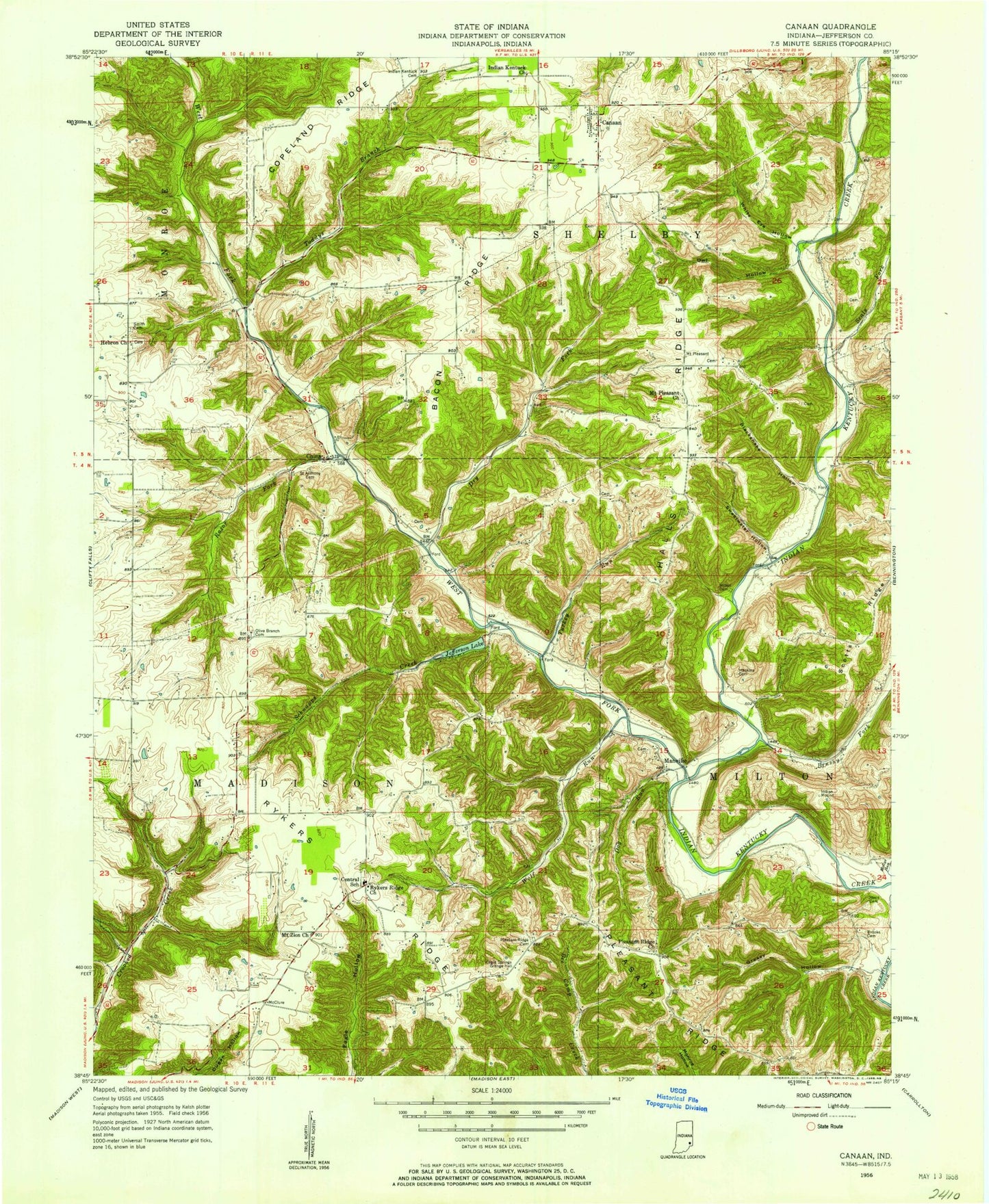
Classic USGS Canaan Indiana 7.5'x7.5' Topo Map
Couldn't load pickup availability
Historical USGS topographic quad map of Canaan in the state of Indiana. Typical map scale is 1:24,000, but may vary for certain years, if available. Print size: 24" x 27"
This quadrangle is in the following counties: Jefferson.
The map contains contour lines, roads, rivers, towns, and lakes. Printed on high-quality waterproof paper with UV fade-resistant inks, and shipped rolled.
Contains the following named places: Bacon Ridge, Blacksnake Hollow, Brushy Fork, Canaan, Central School, China, Copeland Ridge, Dog Run, Dry Fork, Eagle Springs Grange Hall, Grandview Memorial Gardens, Greasy Hollow, Halls Ridge, Hebron Church Cemetery, Indian Kentuck Cemetery, Indian Kentuck Baptist Church, Indian Mound, Jefferson Lake, Joyce Cemetery, Manville, Milton Cemetery, Mount Pleasant Church, Mount Zion Church, Olive Branch Cemetery, Owl Hollow, Pleasant Ridge, Reul Cemetery, Pleasant Ridge Church, Razor Fork, Rykers Ridge, Rykers Ridge Cemetery, Rykers Ridge Baptist Church, Saint Anthony Cemetery, Schnapps Creek, Seals Fork, Smith Cemetery, Sweetwater Hollow, Toddys Branch, Turkey Run, West Fork Indian Kentucky Creek, White Eye Hollow, Wolf Run, Canaan Elementary School, Central, Township of Shelby, Canaan Census Designated Place, Rykers Ridge Volunteer Fire Company, Canaan Volunteer Fire Company, Kings Daughters Hospital, Canaan Post Office