
MyTopo
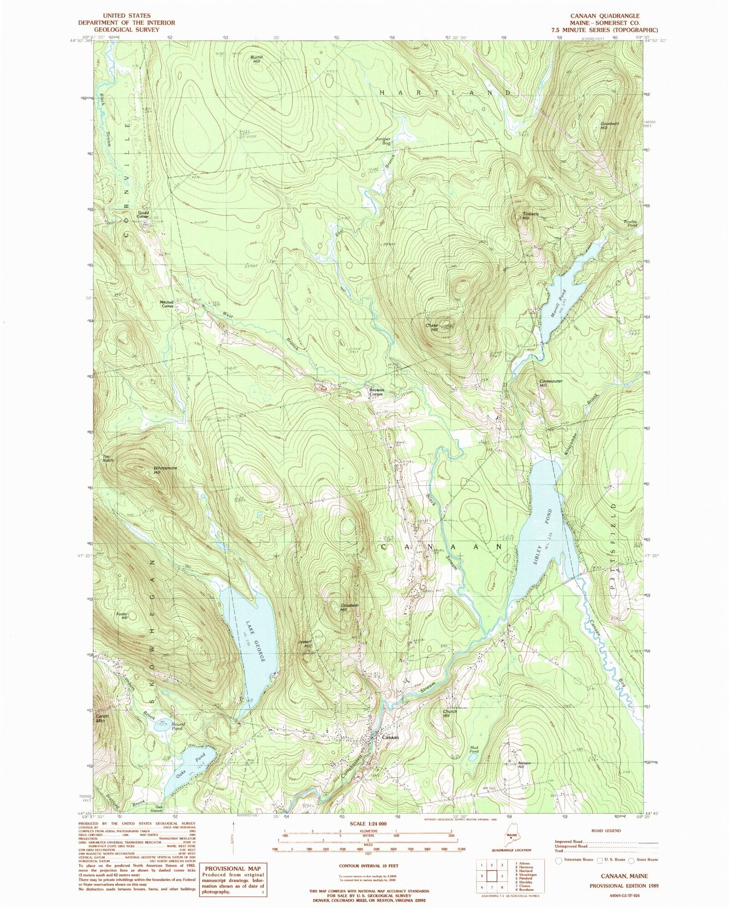
Classic USGS Canaan Maine 7.5'x7.5' Topo Map
Couldn't load pickup availability
Historical USGS topographic quad map of Canaan in the state of Maine. Typical map scale is 1:24,000, but may vary for certain years, if available. Print size: 24" x 27"
This quadrangle is in the following counties: Somerset.
The map contains contour lines, roads, rivers, towns, and lakes. Printed on high-quality waterproof paper with UV fade-resistant inks, and shipped rolled.
Contains the following named places: Black Stream, Burrill Hill, Camp Modin for Boys, Camp Modin for Girls, Canaan, Canaan Bog, Chase Hill, Church Hill, Comeouter Hill, Cooper Brook, East Branch Black Stream, Fairview Cemetery, Lake George, Goodwin Hill, Goodwin Hill, Jewell Hill, Juniper Bog, Lambert Brook, Morrill Pond, Mud Pond, Nelson Hill, Nevins Cemetery, Oaks Pond, Richards Cemetery, Round Pond, Sibley Pond, Slab City Cemetery, Stafford Brook, The Notch, Tibbetts Hill, Union Church, West Branch Black Stream, Whitcombe Brook, Whittemore Hill, Browns Corner, Gould Corner, Mitchell Corner, Town of Canaan, Canaan Elementary School, Canaan Post Office, Canaan Fire Department, Canaan Volunteer Fire Department, Wilson Cemetery, Canaan Public Library


