MyTopo
Classic USGS Canada Calladita New Mexico 7.5'x7.5' Topo Map
Couldn't load pickup availability
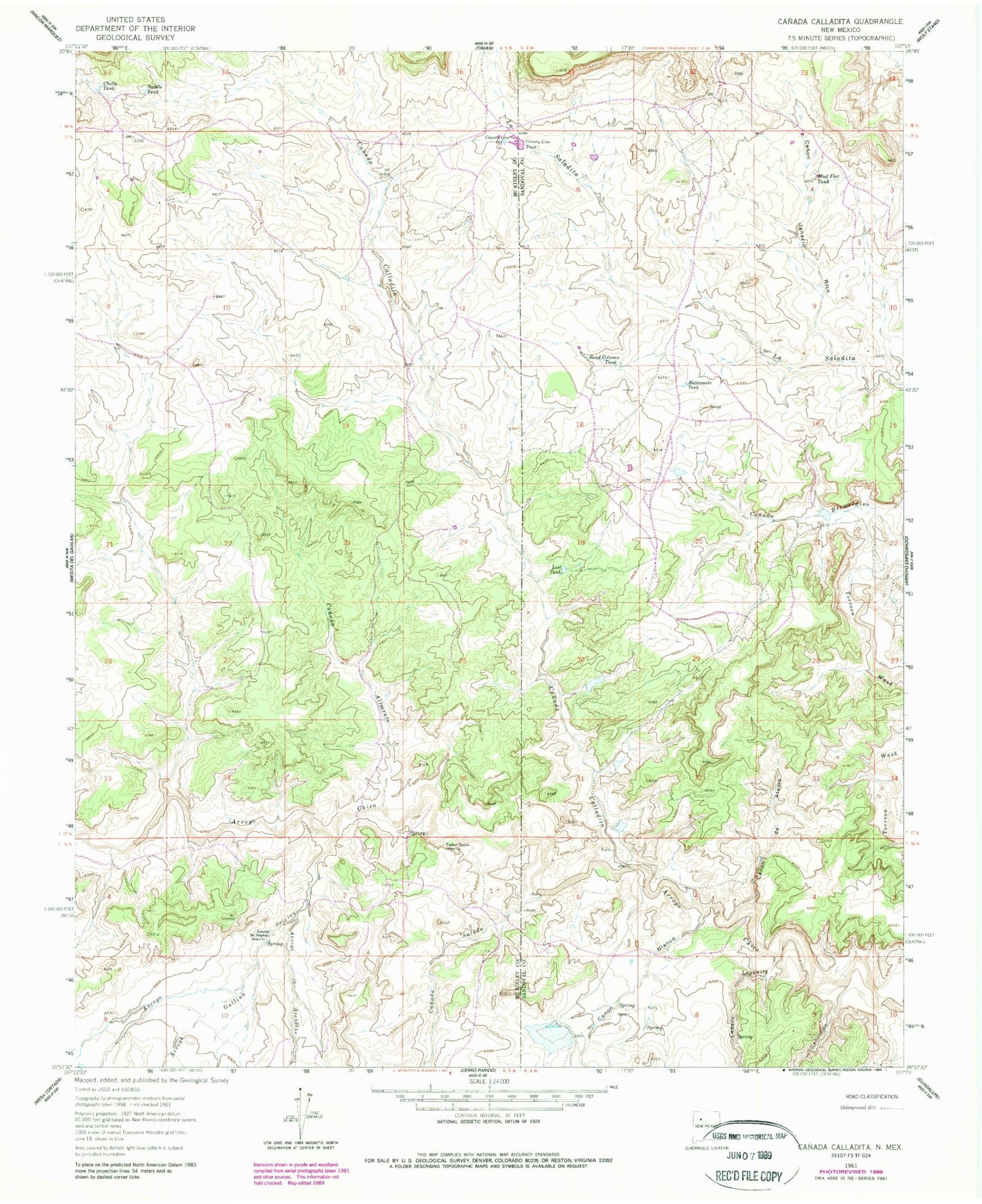
Historical USGS topographic quad map of Canada Calladita in the state of New Mexico. Map scale may vary for some years, but is generally around 1:24,000. Print size is approximately 24" x 27"
This quadrangle is in the following counties: McKinley, Sandoval.
The map contains contour lines, roads, rivers, towns, and lakes. Printed on high-quality waterproof paper with UV fade-resistant inks, and shipped rolled.
Contains the following named places: 10009 Water Well, 15B-32 Water Well, Arroyo Gallina, Arroyo la Azabache, Arroyo Seccion, B P Hovey Ranch Prospect, Canada Alimento, Canada Bernardino, Canada Calladita, Canada Lagunita, Canada Salada, Canon Blanco, Canon de Alamo, Canon Ignacio Rico, Canoncito, Cholla Tank, Cholla Water Well, County Line Dam, County Line Pit, County Line Tank, E Montoya Dam Number Nine, Lost Tank, Mud Flat Tank, R-23 Water Well, R-24 Water Well, Rancho De Stephan, Rattlesnake Tank, Saddle Tank, Sand Column Tank, Tucker Ranch