MyTopo
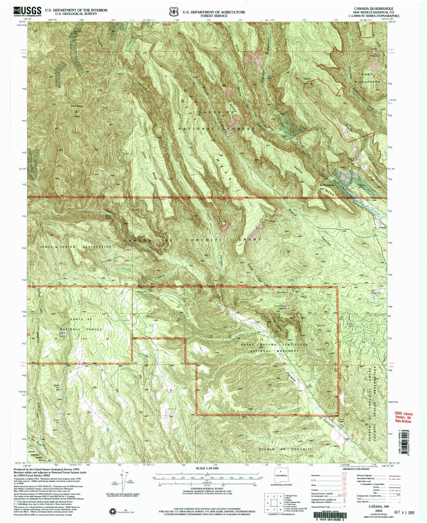
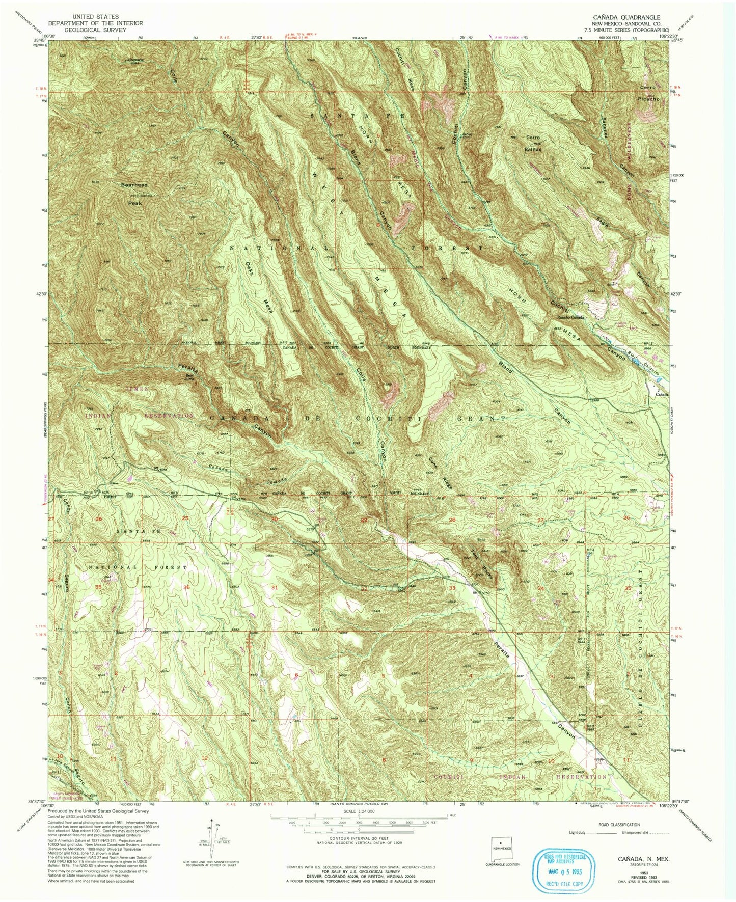
Classic USGS Canada New Mexico 7.5'x7.5' Topo Map
Couldn't load pickup availability
Historical USGS topographic quad map of Canada in the state of New Mexico. Map scale may vary for some years, but is generally around 1:24,000. Print size is approximately 24" x 27"
This quadrangle is in the following counties: Sandoval.
The map contains contour lines, roads, rivers, towns, and lakes. Printed on high-quality waterproof paper with UV fade-resistant inks, and shipped rolled.
Contains the following named places: A B Group, Albemarle, Albemarle Group, Albemarle Post Office, Bear Jump, Bearhead Peak, Benson Claim, Canada, Canada Cabin, Canada Camada, Canada de Cochiti Grant, Cerro Balitas, Cerro Picacho, Colle Canyon, Cone Ridge, Copper Prospect, Corena Lode, Corner Lode, Ellen L Mine, Gold Range Group, Group B Claims, Horn Mesa, Kasha-Katuwe Tent Rocks National Monument, La Jara Canyon, Medio Dia Canyon, Midnight Lode, Monte Carlo Lode, No Name Lode, Oaks Mesa, Otto Pit, Pumice Group Mine, Pumice Mine, Pumice Mines, Puzzle Claim, Rancho Canada, Rising Sun Lode, Saint Peters Dome Trail, Santa Barbabra Group, Smuggler Lode, Sun, T.S. Kline Lode, Tent Rocks, Toby Group, Union, Victor Number Two, West Mesa