MyTopo
Classic USGS Canandaigua Lake New York 7.5'x7.5' Topo Map
Couldn't load pickup availability
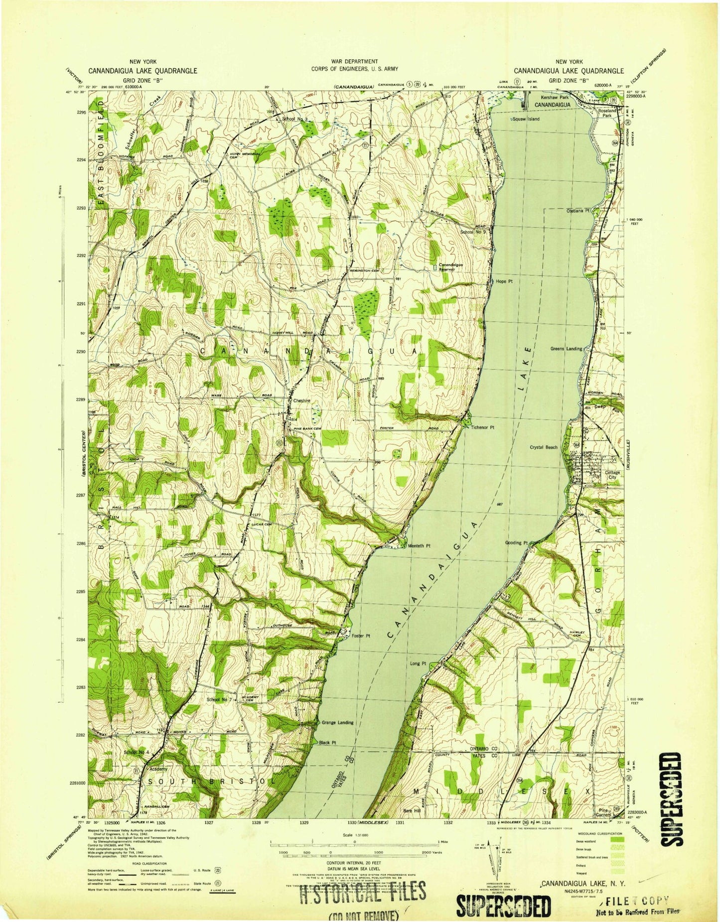
Historical USGS topographic quad map of Canandaigua Lake in the state of New York. Map scale may vary for some years, but is generally around 1:24,000. Print size is approximately 24" x 27"
This quadrangle is in the following counties: Ontario, Yates.
The map contains contour lines, roads, rivers, towns, and lakes. Printed on high-quality waterproof paper with UV fade-resistant inks, and shipped rolled.
Contains the following named places: Academy, Academy Cemetery, Barnes Gully, Black Point, Canandaigua, Canandaigua Country Club, Canandaigua Lake, Canandaigua Reservoir, Cheshire, Cheshire Community Church, Cheshire Volunteer Fire Department, Clark Meadows at Ferris Hills Adult Care Facility, Cottage City, Crosswinds Wesleyan Church, Crystal Beach, Crystal Beach Census Designated Place, Crystal Beach Volunteer Fire Department, Deep Run, Fallbrook Mobile Home Park, First Church of Christ Scientist, Fisher Gully, Foster Point, Gage Gully, Gooding Point, Grange Landing, Greens Landing, Hope Point, Horizons Assisted Living Center, Hunn Memorial Cemetery, Johnson Hill, Kingdom Hall of Jehovahs Witnesses, Long Point, Lord Cemetery, Lucas Cemetery, Menteth Gully, Menteth Point, Ontario County, Otetiana Point, Pine Bank Cemetery, Quail Summit Adult Care Facility, Randall Cemetery, Randall-Standish Vineyards, Remington Cemetery, Roseland Park, School Number 3, School Number 4, School Number 7, School Number 9, Squaw Island, Sucker Brook, The Church of Jesus Christ of Latter Day Saints, Tichenor Gully, Tichenor Point, Town of Canandaigua, WLKA-FM (Canandaigua), ZIP Code: 14424