
MyTopo
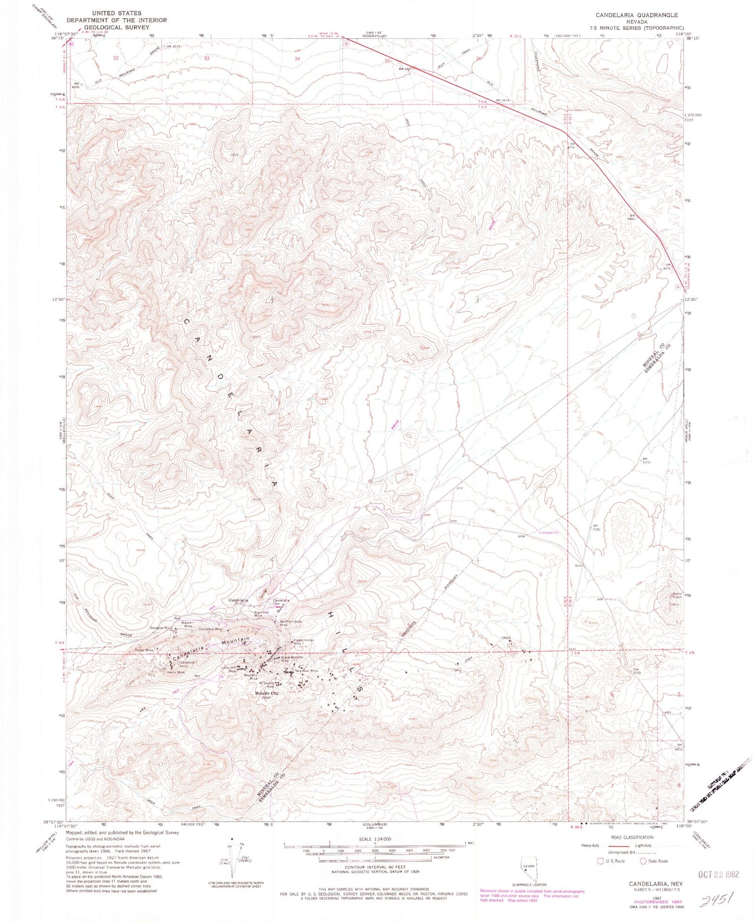
Classic USGS Candelaria Nevada 7.5'x7.5' Topo Map
Couldn't load pickup availability
Historical USGS topographic quad map of Candelaria in the state of Nevada. Map scale may vary for some years, but is generally around 1:24,000. Print size is approximately 24" x 27"
This quadrangle is in the following counties: Esmeralda, Mineral.
The map contains contour lines, roads, rivers, towns, and lakes. Printed on high-quality waterproof paper with UV fade-resistant inks, and shipped rolled.
Contains the following named places: Argentum Mine, Bellmarte Mine, Black Metallic Mine, Blanch Mine, Boak Mine, Candelaria, Candelaria Cemetery, Candelaria Hills, Candelaria Mines Company Mill, Candelaria Mining District, Candelaria Mountain, Candelaria Post Office, Candelaria Water Works and Milling Company Mill, Columbus Consolidated Mine, Columbus Mine, Equator Mine, Figge Hoblyn Mine, Georgine Mine, Hecla Mine, Lucky Hill Mine, Metallic City, Metallic Mine, Metallic Post Office, Metallic-Equator Joint Shaft, Mount Diablo Mine, New Potosi Mine, Newmont Mine, Northern Belle Mine, Pappinaux Mine, Peru Mine, Petrol Mine, Pickhandle Gulch, Potosi Mine, Princess Mine, Swastika Mine, The Victor Mine, Vulture Mine


