MyTopo
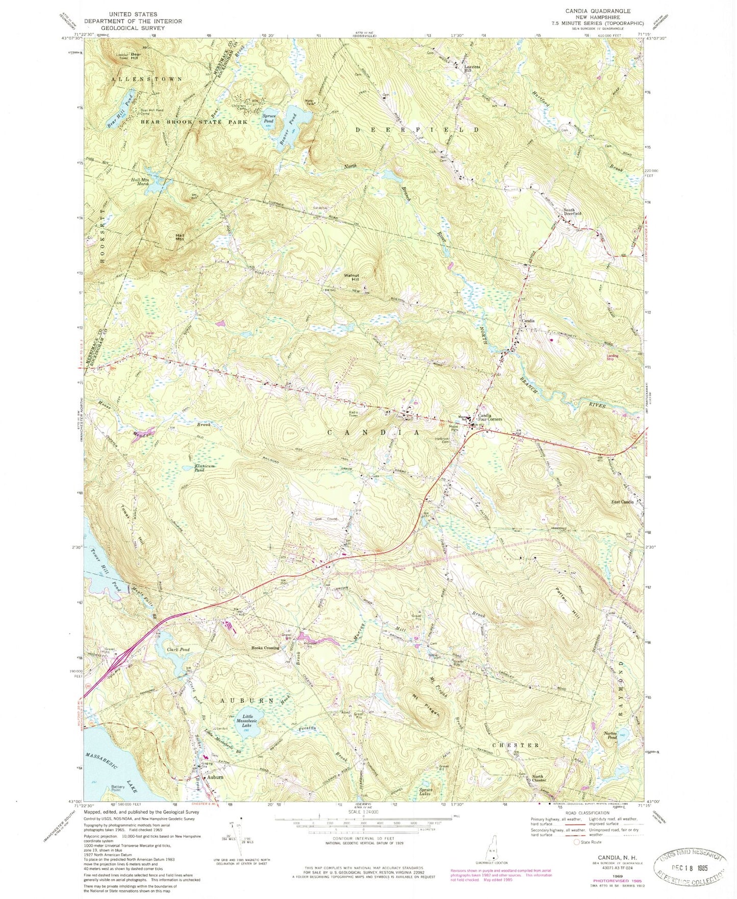
Classic USGS Candia New Hampshire 7.5'x7.5' Topo Map
Couldn't load pickup availability
Historical USGS topographic quad map of Candia in the state of New Hampshire. Typical map scale is 1:24,000, but may vary for certain years, if available. Print size: 24" x 27"
This quadrangle is in the following counties: Merrimack, Rockingham.
The map contains contour lines, roads, rivers, towns, and lakes. Printed on high-quality waterproof paper with UV fade-resistant inks, and shipped rolled.
Contains the following named places: Auburn, Battery Point, Bear Brook State Park, Bear Hill, Bear Hill Pond, Bear Hill Pond Camp, Beaver Pond, Broken Boulder Smith Pond Trail, Campground Trail, Candia, Candia Four Corners, Childrens Camp, Clark Pond Brook, Hall Mountain, Hall Mountain Marsh, Holbrook Cemetery, Hook Brook, Kinnicum Pond, Leavitts Hill, Little Massabesic Brook, Little Massabesic Lake, Maple Falls Brook, Moore Park, Henry W Moore School, Mount Pisgah Brook, Murray Mill Brook, North Chester, Norton Pond, Patten Hill, Mount Pisgah, Preston Brook, South Deerfield, Spruce Lakes, Spruce Pond, Sucker Brook, Tower Hill, Tower Hill Pond, Walnut Hill, Hooks Crossing, Town of Candia, Tower Hill Pond Dam, Clark Pond East Dam, Clark Pond West Dam, Clark Pond, Hall Mountain Marsh Dam, Abe Emerson Marsh, Auburn Cemetery, Auburn Post Office, Auburn Railroad Station, Candia Congregational Church, Candia Hill School (historical), Candia Post Office, Candia Station, Charmingfare Links, East Candia Railroad Station, First Baptist Church, Griffin Free Public Library, Saint Peter Parish Church, Smyth Public Library, Charmingfare Ski Touring Center, Jesse Remington High School, Tot Spot Learning Center, Village Childrens Center, Candia Fire Department, Auburn Fire Department Station 1, Candia Police Department, Auburn Police Department, Cleary Airport, Woodman Cemetery, Batchelder Cemetery