MyTopo
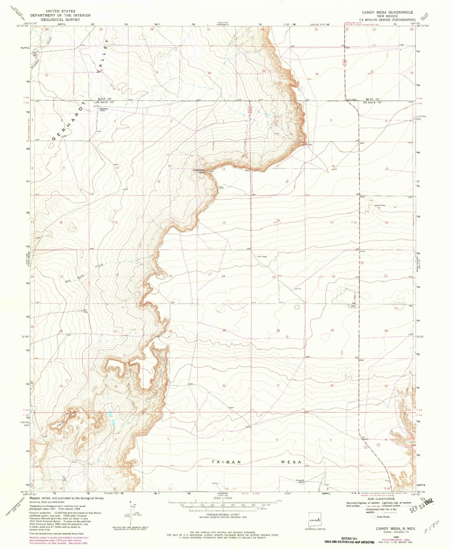
Classic USGS Candy Mesa New Mexico 7.5'x7.5' Topo Map
Couldn't load pickup availability
Historical USGS topographic quad map of Candy Mesa in the state of New Mexico. Map scale may vary for some years, but is generally around 1:24,000. Print size is approximately 24" x 27"
This quadrangle is in the following counties: De Baca, Quay.
The map contains contour lines, roads, rivers, towns, and lakes. Printed on high-quality waterproof paper with UV fade-resistant inks, and shipped rolled.
Contains the following named places: 10219 Water Well, 10220 Water Well, 10241 Water Well, 10314 Water Well, 10318 Water Well, 10319 Water Well, 10340 Water Well, 10341 Water Well, 10522 Water Well, 10543 Water Well, 10544 Water Well, 10545 Water Well, 10546 Water Well, 10551 Water Well, 10553 Water Well, 10557 Water Well, 10558 Water Well, 10564 Water Well, 10565 Water Well, 10566 Water Well, 10567 Water Well, 10570 Water Well, 10572 Water Well, 10573 Water Well, Candy Mesa, Charlotte Point, Knighten Ranch, M and M Ranch, Red Tank Creek, Taiban Mesa