MyTopo
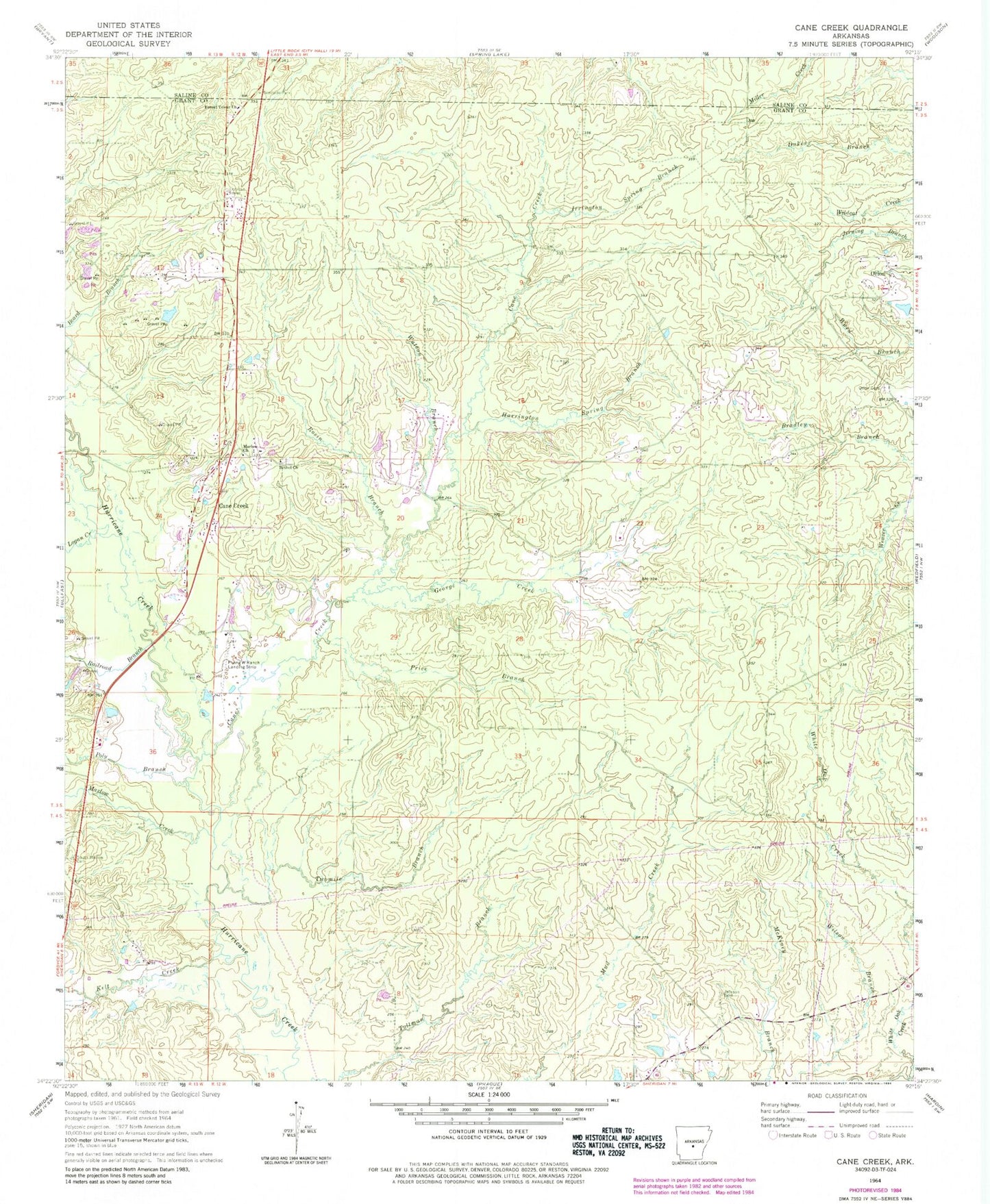
Classic USGS Cane Creek Arkansas 7.5'x7.5' Topo Map
Couldn't load pickup availability
Historical USGS topographic quad map of Cane Creek in the state of Arkansas. Map scale may vary for some years, but is generally around 1:24,000. Print size is approximately 24" x 27"
This quadrangle is in the following counties: Grant, Saline.
The map contains contour lines, roads, rivers, towns, and lakes. Printed on high-quality waterproof paper with UV fade-resistant inks, and shipped rolled.
Contains the following named places: Bethel Church, Cane Creek, Cane Creek Volunteer Fire Department, Forest Tower Church, George Creek, Gum Springs Cemetery, Harrington Spring Branch, Ico, Irrington Spring Branch, Jackson Cemetery, Kelt Creek, KXIX-FM (Sheridan), Logan Creek, Marlow Church, Marlow Creek, Obin, Orion, Orion Cemetery, Poly Branch, Price Branch, Railroad Branch, Rosin Branch, South Marlow Cemetery, Township of Simpson, Twomile Branch, Watson Branch