MyTopo
Classic USGS Cane Spring Nevada 7.5'x7.5' Topo Map
Regular price
$16.95
Regular price
Sale price
$16.95
Unit price
per
Couldn't load pickup availability
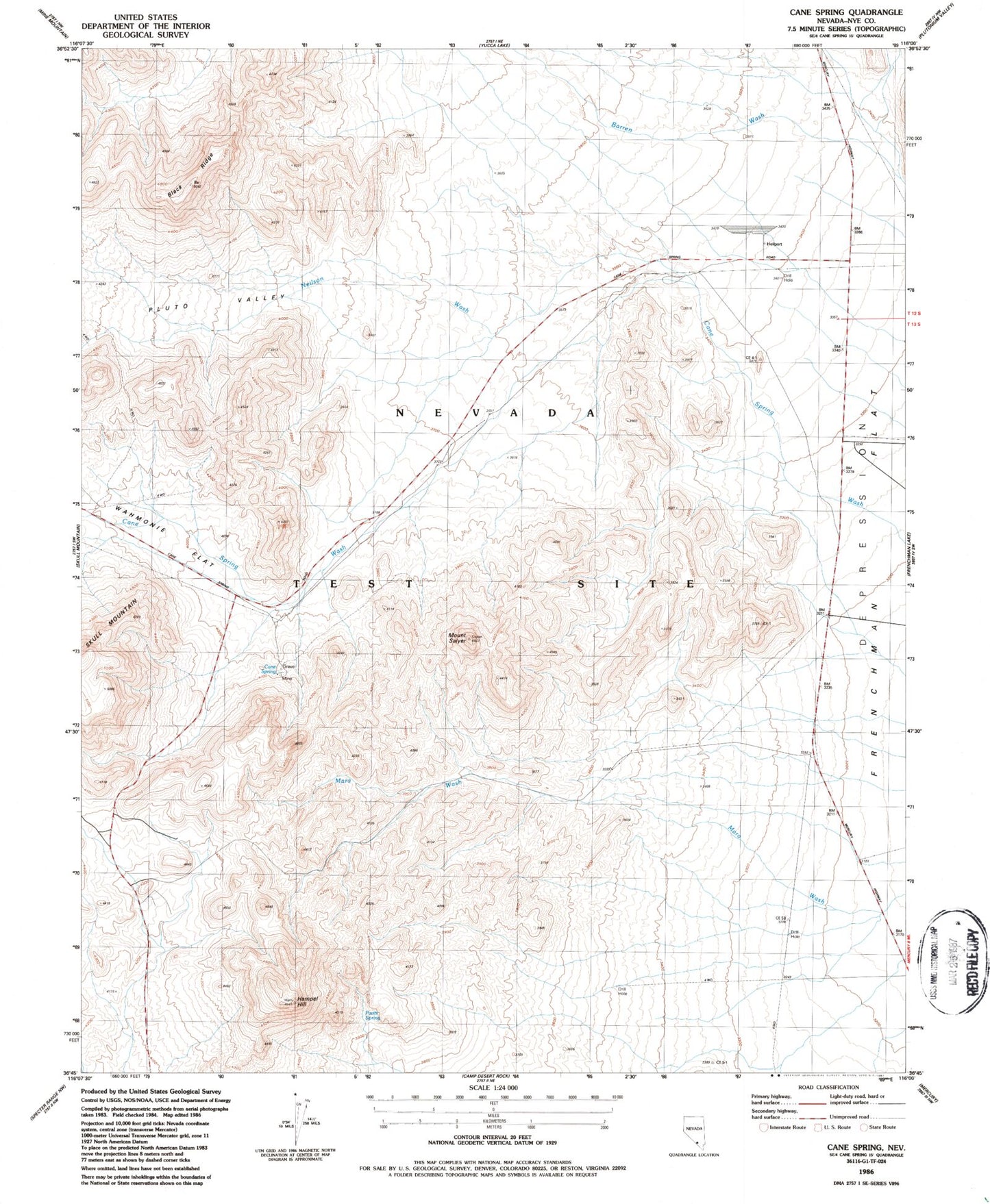
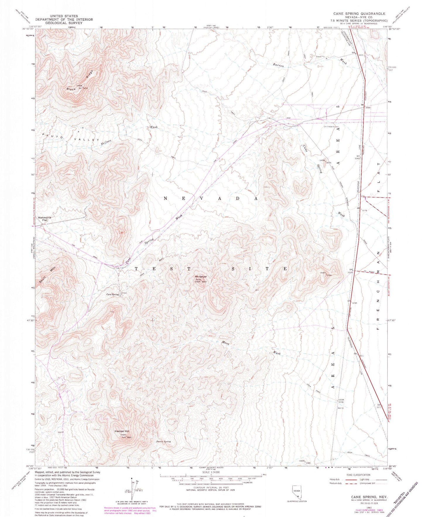
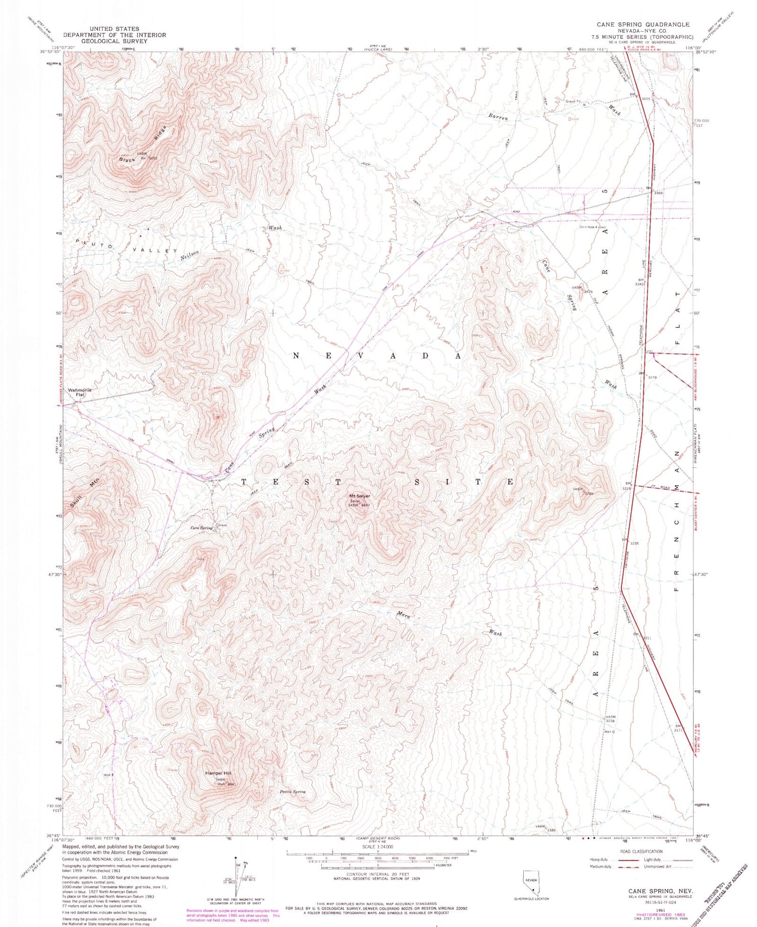
Historical USGS topographic quad map of Cane Spring in the state of Nevada. Map scale may vary for some years, but is generally around 1:24,000. Print size is approximately 24" x 27"
This quadrangle is in the following counties: Nye.
The map contains contour lines, roads, rivers, towns, and lakes. Printed on high-quality waterproof paper with UV fade-resistant inks, and shipped rolled.
Contains the following named places: Black Ridge, Cane Spring, Drill Hole 4, Hampel Hill, Mara Wash, Mount Salyer, Neilson Wash, Nevada Test Site Area 5, Pavits Spring, Pluto Valley, Well G