MyTopo
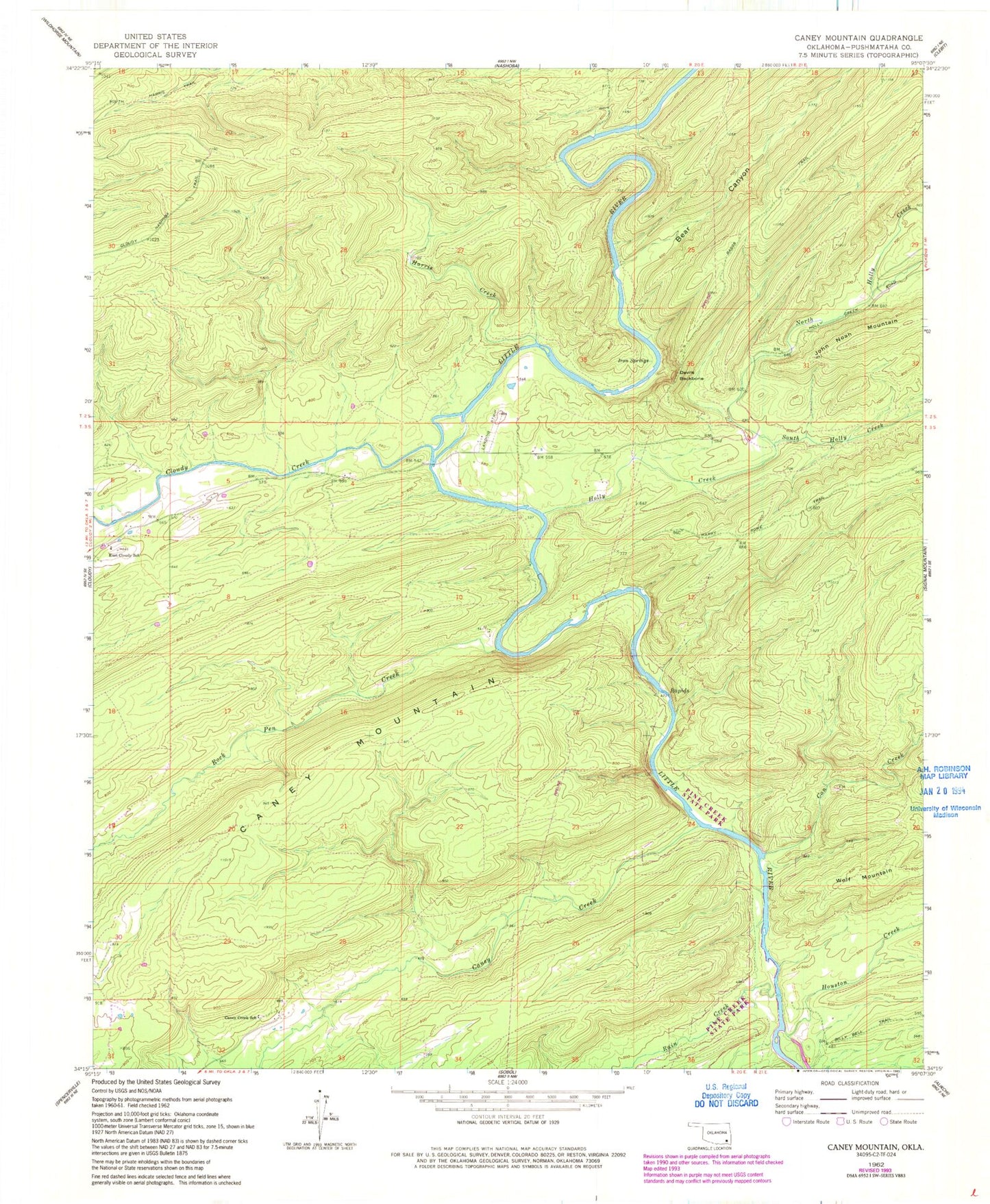
Classic USGS Caney Mountain Oklahoma 7.5'x7.5' Topo Map
Couldn't load pickup availability
Historical USGS topographic quad map of Caney Mountain in the state of Oklahoma. Map scale may vary for some years, but is generally around 1:24,000. Print size is approximately 24" x 27"
This quadrangle is in the following counties: Pushmataha.
The map contains contour lines, roads, rivers, towns, and lakes. Printed on high-quality waterproof paper with UV fade-resistant inks, and shipped rolled.
Contains the following named places: Bear Canyon, Big Branch, Can Creek, Caney Creek, Caney Creek School, Caney Creek Trail, Caney Mountain, Caney Mountain Trail, Cloudy Creek, Cloudy Nashoba Trail, Devils Backbone, East Cloudy School, Harris Creek, Holly Creek, Houston Creek, Iron Springs, Iron Springs Trail, North Holly Creek, Rain Creek, Rock Pen Creek, South Holly Creek, Wolf Mountain