MyTopo
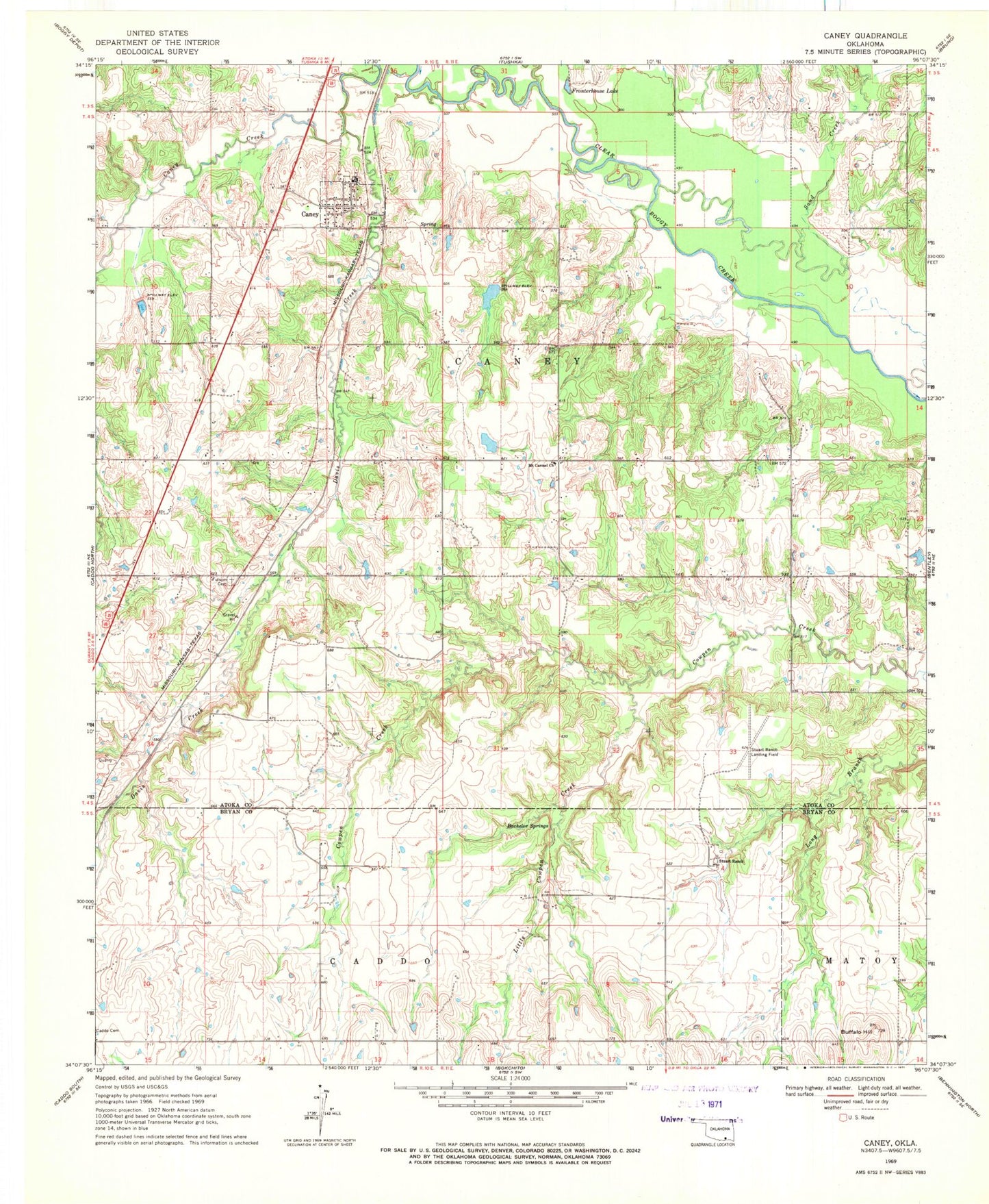
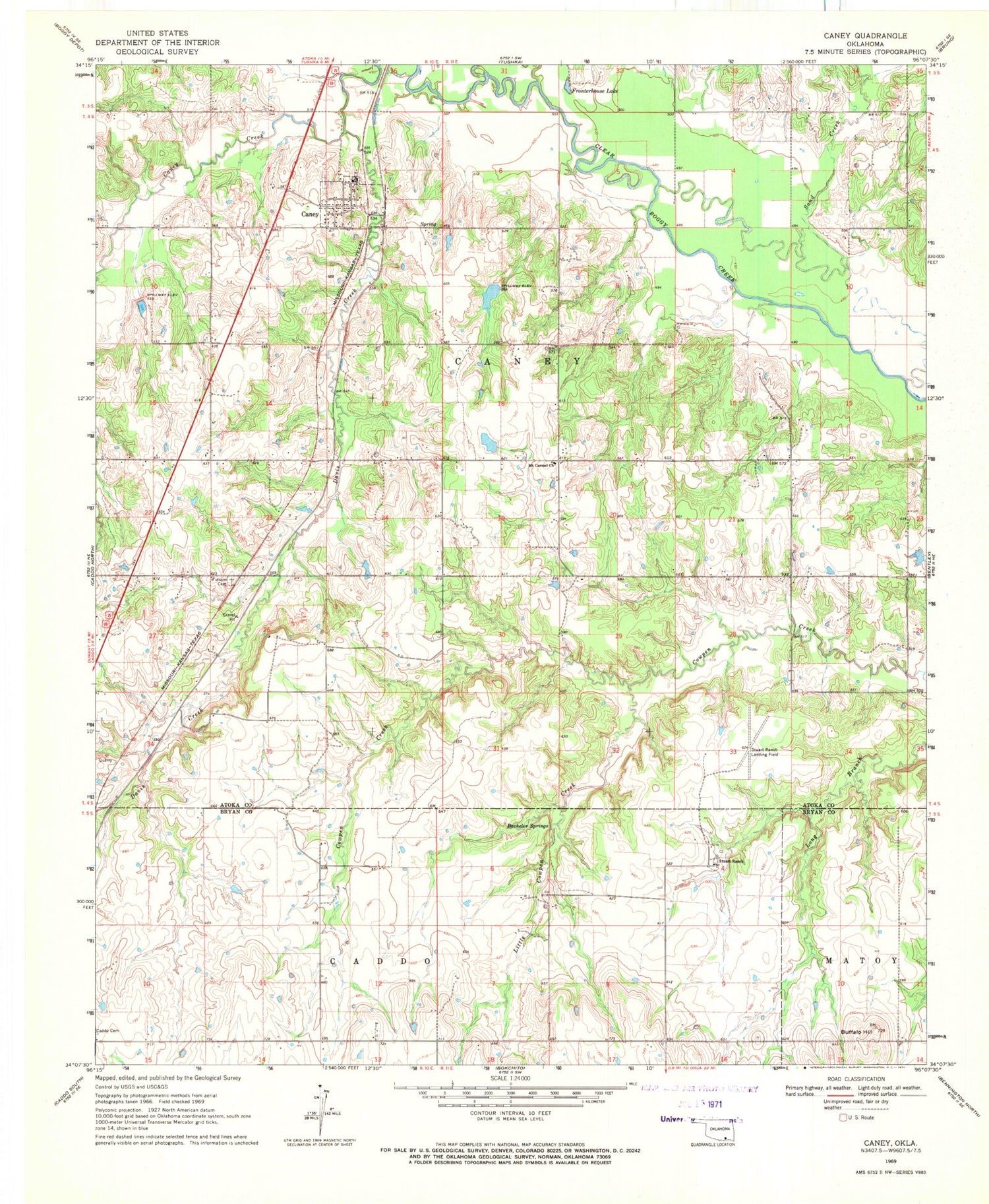
Classic USGS Caney Oklahoma 7.5'x7.5' Topo Map
Couldn't load pickup availability
Historical USGS topographic quad map of Caney in the state of Oklahoma. Map scale may vary for some years, but is generally around 1:24,000. Print size is approximately 24" x 27"
This quadrangle is in the following counties: Atoka, Bryan.
The map contains contour lines, roads, rivers, towns, and lakes. Printed on high-quality waterproof paper with UV fade-resistant inks, and shipped rolled.
Contains the following named places: Bachelor Springs, Buffalo Hill, Caney, Caney Creek Site 1 Dam, Caney Creek Site 1 Reservoir, Caney Creek Site 2 Dam, Caney Creek Site 2 Reservoir, Caney Elementary School, Caney High School, Caney Police Department, Caney Post Office, Caney Volunteer Fire Department, Davis Creek, Folsom Cemetery, Fronterhouse Creek, Fronterhouse Lake, Little Cowpen Creek, Lower Clear Boggy Site Number 38 Dam, Lower Clear Boggy Site Number 38 Reservoir, Mount Carmel Church, Nickles Lake, Nickles Lake Dam, Sand Creek, Stewart Cemetery, Stewart Gammon Cemetery, Stuart Ranch, Stuart Ranch Airport, Town of Caney, Township of Caney, ZIP Code: 74533