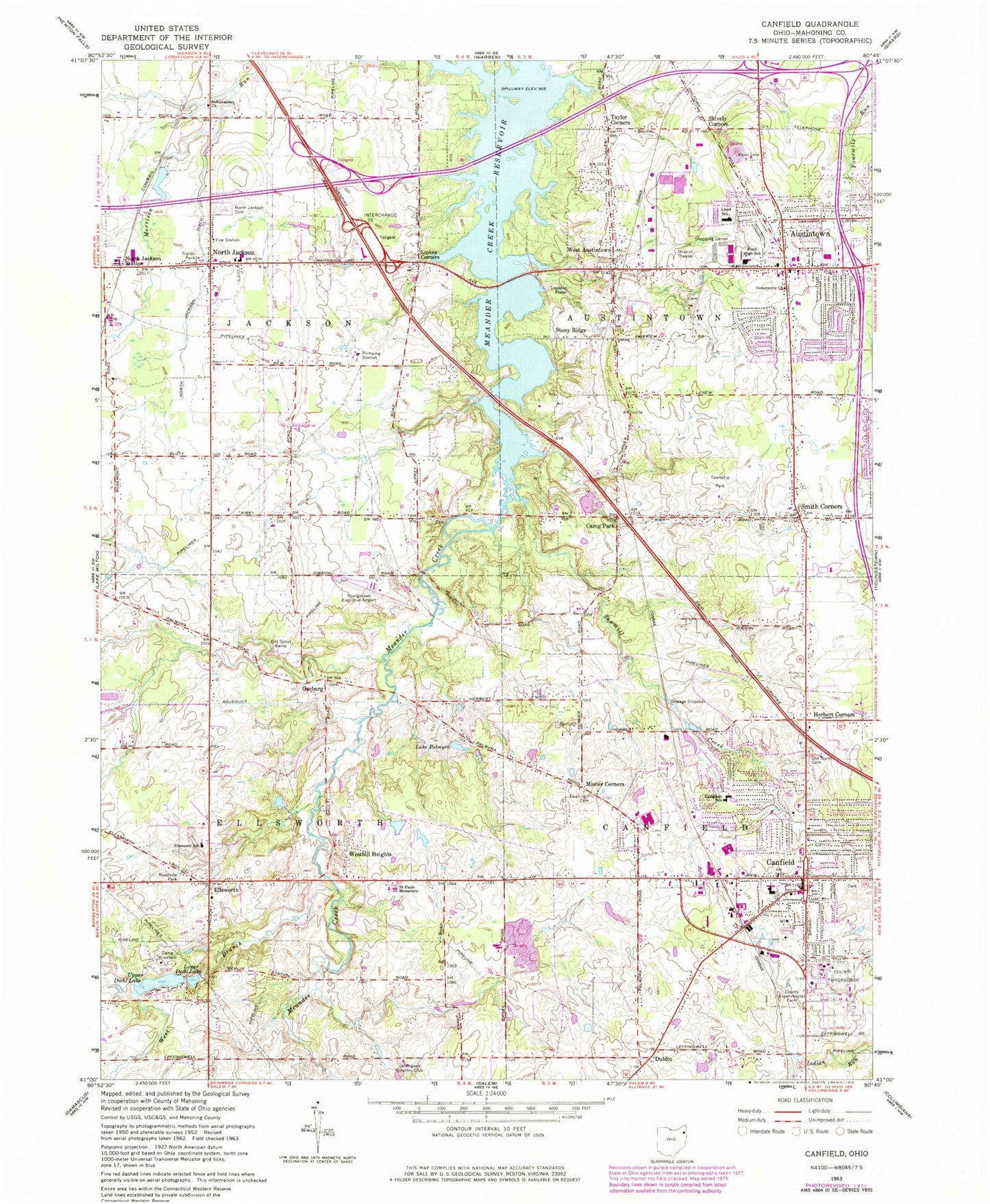
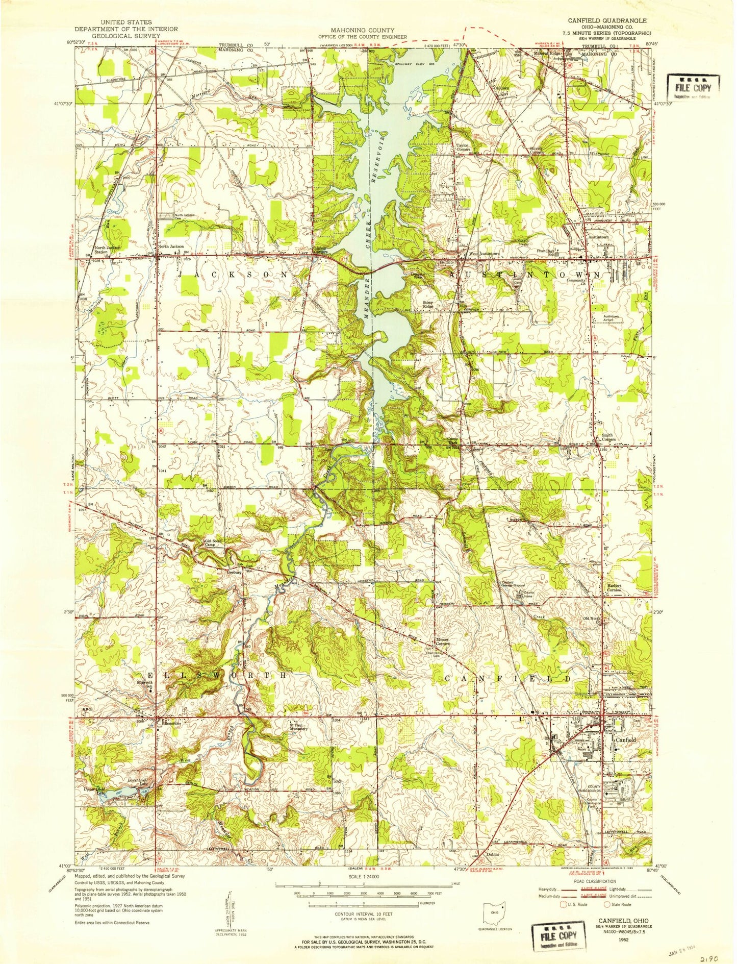
MyTopo
Classic USGS Canfield Ohio 7.5'x7.5' Topo Map
Couldn't load pickup availability
Historical USGS topographic quad map of Canfield in the state of Ohio. Typical map scale is 1:24,000, but may vary for certain years, if available. Print size: 24" x 27"
This quadrangle is in the following counties: Mahoning.
The map contains contour lines, roads, rivers, towns, and lakes. Printed on high-quality waterproof paper with UV fade-resistant inks, and shipped rolled.
Contains the following named places: Camp Kiwatani, Camp Park, Canfield, Dean Hill Cemetery, Geeburg, Girl Scout Camp, Independent Church, Lower Diehl Lake, North Jackson Ditch, Old North Cemetery, Palmyra Lake, Saint Pauls Monastery, Sawmill Creek, Shively Corners, Smith Corners, Upper Diehl Lake, West Branch Meander Creek, Dublin, Westhill Heights, Austintown Community Church, Canfield Christian Church, Canfield High School, Canfield Middle School, Canfield Presbyterian Church, Canfield United Methodist Church, Dublin School (historical), First United Methodist Church of West Austintown, Old North Baptist Church, Geeburg School (historical), Jackson-Milton Elementary School, Jackson-Milton High School, Mahoning County Experimental Farm, Mahoning County Fairgrounds, Ohlton (historical), Russell School (historical), Smith Corners United Methodist Church, Turner Street School (historical), Youngs School (historical), Austintown Middle School, Herbert Corners, Lipkey Corners, North Jackson Station, Stony Ridge, Taylor Corners, West Austintown, Campbell School, Austintown Plaza Shopping Center, Austintown, Ellsworth, North Jackson, Misner Corners, Meander Creek Reservoir, Austintown Branch Library, Brunsteter Cemetery, First Freewill Baptist Church, Lord of Life Lutheran Church, Saint Michael Catholic Church, Smith Corners Cemetery, Village Square Shopping Center, Mahoning County, Diehl Lake Dam, Diehl Lake, Leffingwell Country Club, Ellsworth Elementary School, Lloyd Elementary School, Brocker Field, Briel Airport (historical), Mahoning County Joint Vocational School Airport, Wetzl Airport, Youngstown Executive Airport (historical), Township of Austintown, Township of Canfield, Township of Ellsworth, Township of Jackson, Canfield Memorial Building, Canfield Post Office, Canfield Cemetery, Cotton Private Cemetery, Covenanter Cemetery, Ellsworth Cemetery, Geeburg Cemetery, Green Haven Memorial Gardens Cemetery, Methodist Church Cemetery, North Jackson Cemetery, West Austintown Post Office (historical), Ellsworth Post Office (historical), North Jackson Post Office, Austintown Post Office (historical), City of Canfield, Mollica Airport (historical), Shepard's Mobile Home Park, Austintown Fire Department Station 4, Jackson Township Fire Department, Ellsworth Fire Department Station 400, Cardinal Joint Fire District Station 1, Austintown Fire Department Station 1, Lane Life Transport Paramedics, Pellin Ambulance Service Station 2, Pellin Ambulance Service Station 1, Chucks Greenhouses, Canfield Police Department, Austintown Township Police Department, Ohio State Highway Patrol - Canfield Patrol Post, Austintown Post Office, Ellsworth Post Office