MyTopo
Classic USGS Canjilon Mountain New Mexico 7.5'x7.5' Topo Map
Couldn't load pickup availability
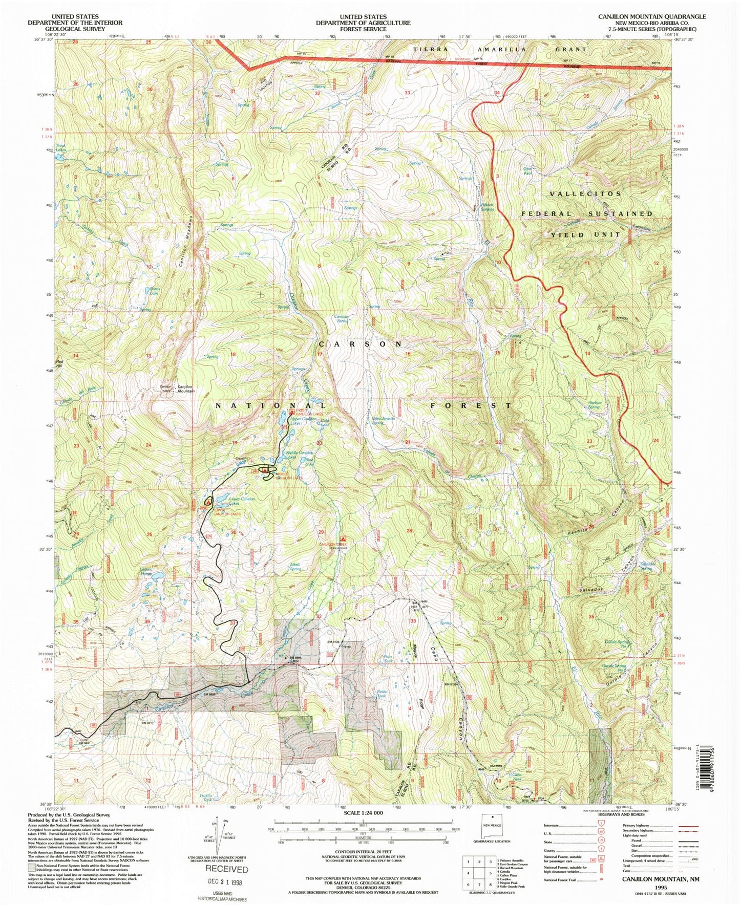
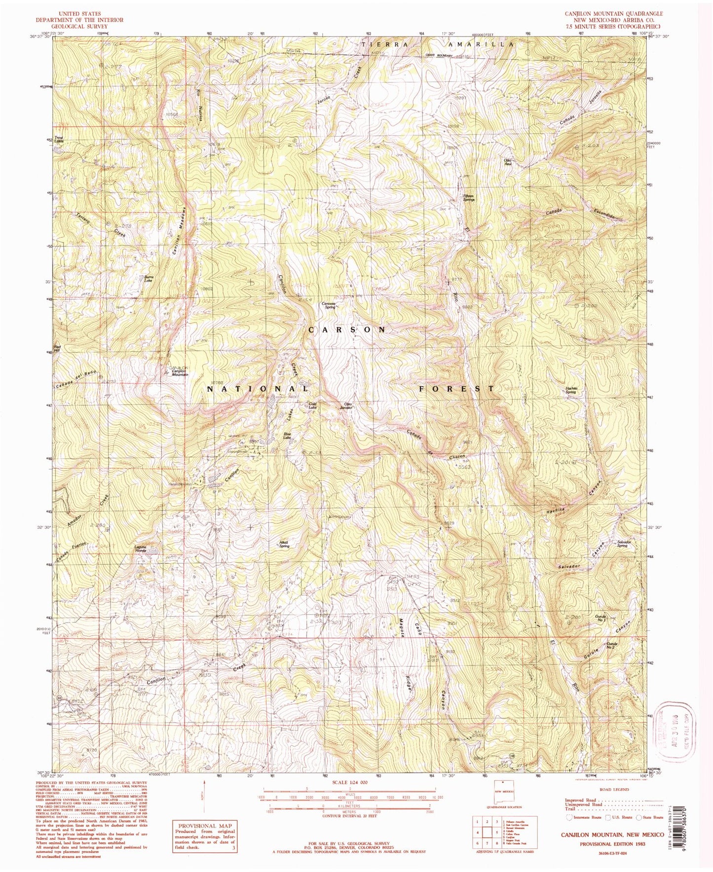
Historical USGS topographic quad map of Canjilon Mountain in the state of New Mexico. Typical map scale is 1:24,000, but may vary for certain years, if available. Print size: 24" x 27"
This quadrangle is in the following counties: Rio Arriba.
The map contains contour lines, roads, rivers, towns, and lakes. Printed on high-quality waterproof paper with UV fade-resistant inks, and shipped rolled.
Contains the following named places: Fifteen Springs, Alkali Spring, Blue Lake, Canada de Chacon, Canjilon Creek Forest Camp (historical), Canjilon Lakes, Cold Lake, Hachita Canyon, Ojito Jarosito, Salvador Canyon, Upper Canjilon Lakes Picnic Area, Lower Canjilon Lakes, Lower Canjilon Lakes Campground, Canjilon Creek Campground, Upper Canjilon Lakes, Middle Canjilon Lakes, Middle Canjilon Campground, Pato Tank, Patito Tank, Canjilon Mountain, Gurule Spring Number One, Gurule Spring Number Two, Gurule Canyon, Cano Tank, Salvador Spring, Trujillo Tank, Laguna Honda, Canovas Spring, Canjilon Meadows, Burns Lake, Ojito Azul