MyTopo
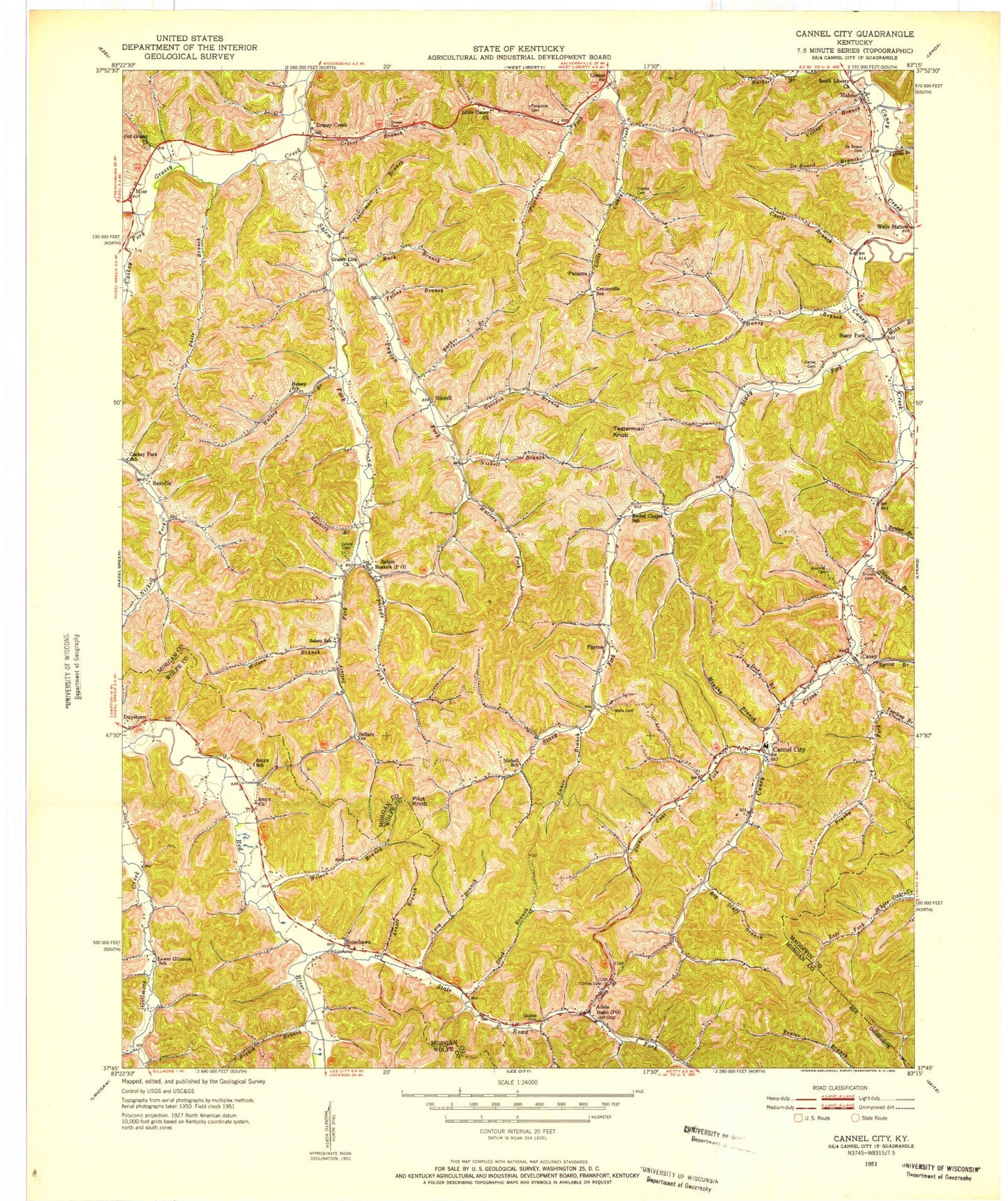
Classic USGS Cannel City Kentucky 7.5'x7.5' Topo Map
Couldn't load pickup availability
Historical USGS topographic quad map of Cannel City in the state of Kentucky. Map scale may vary for some years, but is generally around 1:24,000. Print size is approximately 24" x 27"
This quadrangle is in the following counties: Magoffin, Morgan, Wolfe.
The map contains contour lines, roads, rivers, towns, and lakes. Printed on high-quality waterproof paper with UV fade-resistant inks, and shipped rolled.
Contains the following named places: Adele, Adele School, Amyx Church, Amyx School, Arnett Branch, Barker Branch, Benton Branch, Big Staff Branch, Brushy Fork, Brushy Fork United Baptist Church, Buck Branch, Buskirk Post Office, Caney, Caney Cemetery, Caney School, Cannel City, Cannel City Division, Cannel City Elementary School, Cannel City Post Office, Caskey Fork, Castle Branch, Centerville Enterprise Baptist Church, Centerville School, Combs Cemetery, Conley Branch, Conley Cemetery, De Board Branch, Deboard Cemetery, Demund Post Office, Doe Branch, Eighth Branch, Felins Branch, Ferguson Cemetery, Gevedon Branch, Gibbs Cemetery, Gibbs Hollow, Gilmore Post Office, Goodwins Chapel, Grassy Creek, Grassy Creek Post Office, Grassy Lick Church, Grassy Lick School, Greear Branch, Greear Cemetery, Halsey Branch, Halsey School, Haney Branch, Head of Stacy Fork, Helechawa, Helechawa Post Office, Helechawa Railroad Station, Insko Post Office, Lacy Branch, Lewis Branch, Little Caney Church, Lizzie Lane Post Office, Lower Gillmore, Lower Gilmore School, Lunce Branch, Lykins Branch, Malone, Malone Post Office, Mining Branch, Mize, Mize Post Office, Morris Cemetery, Nickell, Nickell Branch, Nickell Post Office, Old Grassy Cemetery, Old Grassy Church, Oldfield Fork, Panama, Panama Post Office, Payton, Payton Fork, Payton Post Office, Phils Branch, Phipps Fork, Pilot Knob, Poorhouse Fork, Rexville, Rexville Post Office, Right Fork, Road Fork, Rockcastle Baptist Church, Rosnick Branch, Saints Bottom, Salem, Salem Cemetery, Salem Fork, Salem Fork Christian Church, Salem School, Sellars, Sellars Fork, Sellers Post Office, South Liberty Church, South Liberty School, Spring Branch, Stacy Fork, State Road Fork, Stick Branch, Stinson Branch, Stinson Cemetery, Stone Coal Fork, Taulbee Cemetery, Testerman Branch, Testerman Knob, The Chapel, Village Branch, Walnut Grove Church, Walters Fork, Webb Branch, Wells Cemetery, Wells Chapel, Wells Post Office, Wells Railroad Station, Wells Station, Wilson Branch, Yearling Branch, ZIP Codes: 41352, 41408


