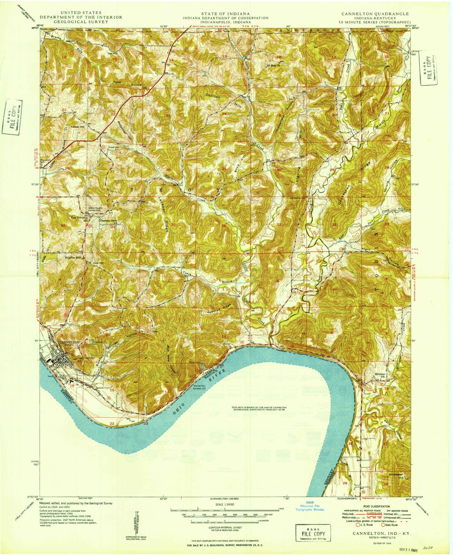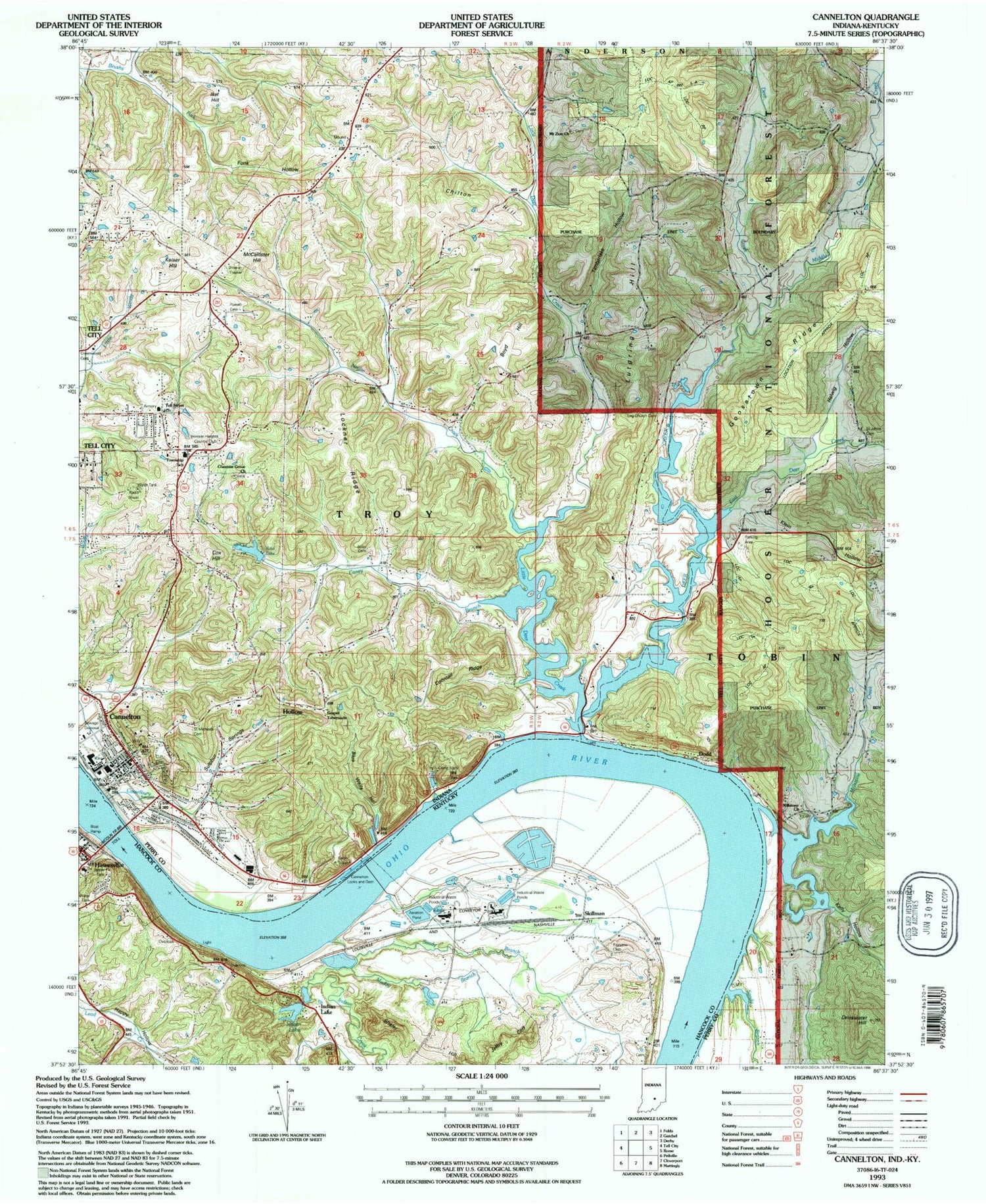
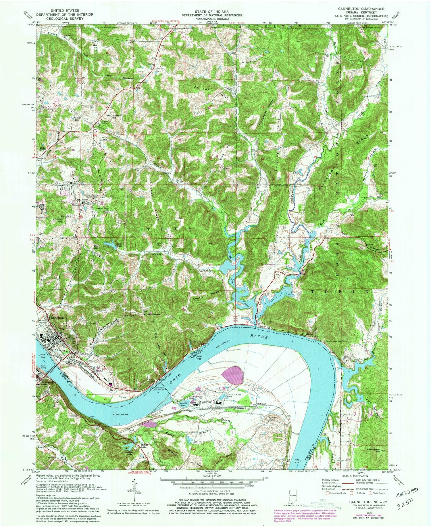
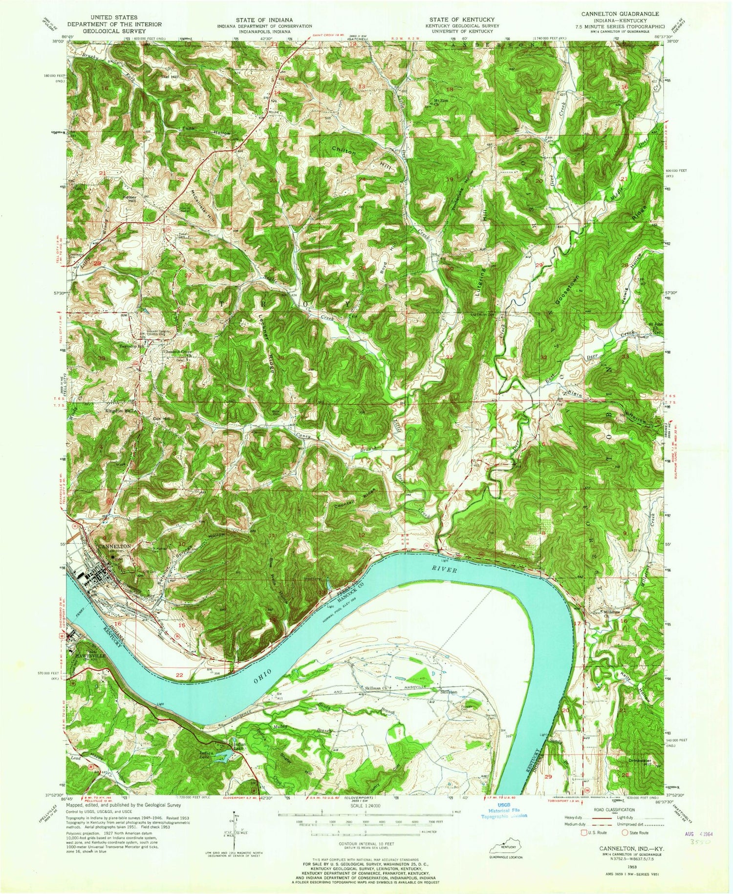

MyTopo
Classic USGS Cannelton Indiana 7.5'x7.5' Topo Map
Couldn't load pickup availability
Historical USGS topographic quad map of Cannelton in the states of Indiana, Kentucky. Map scale may vary for some years, but is generally around 1:24,000. Print size is approximately 24" x 27"
This quadrangle is in the following counties: Hancock, Perry.
The map contains contour lines, roads, rivers, towns, and lakes. Printed on high-quality waterproof paper with UV fade-resistant inks, and shipped rolled.
Contains the following named places: Blue Wells Hollow, Bolin Cemetery, Boyd Hill, Brushy Hollow, Camp Koch, Caney Branch, Cannelton, Cannelton City Police Department, Cannelton Locks and Dam, Cannelton Post Office, Cannelton Volunteer Fire Department, Chestnut Grove Church, Chilton Hill, City of Cannelton, Cliff Cemetery, Coontail Ridge, Cox Hill, Deer Creek, Dodd, East Deer Creek, Echo Valley Lake, Echo Valley Lake Dam, Fairview Cemetery, Funk Hollow, Goosetown Ridge, Gospel Tabernacle, Hancock County Emergency Services, Hancock County Sheriff's Office, Hawesville Division, Hawesville Post Office, Helwig Hollow, Helwig Hollow Pond, Hoosier Heights Country Club, Ikel Hill, Indian Creek, Indian Lake, Jeffry Cliff, Keiser Hill, Kelly Hollow, Klein Hollow, Lincoln Toll Road Bridge, Lincoln Trail Bridge, Little Deer Creek, Lockner Ridge, Log Church Cemetery, Lost Lake Pond, Lutgring Hill, McCallister Hill, Middle Deer Creek, Miller Branch, Millstone Church, Millstone Creek, Mount Zion Church, Muddy Branch, Murmer Creek, Neglie Creek, Perry County Memorial Hospital, Powell Cemetery, Rock Island Post Office, Saint Johns Cemetery, Saint Michaels Cemetery, Sandy Branch, Shafer Hill, Skillman, Sterretts Bottom, Sulphur Springs Hollow, Tell City Junior High School, Tell Street Church, Timberlake Hollow, Timberlake Pond, Township of Troy, ZIP Code: 47520