MyTopo
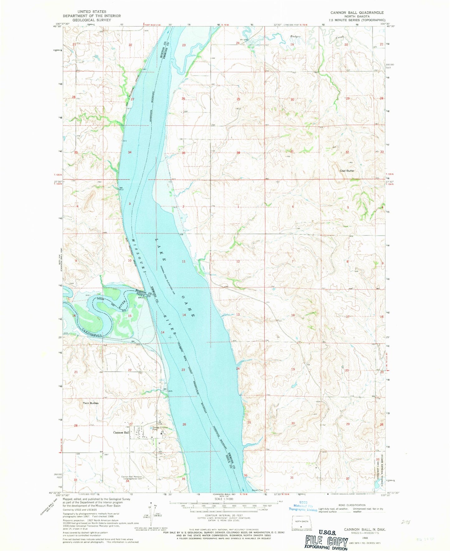
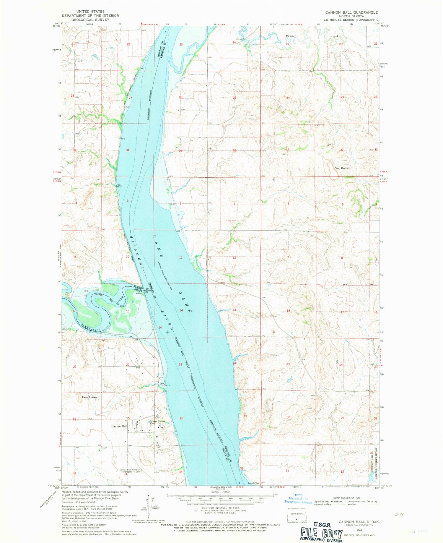
Classic USGS Cannon Ball North Dakota 7.5'x7.5' Topo Map
Regular price
$16.95
Regular price
Sale price
$16.95
Unit price
per
Couldn't load pickup availability
Historical USGS topographic quad map of Cannon Ball in the state of North Dakota. Map scale may vary for some years, but is generally around 1:24,000. Print size is approximately 24" x 27"
This quadrangle is in the following counties: Emmons, Morton, Sioux.
The map contains contour lines, roads, rivers, towns, and lakes. Printed on high-quality waterproof paper with UV fade-resistant inks, and shipped rolled.
Contains the following named places: Badger School, Cannon Ball, Cannon Ball Elementary School, Cannon Ball Memorial Congregational Cemetery, Cannon Ball Post Office, Cannonball River, Coal Butte, Gayton Post Office, Saint Elizabeth's Catholic Cemetery, Sunburst Lake, Sunburst Lake Dam, Twin Buttes