MyTopo
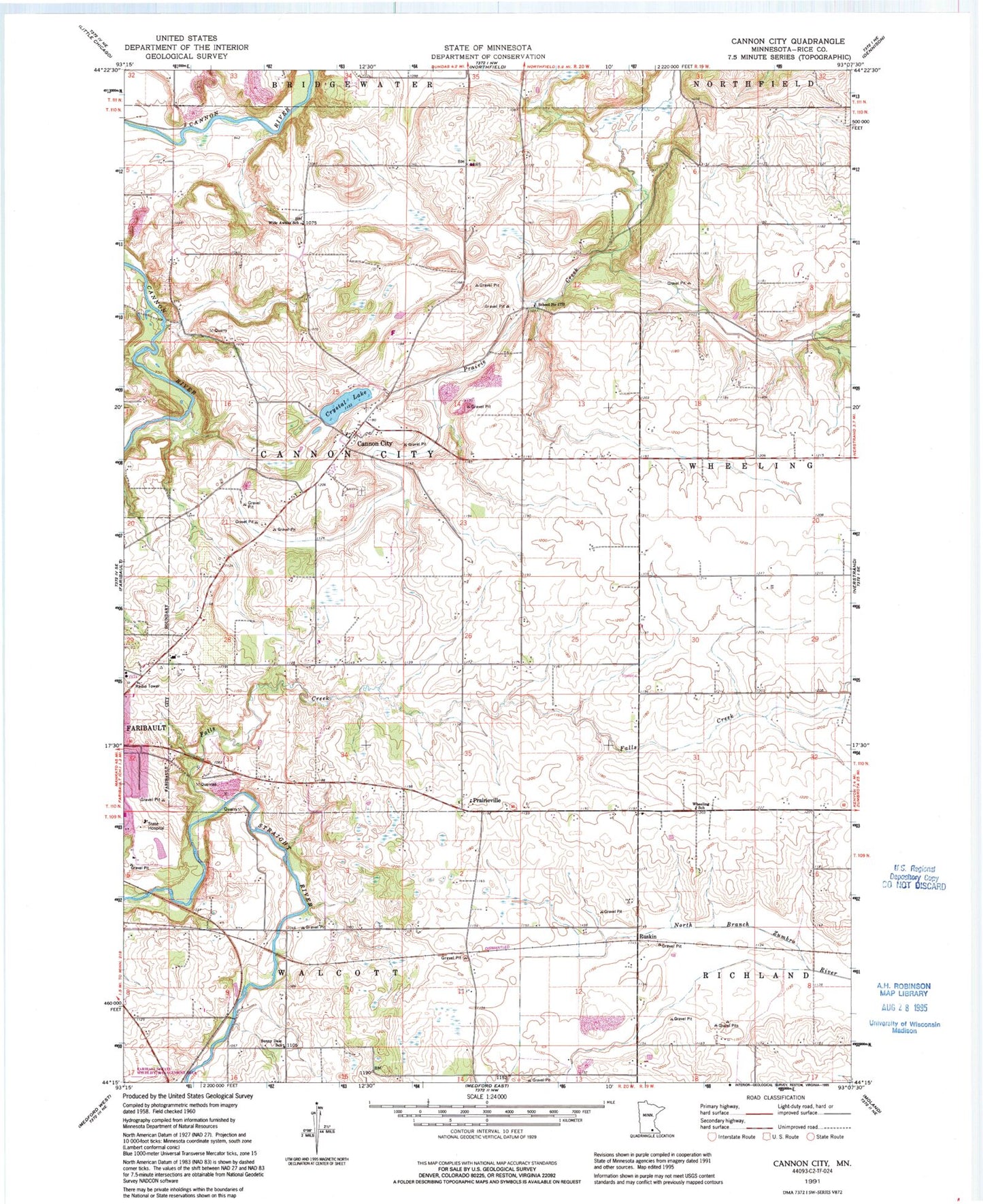
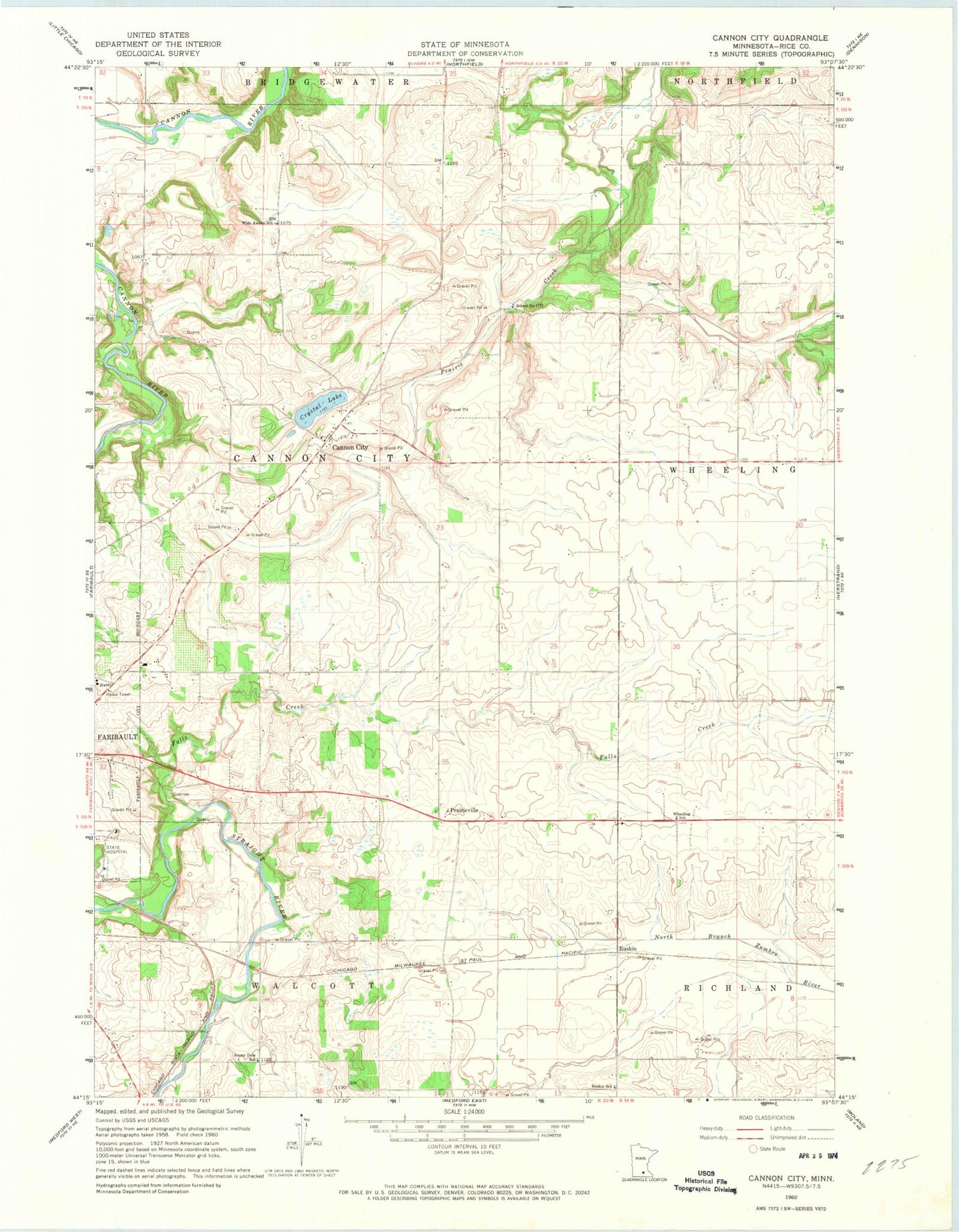
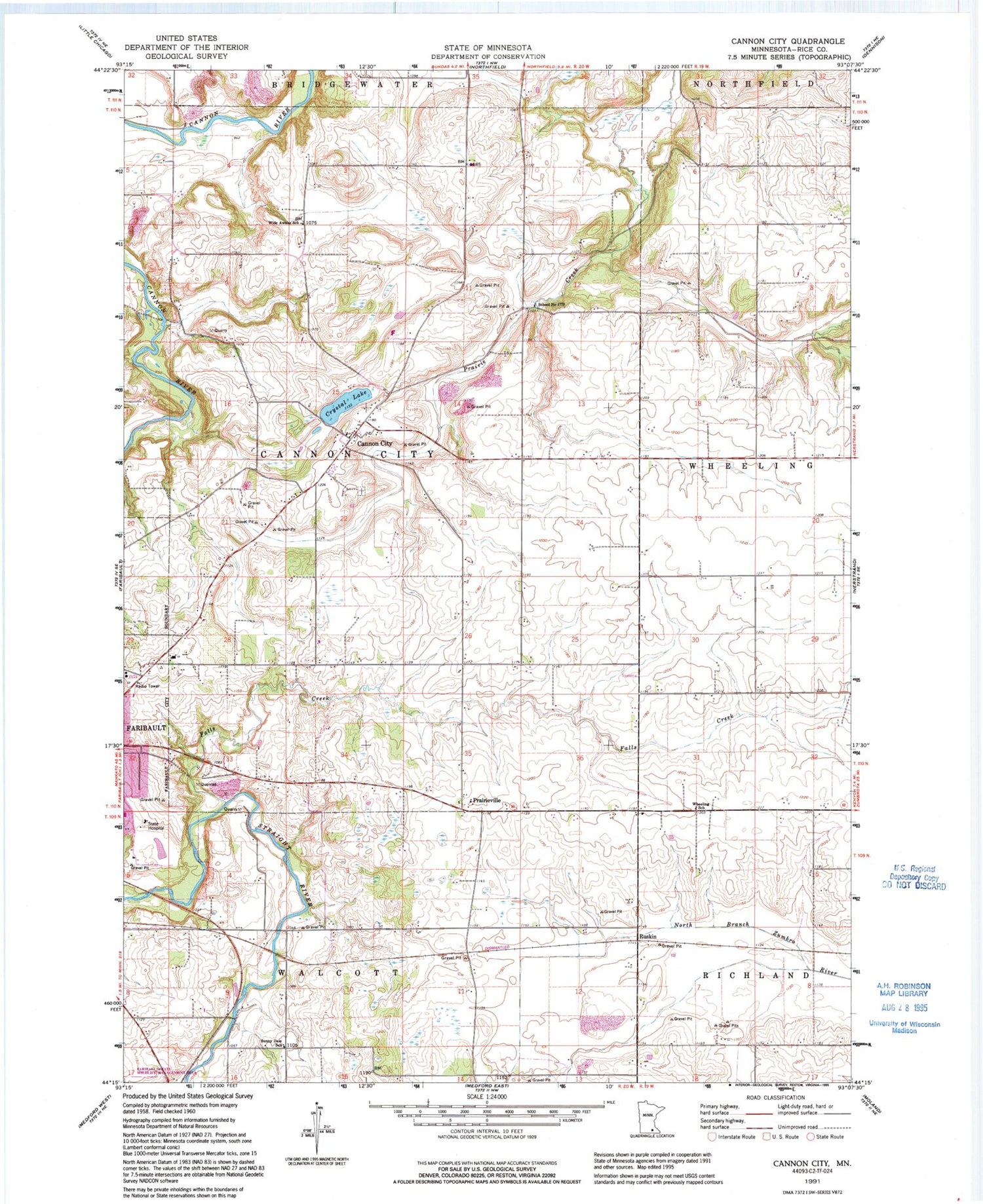
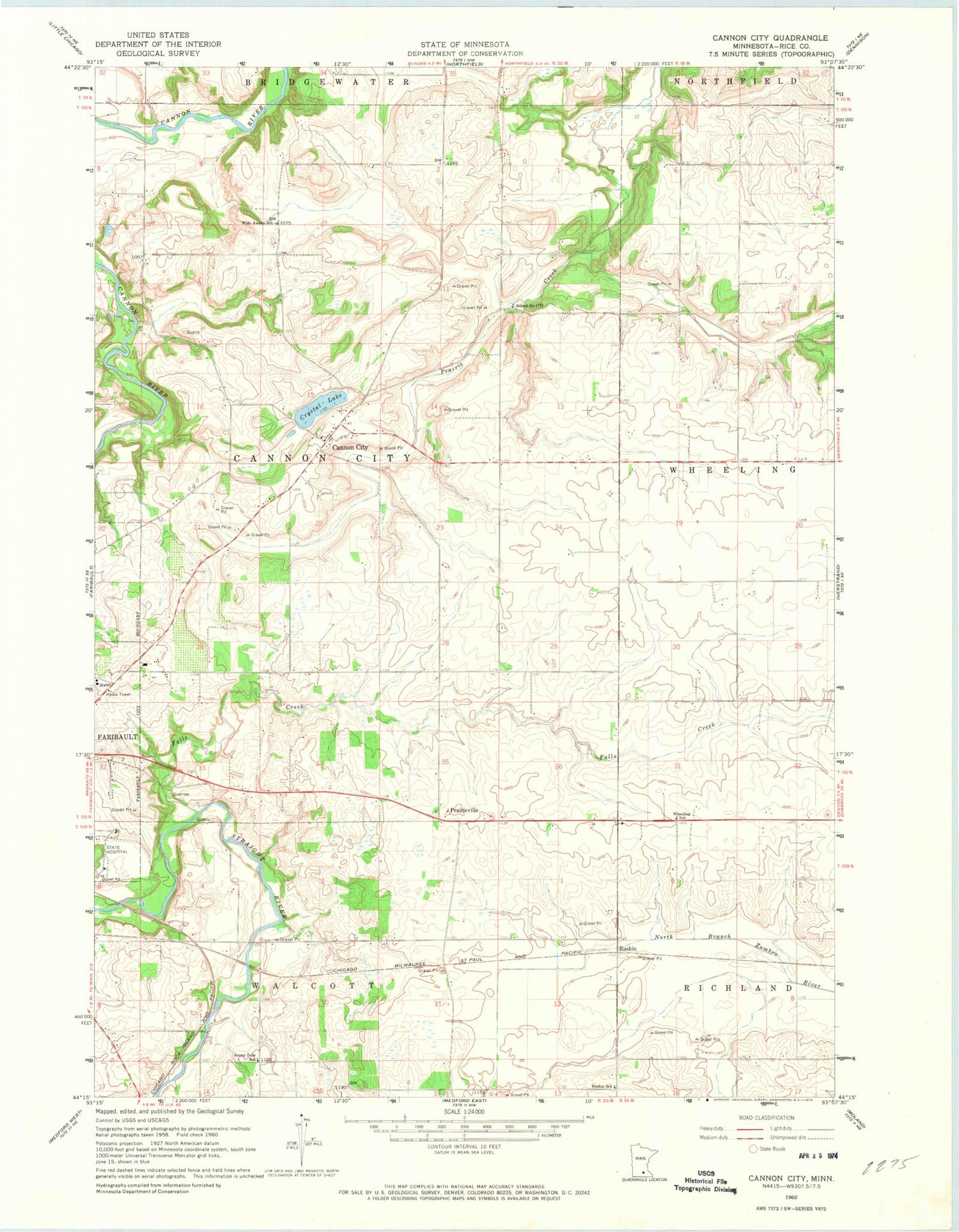
Classic USGS Cannon City Minnesota 7.5'x7.5' Topo Map
Regular price
$16.95
Regular price
Sale price
$16.95
Unit price
per
Couldn't load pickup availability
Historical USGS topographic quad map of Cannon City in the state of Minnesota. Map scale may vary for some years, but is generally around 1:24,000. Print size is approximately 24" x 27"
This quadrangle is in the following counties: Rice.
The map contains contour lines, roads, rivers, towns, and lakes. Printed on high-quality waterproof paper with UV fade-resistant inks, and shipped rolled.
Contains the following named places: Cannon City, Crystal Lake, Falls Creek, Kanne Orchard, KQCL-FM (Faribault), Prairieville, Ruskin, Ruskin School, School Number 1773, Sunny Dale School, Township of Cannon City, Trumps Orchard, Wheeling School, Wide Awake School