MyTopo
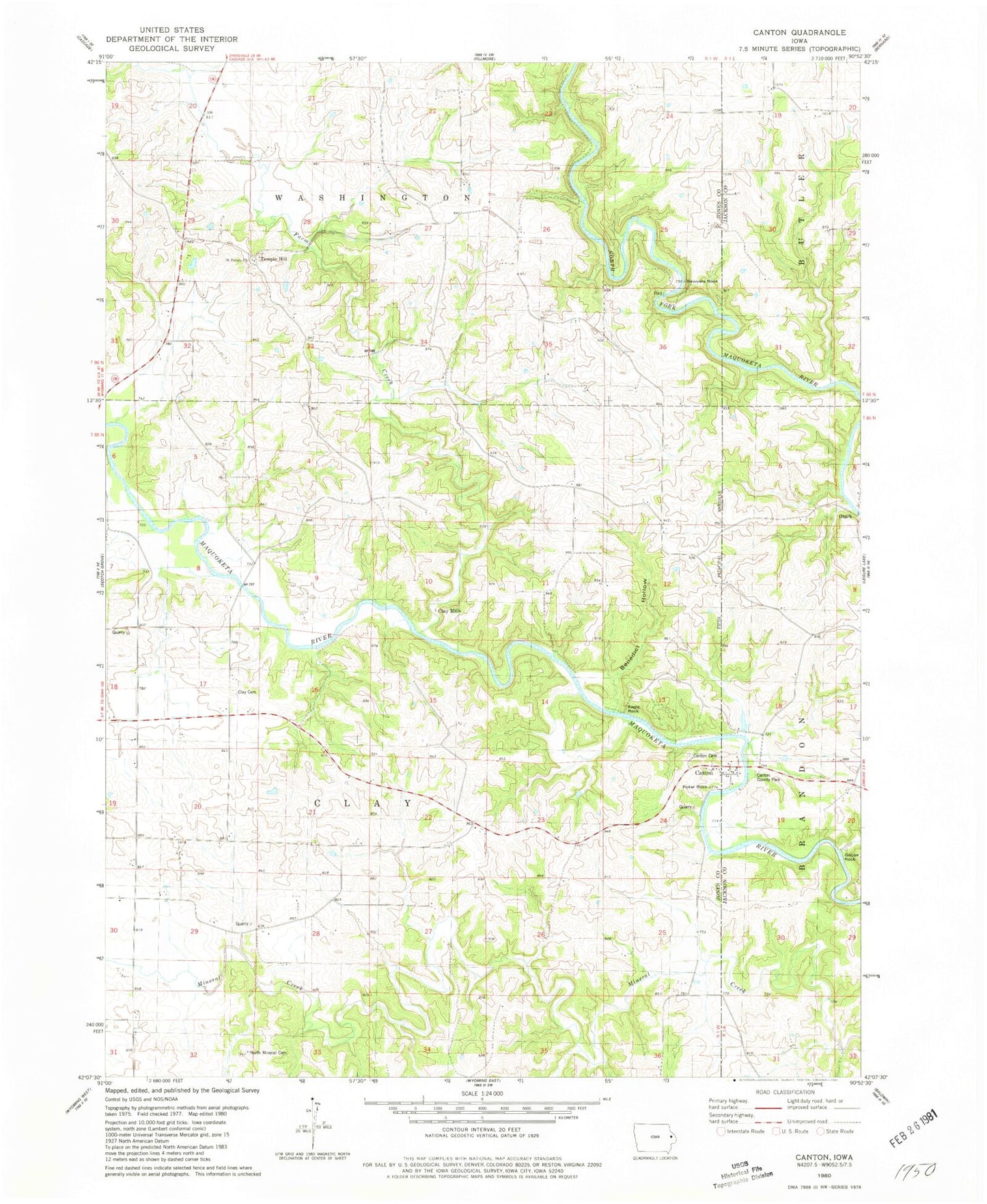
Classic USGS Canton Iowa 7.5'x7.5' Topo Map
Couldn't load pickup availability
Historical USGS topographic quad map of Canton in the state of Iowa. Map scale may vary for some years, but is generally around 1:24,000. Print size is approximately 24" x 27"
This quadrangle is in the following counties: Jackson, Jones.
The map contains contour lines, roads, rivers, towns, and lakes. Printed on high-quality waterproof paper with UV fade-resistant inks, and shipped rolled.
Contains the following named places: Benedict Hollow, Black Hawk Creek, Canton, Canton Cemetery, Canton County Park, Canton Post Office, Canton School, Clay Cemetery, Clay Mills, Clay Mills Post Office, Clayford, Clayford Post Office, Eagle Rock, East Canton, Farm Creek, Goose Rock, Mahoneys Bend, McGargels Ford, North Mineral Cemetery, Oxbow, Ozark, Poker Rock, Saint Peters Cemetery, Saint Peters Church, Sawyers Rock, Squirrel Island, Supple Bridge, Temple Hill, Temple Hill Post Office, Township of Clay, Walters Mill Post Office, ZIP Codes: 52309, 52321