
MyTopo
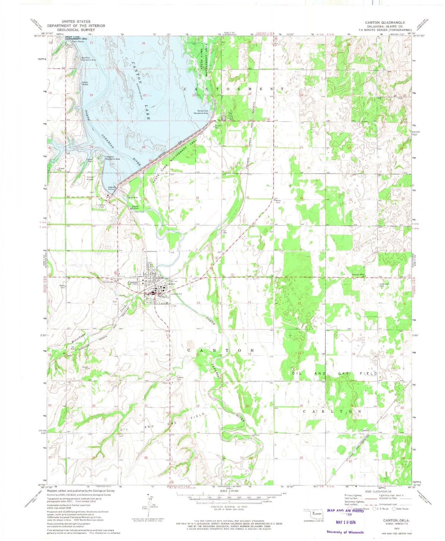
Classic USGS Canton Oklahoma 7.5'x7.5' Topo Map
Couldn't load pickup availability
Historical USGS topographic quad map of Canton in the state of Oklahoma. Map scale may vary for some years, but is generally around 1:24,000. Print size is approximately 24" x 27"
This quadrangle is in the following counties: Blaine.
The map contains contour lines, roads, rivers, towns, and lakes. Printed on high-quality waterproof paper with UV fade-resistant inks, and shipped rolled.
Contains the following named places: Assembly of God Church, Big Bend Recreation Area, Canadian Recreation Area, Canton, Canton - Longdale Ambulance Service, Canton Cemetery, Canton Dam, Canton Division, Canton Elementary School, Canton High School, Canton Lake, Canton Police Department, Canton Post Office, Canton Volunteer Fire Department, Cantonment Reinterment Cemetery, Carleton, Carlton, Cherryvale Cemetery, Christian Church, Family Worship Center, Indian Church, Indian-Mennonite Cemetery, Minnehaha Creek, Sandy Cove Recreation Area, Town of Canton, Township of Canton, Township of Cantonment, Zion Mennonite Indian Cemetery


