MyTopo
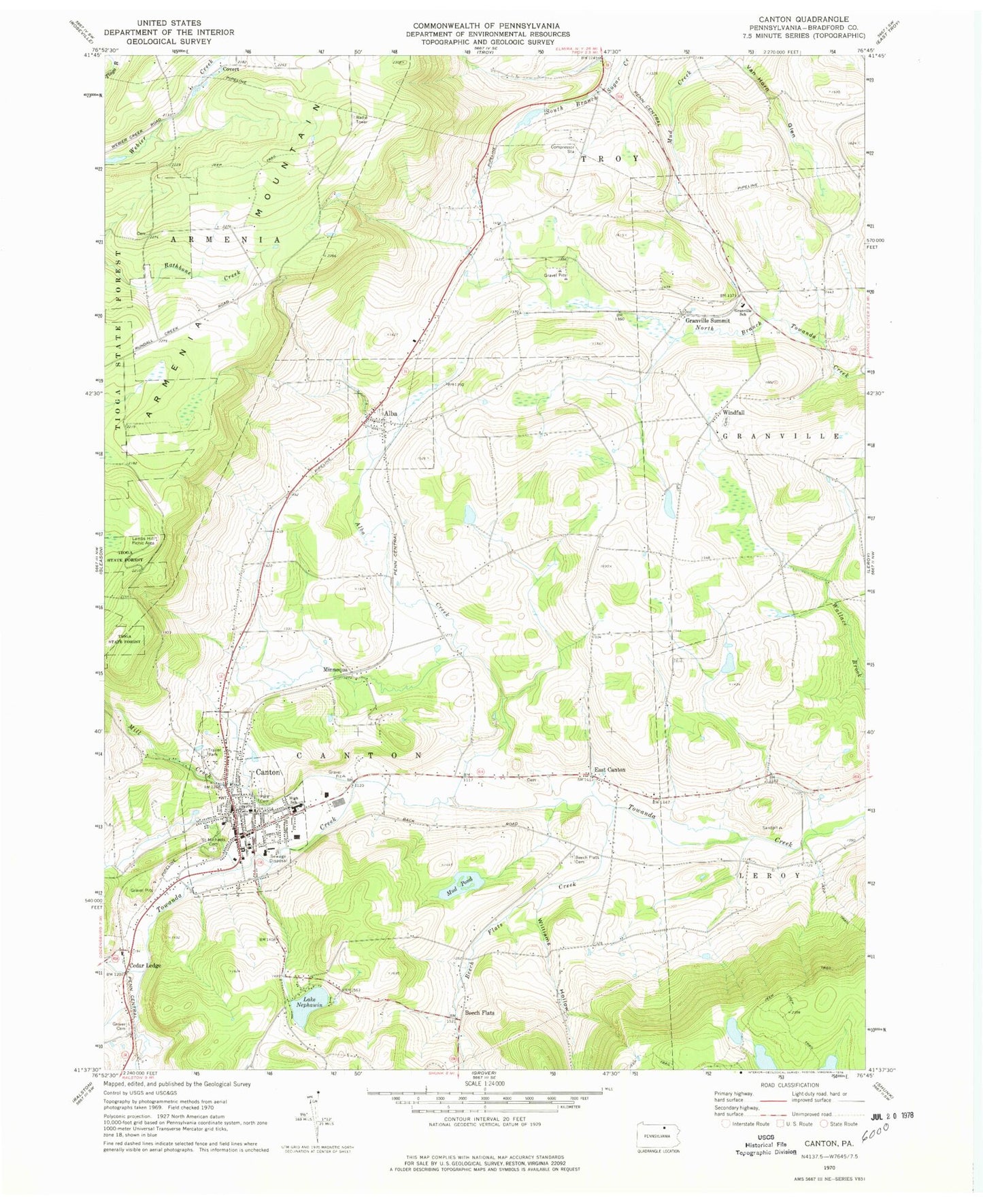
Classic USGS Canton Pennsylvania 7.5'x7.5' Topo Map
Couldn't load pickup availability
Historical USGS topographic quad map of Canton in the state of Pennsylvania. Map scale may vary for some years, but is generally around 1:24,000. Print size is approximately 24" x 27"
This quadrangle is in the following counties: Bradford.
The map contains contour lines, roads, rivers, towns, and lakes. Printed on high-quality waterproof paper with UV fade-resistant inks, and shipped rolled.
Contains the following named places: A Griffin Cemetery, Alba, Alba Cemetery, Alba Creek, Beech Flats, Beech Flats Cemetery, Beech Flats Creek, Borough of Alba, Borough of Canton, Canton, Canton Borough Police Department, Canton Post Office, Canton Volunteer Fire Department / Innes Hose Company, Cedar Ledge, Covert, Cowley Station, East Canton, East Canton Cemetery, Granville School, Granville Summit, Granville Summit Post Office, Grover Cemetery, Lake Nephawin, Lambs Hill Picnic Area, Main Street Cemetery, Mill Creek, Minnequa, Mud Pond, North Woods School, Park Cemetery, Pierce Cemetery, Robbins Farm Airport, Saint Michaels Cemetery, Spaulding Cemetery, Sugar Creek Dam, Tenneco Heliport, Township of Armenia, Township of Canton, Van Horn Glen, Western Alliance Emergency Services Satellite Station 1, Williams Hollow, Windfall, Windfall Cemetery, ZIP Code: 17724