
MyTopo
Classic USGS Canton South Dakota 7.5'x7.5' Topo Map
Couldn't load pickup availability
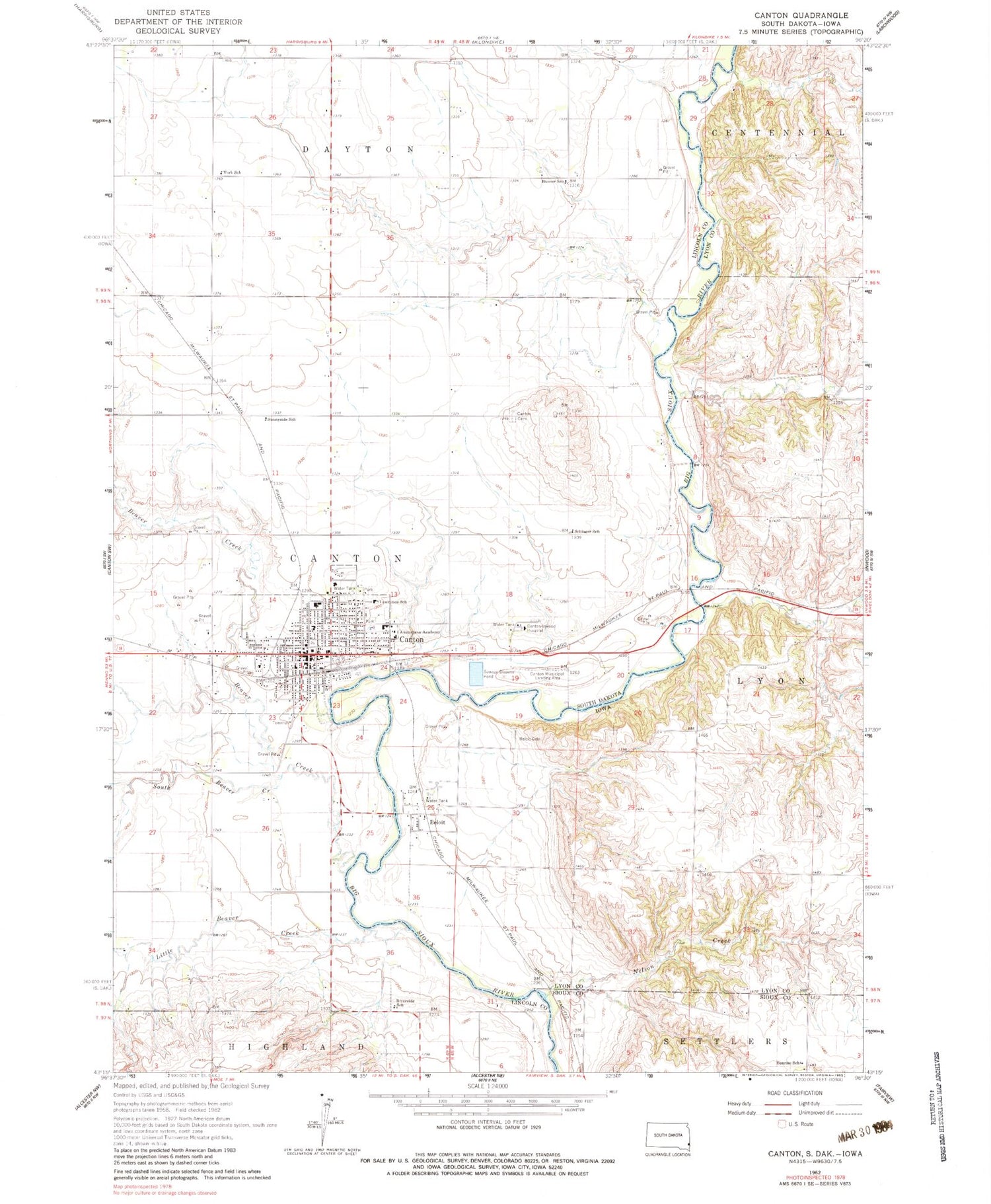
Historical USGS topographic quad map of Canton in the states of South Dakota, Iowa. Map scale may vary for some years, but is generally around 1:24,000. Print size is approximately 24" x 27"
This quadrangle is in the following counties: Lincoln, Lyon, Sioux.
The map contains contour lines, roads, rivers, towns, and lakes. Printed on high-quality waterproof paper with UV fade-resistant inks, and shipped rolled.
Contains the following named places: Augustana Academy, Banner School, Beaver Creek, Beloit, Beloit Cemetery, Beloit Post Office, Big Sioux River Wildlife Area - Kroger Tract, Big Sioux River Wildlife Area - Nelson Tract, Big Sioux River Wildlife Area - Olson Tract, Big Sioux Wildlife Public Hunting Area, Canton, Canton - Inwood Ambulance Service, Canton - Inwood Memorial Hospital, Canton Cemetery, Canton City Hall, Canton Fire Department, Canton High School, Canton Middle School, Canton Mounds, Canton Municipal Airport, Canton Police Department, Canton Post Office, Canton Public Library, City of Canton, Hiawatha Asylum Cemetery, Keystone Treatment Center, Lawrence School, Lincoln County Courthouse, Lincoln County Sheriff, Little Beaver Creek, Nelson Creek, Remedy High School, Riverside School, Schiager School, South Beaver Creek, Sunnyside School, Sunrise School, Township of Lyon, York School, ZIP Code: 57013


