MyTopo
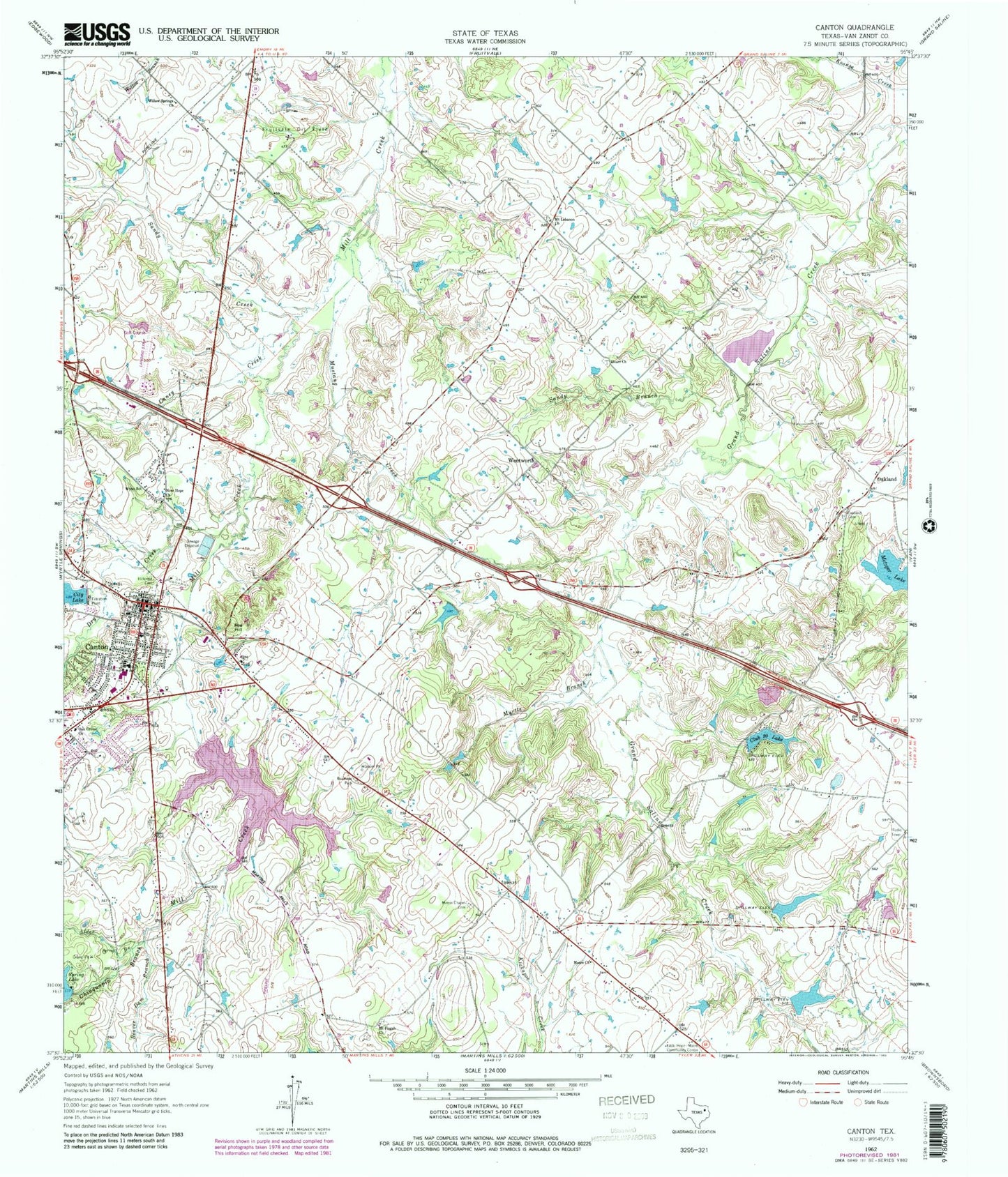
Classic USGS Canton Texas 7.5'x7.5' Topo Map
Couldn't load pickup availability
Historical USGS topographic quad map of Canton in the state of Texas. Map scale may vary for some years, but is generally around 1:24,000. Print size is approximately 24" x 27"
This quadrangle is in the following counties: Van Zandt.
The map contains contour lines, roads, rivers, towns, and lakes. Printed on high-quality waterproof paper with UV fade-resistant inks, and shipped rolled.
Contains the following named places: Alder Branch, Beaver Dam Branch, Caney Creek, Canton, Canton City Hall, Canton City Lake Dam, Canton Elementary School, Canton Fire Department, Canton Intermediate School, Canton Junior High School, Canton Police Department, Canton Post Office, Canton-Hackney Airport, Chinguapin Branch, Church of Christ on Big Rock, City Lake, City of Canton, Club 20 Lake Dam, Club Twenty Lake, Dry Creek, First Presbyterian Church, Hillcrest Cemetery, Kellam Number 1 Dam, Kellam Number 1 Lake, Kellam Number 2 Dam, Kellam Number 2 Lake, Little Hope-Moore Community Center, Metzger Lake, Metzger Lake Number 1, Moore Church, Morris Chapel Cemetery, Mount Lebanon Church, Mount Pisgah Church, Mustang Creek, Myrtle Branch, New Hope Church, Oak Grove Baptist Church, Oak Grove Church, Oakland, Oakland Cemetery, Owen Lake, Owen Lake Dam, Red Hill, Sandy Branch, Sandy Creek, Soil Conservation Service Site Number 1 Dam, Soil Conservation Service Site Number 1 Reservoir, Spring Lake Dam, Starr Church, Texas Department of Public Safety - Highway Patrol Office, Thompson Field, Van Zandt County, Van Zandt County Justice Center, Van Zandt County Sheriff's Office, Wentworth, Willow Springs Church, Wynn School