MyTopo
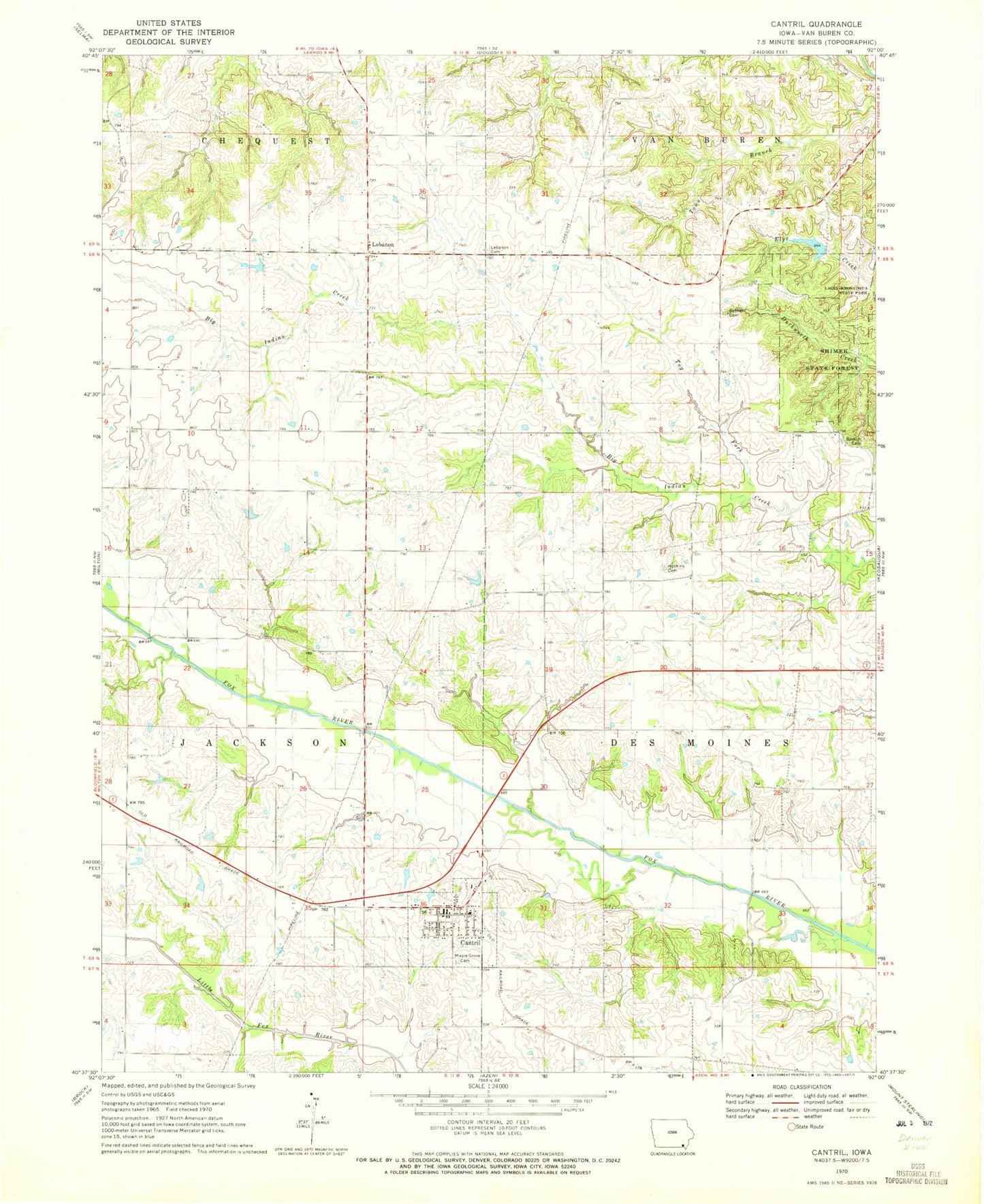
Classic USGS Cantril Iowa 7.5'x7.5' Topo Map
Couldn't load pickup availability
Historical USGS topographic quad map of Cantril in the state of Iowa. Map scale may vary for some years, but is generally around 1:24,000. Print size is approximately 24" x 27"
This quadrangle is in the following counties: Van Buren.
The map contains contour lines, roads, rivers, towns, and lakes. Printed on high-quality waterproof paper with UV fade-resistant inks, and shipped rolled.
Contains the following named places: Bethel Cemetery, Boston Cemetery, Cantril, Cantril Christian Church, Cantril Elementary School, Cantril Post Office, Cantril Public Library, Cantril Volunteer Fire Department, City of Cantril, East Home Prairie Cemetery, Egypt Cemetery, Home Post Office, Hoskins Cemetery, Lebanon, Lebanon Cemetery, Lebanon Church, Lebanon Post Office, Mantoyne Cemetery, Maple Grove Cemetery, Mechanicsburgh Post Office, Niles Post Office, Shimek State Forest Wildlife Management Area - Keosauqua Unit, Ten Sych Cemetery, Township of Des Moines, Township of Jackson, Tug Fork Big Indian Creek, United Methodist Church, Upton Post Office