MyTopo
Classic USGS Canyon Day Arizona 7.5'x7.5' Topo Map
Couldn't load pickup availability
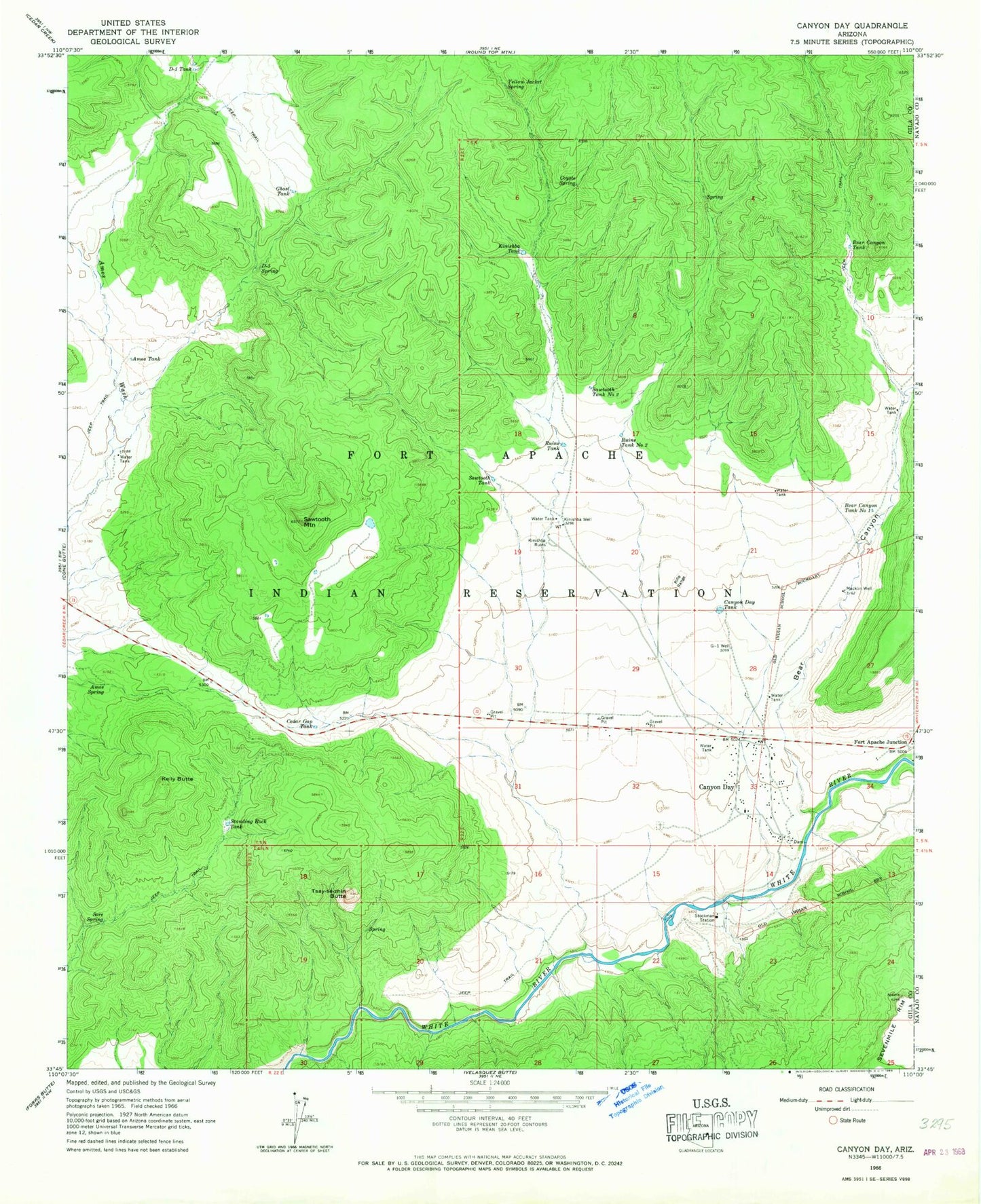
Historical USGS topographic quad map of Canyon Day in the state of Arizona. Map scale may vary for some years, but is generally around 1:24,000. Print size is approximately 24" x 27"
This quadrangle is in the following counties: Gila, Navajo.
The map contains contour lines, roads, rivers, towns, and lakes. Printed on high-quality waterproof paper with UV fade-resistant inks, and shipped rolled.
Contains the following named places: Amos Spring, Amos Tank, Bear Canyon, Bear Canyon Number One, Bear Canyon Tank, Canyon Day, Canyon Day Census Designated Place, Canyon Day Junior High School, Canyon Day Tank, Cedar Gap Tank, Coyote Spring, D-five Spring, D-five Tank, Fort Apache Junction, Ghost Tank, G-one Well, Kelly Butte, Kinishba Tank, Kinishba Well, Macklin Well, Ruins Tank, Ruins Tank Number Two, Sawtooth Mountain, Sawtooth Tank, Sawtooth Tank Number Two, Sore Spring, Standing Rock Tank, Stockman Station, Tsay-se-zhin Butte, Yellow Jacket Spring