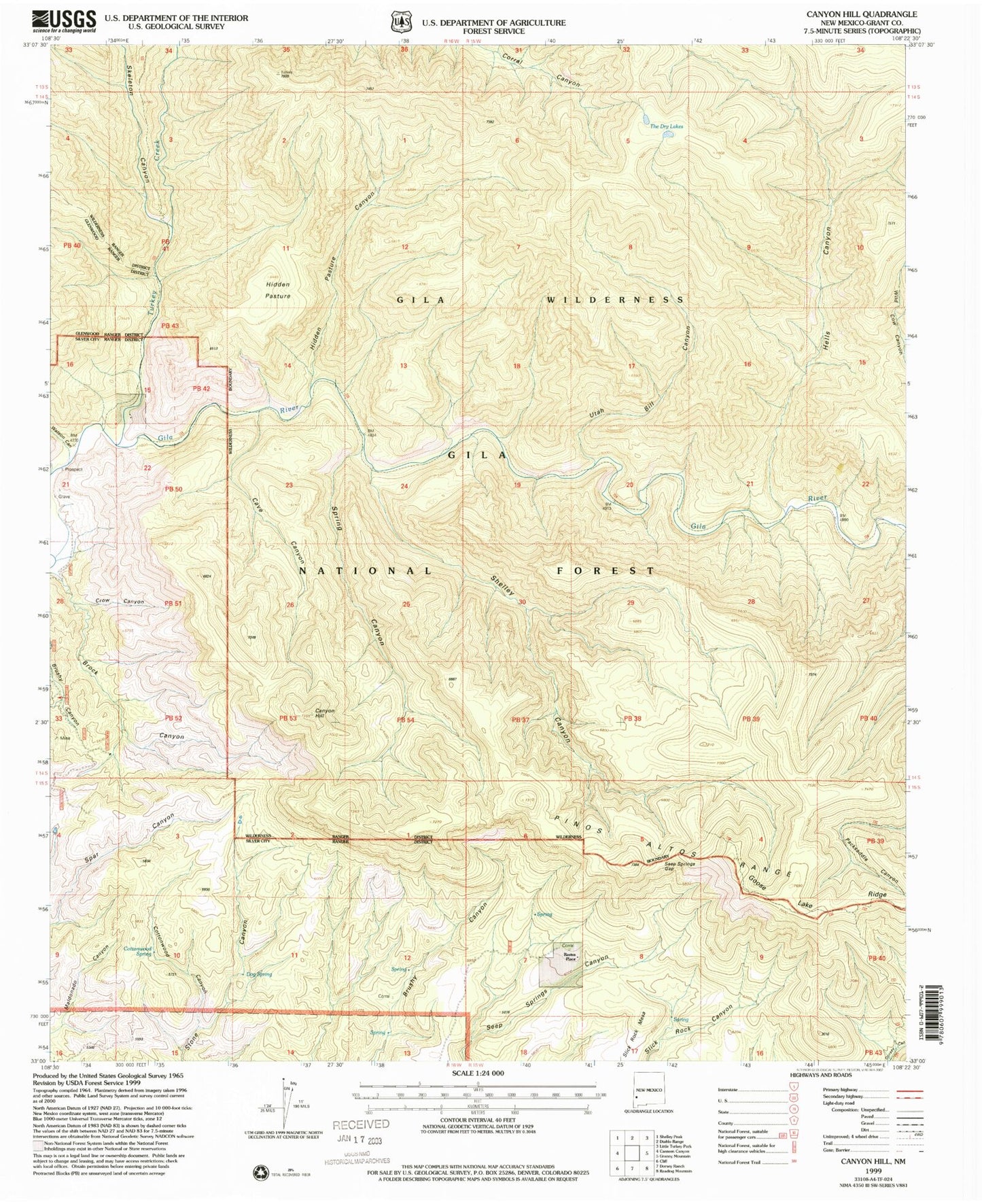
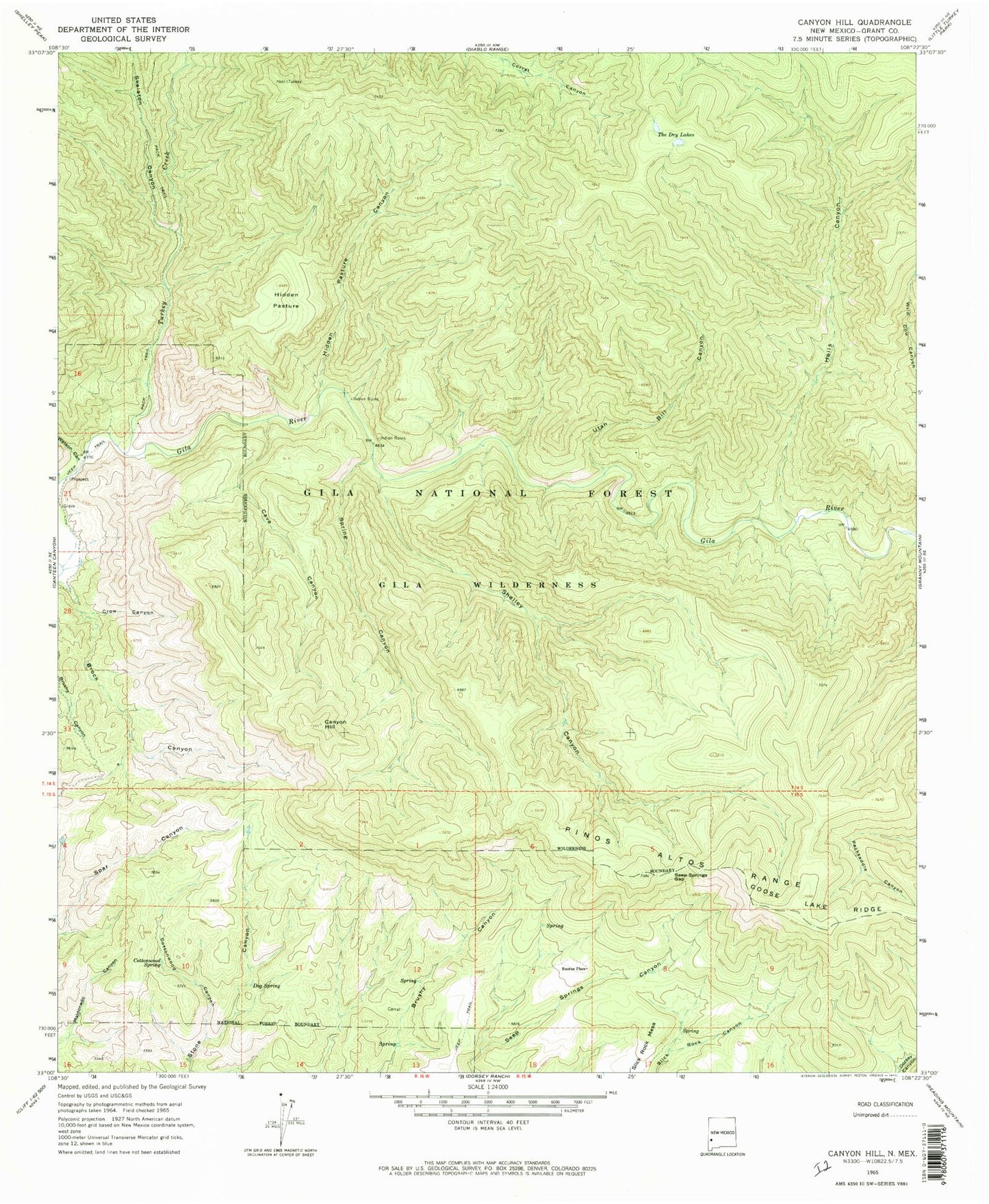
MyTopo
Classic USGS Canyon Hill New Mexico 7.5'x7.5' Topo Map
Couldn't load pickup availability
Historical USGS topographic quad map of Canyon Hill in the state of New Mexico. Typical map scale is 1:24,000, but may vary for certain years, if available. Print size: 24" x 27"
This quadrangle is in the following counties: Grant.
The map contains contour lines, roads, rivers, towns, and lakes. Printed on high-quality waterproof paper with UV fade-resistant inks, and shipped rolled.
Contains the following named places: Brock Canyon, Canyon Hill, Cave Canyon, Cottonwood Canyon, Cottonwood Spring, Crow Canyon, Dog Spring, Hells Canyon, Hidden Pasture, Hidden Pasture Canyon, Rastus Place, Seep Springs Gap, Shelley Canyon, Skeleton Canyon, Slick Rock Mesa, Spring Canyon, The Dry Lakes, Utah Bill Canyon, Watson Canyon, Blue Benny Mine, Watson Mountain Deposit, Brock Canyon Prospect, Turkey Creek, The Clanton Hideout Historical Marker, Turkey