MyTopo
Classic USGS Canyon Lake Washington 7.5'x7.5' Topo Map
Regular price
$16.95
Regular price
Sale price
$16.95
Unit price
per
Couldn't load pickup availability
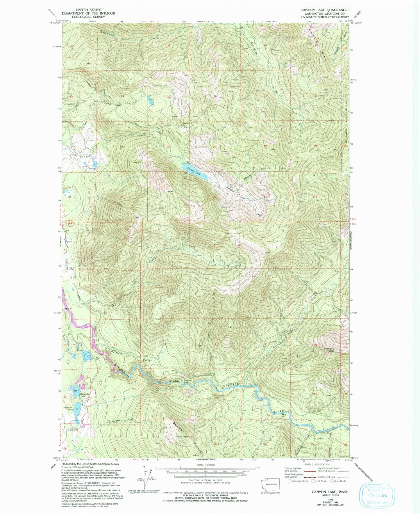
Historical USGS topographic quad map of Canyon Lake in the state of Washington. Map scale may vary for some years, but is generally around 1:24,000. Print size is approximately 24" x 27"
This quadrangle is in the following counties: Whatcom.
The map contains contour lines, roads, rivers, towns, and lakes. Printed on high-quality waterproof paper with UV fade-resistant inks, and shipped rolled.
Contains the following named places: Canyon Lake, Clearwater Creek, Falls Creek, Galbraith Creek, Heislers Creek, Johnsons Creek, Jorgensen Lake, Mosquito Lake, Mosquito Lake Road Bridge, Nooksack Lookout, Seymour Creek, Slide Mountain, Stewart Peak, Toboggan Creek