MyTopo
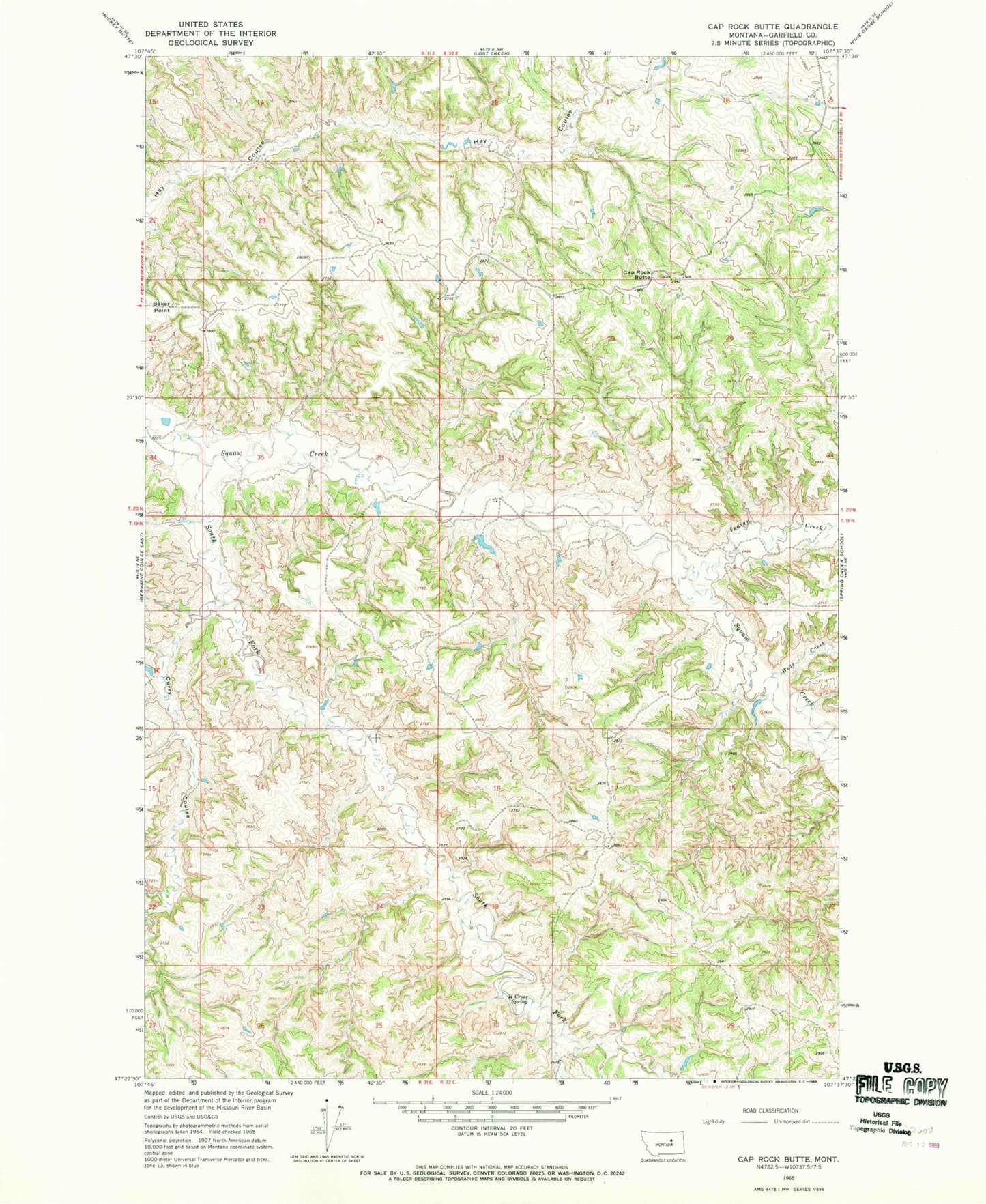
Classic USGS Cap Rock Butte Montana 7.5'x7.5' Topo Map
Regular price
$16.95
Regular price
Sale price
$16.95
Unit price
per
Couldn't load pickup availability
Historical USGS topographic quad map of Cap Rock Butte in the state of Montana. Map scale may vary for some years, but is generally around 1:24,000. Print size is approximately 24" x 27"
This quadrangle is in the following counties: Garfield.
The map contains contour lines, roads, rivers, towns, and lakes. Printed on high-quality waterproof paper with UV fade-resistant inks, and shipped rolled.
Contains the following named places: 20N31E23BABC01 Well, 20N31E23BBAD01 Well, 20N31E23BD__01 Well, Baker Point, Cap Rock Butte, Curry Coulee, H Cross Spring, Indian Creek, Little Nancy Russell Creek, Shawver Number 1 Dam, Uebra Post Office, Wolf Creek