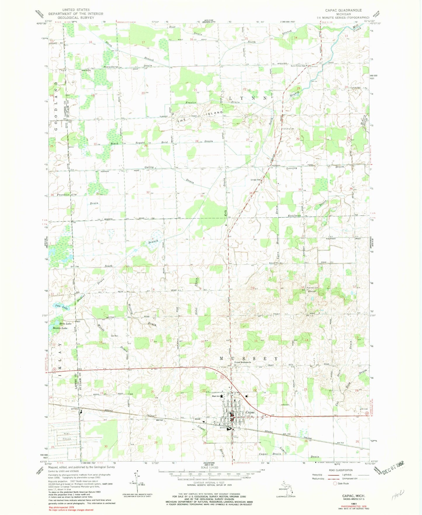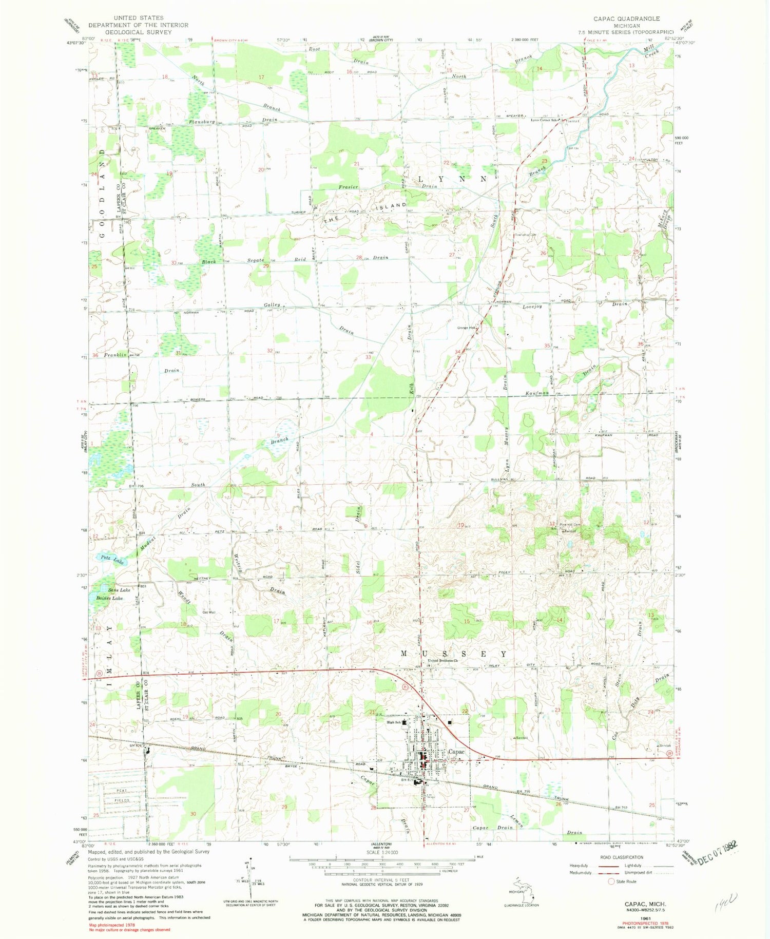
MyTopo
Classic USGS Capac Michigan 7.5'x7.5' Topo Map
Couldn't load pickup availability
Historical USGS topographic quad map of Capac in the state of Michigan. Map scale may vary for some years, but is generally around 1:24,000. Print size is approximately 24" x 27"
This quadrangle is in the following counties: Lapeer, St. Clair.
The map contains contour lines, roads, rivers, towns, and lakes. Printed on high-quality waterproof paper with UV fade-resistant inks, and shipped rolled.
Contains the following named places: Baines Lake, Black Segate Reid Drain, Capac, Capac Community Museum, Capac Elementary School, Capac High School, Capac Library, Capac Middle School, Capac Police Department, Capac Post Office, Capac Station, Deer View Golf Club, First Baptist Church of Capac, First United Methodist Church, Flansburg Drain, Franklin Drain, Frasier Drain, Galley Drain, Gavagan Field, Kaufman Drain, Kolb Drain, Lemon Drain, Lynn Corner School, Lynn Mussey Drain, Lynn Post Office, Lynn Township Cemetery, Mercy Family Care, Mudcat Drain, Mussey Township Cemetery, Mussey Township Fire Department, North Branch Mill Creek, Petz Lake, Pine Hill Cemetery, Root Drain, Saint John's Lutheran Church, Saint Nicholas Catholic Church, Sans Lake, Sidel Drain, South Branch Mill Creek, Stein Drain, The Island, Township of Lynn, Township of Mussey, Tri - Hospital Emergency Medical Services Station 7, United Brethren Cemetery, United Brethren Church, Village of Capac, Weitzig Drain, Wendt Drain, ZIP Code: 48014