MyTopo
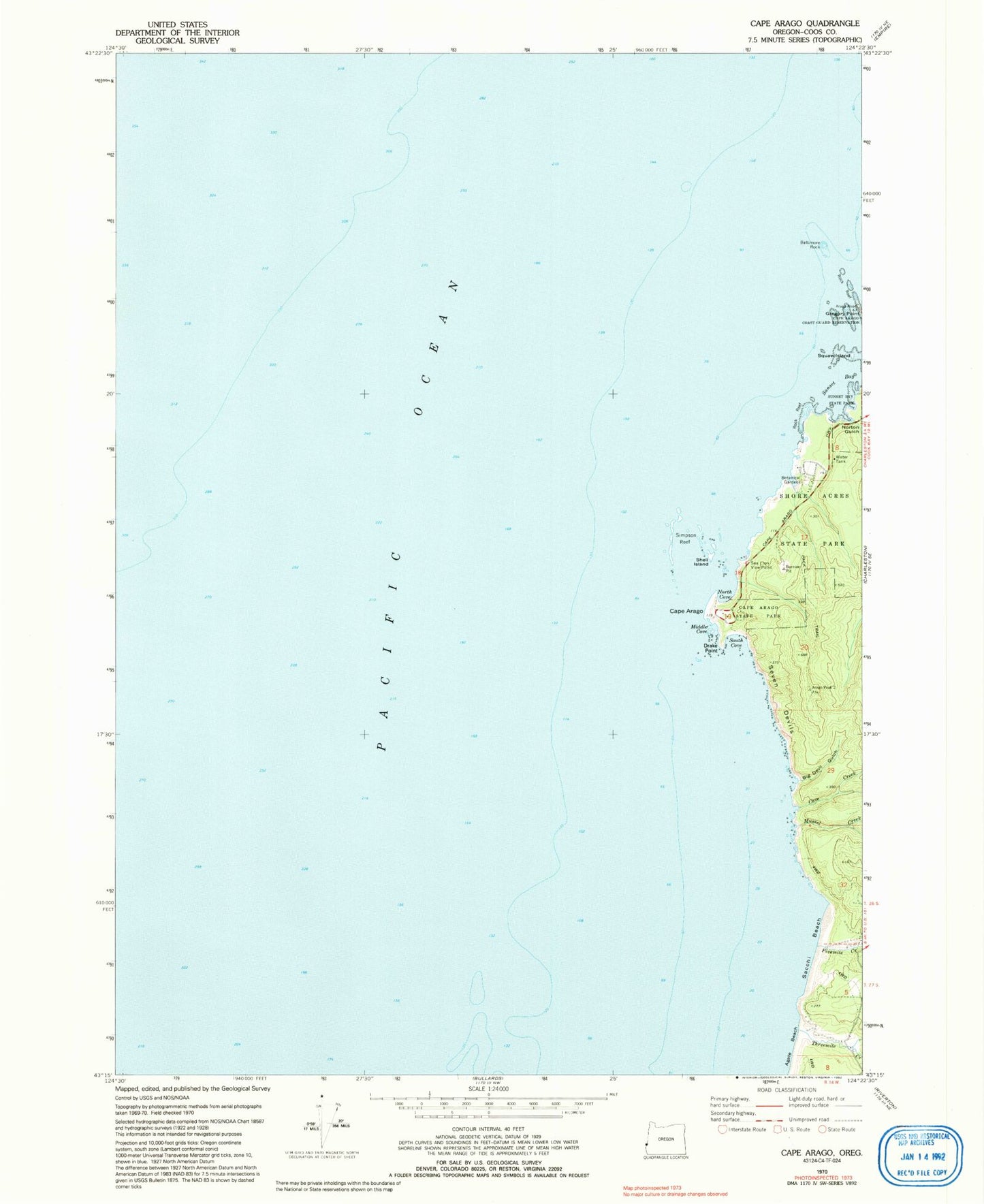
Classic USGS Cape Arago Oregon 7.5'x7.5' Topo Map
Couldn't load pickup availability
Historical USGS topographic quad map of Cape Arago in the state of Oregon. Map scale may vary for some years, but is generally around 1:24,000. Print size is approximately 24" x 27"
This quadrangle is in the following counties: Coos.
The map contains contour lines, roads, rivers, towns, and lakes. Printed on high-quality waterproof paper with UV fade-resistant inks, and shipped rolled.
Contains the following named places: Agate Beach, Baltimore Rock, Big Creek, Big Devil Gulch, Cape Arago, Cape Arago Lighthouse, Cape Arago State Park, Cave Creek, Chiefs Island, Drake Point, First Creek, Fivemile Creek, Gregory Point, Middle Cove, Mussel Creek, North Cove, Norton Gulch, Qochyax Island, Sacchi Beach, Sea Lion View Point, Seven Devils, Shell Island, Shore Acres, Shore Acres State Park, Simpson Reef, South Cove, Sunset Bay, Threemile Creek