
MyTopo
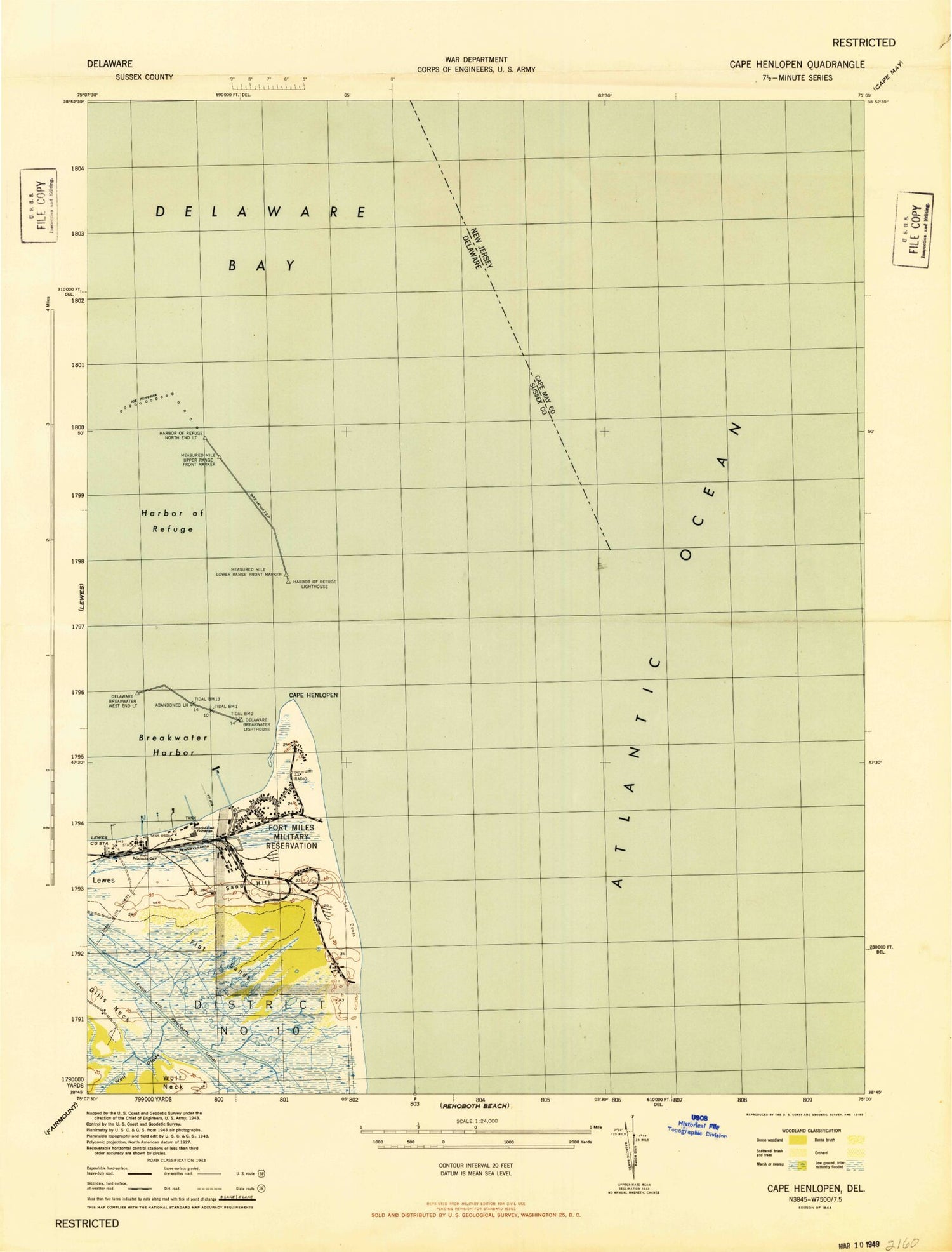
Classic USGS Cape Henlopen Delaware 7.5'x7.5' Topo Map
Couldn't load pickup availability
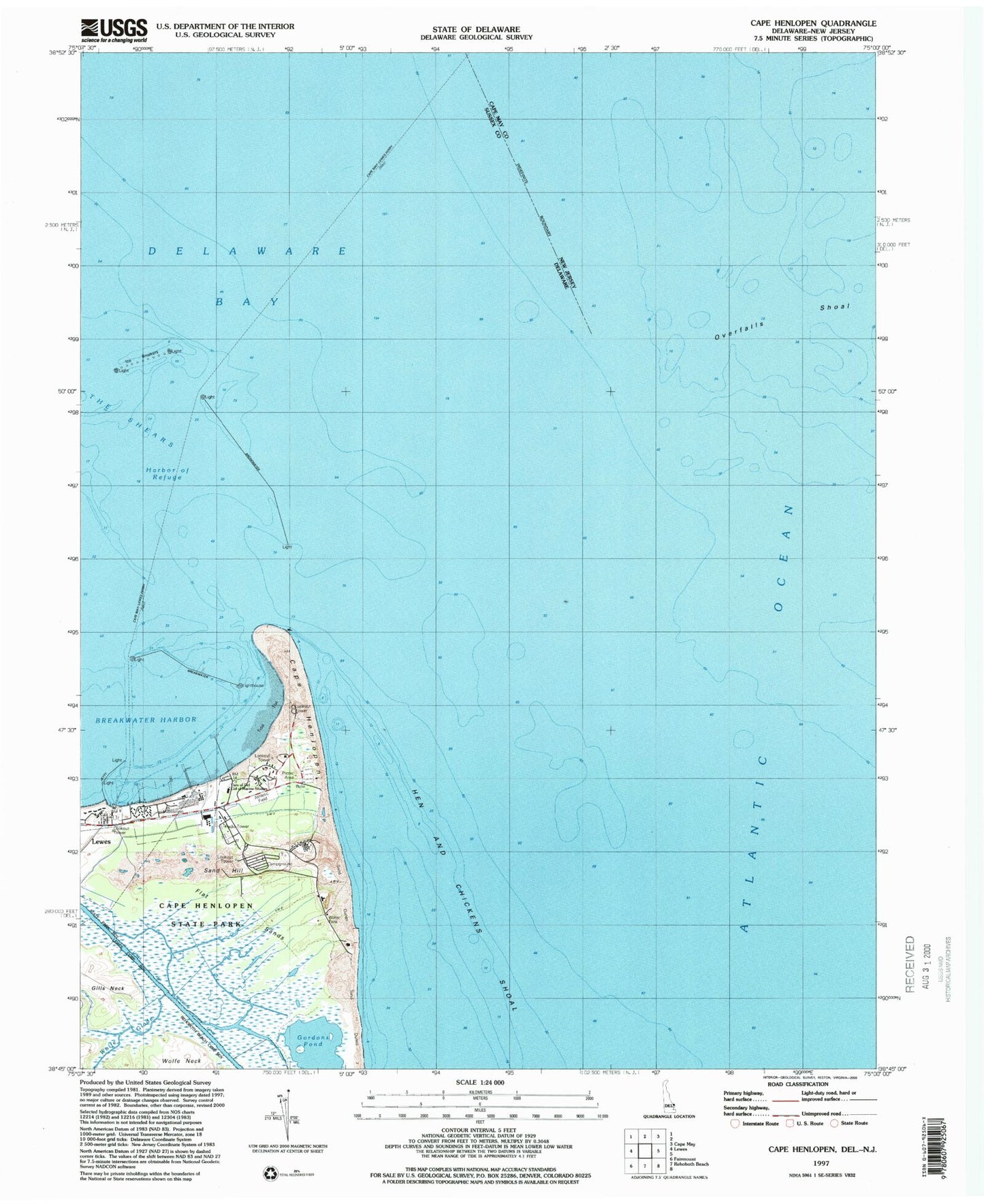
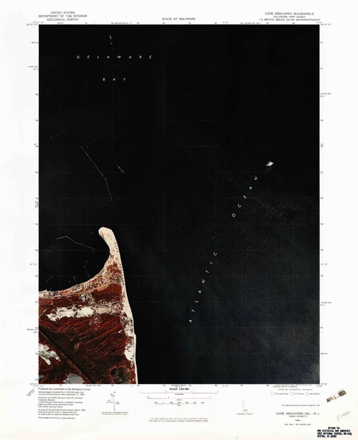
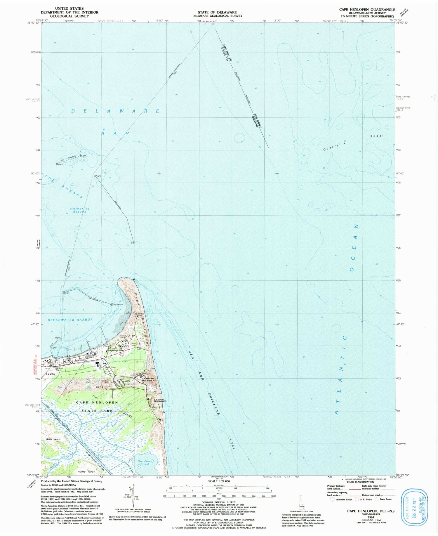
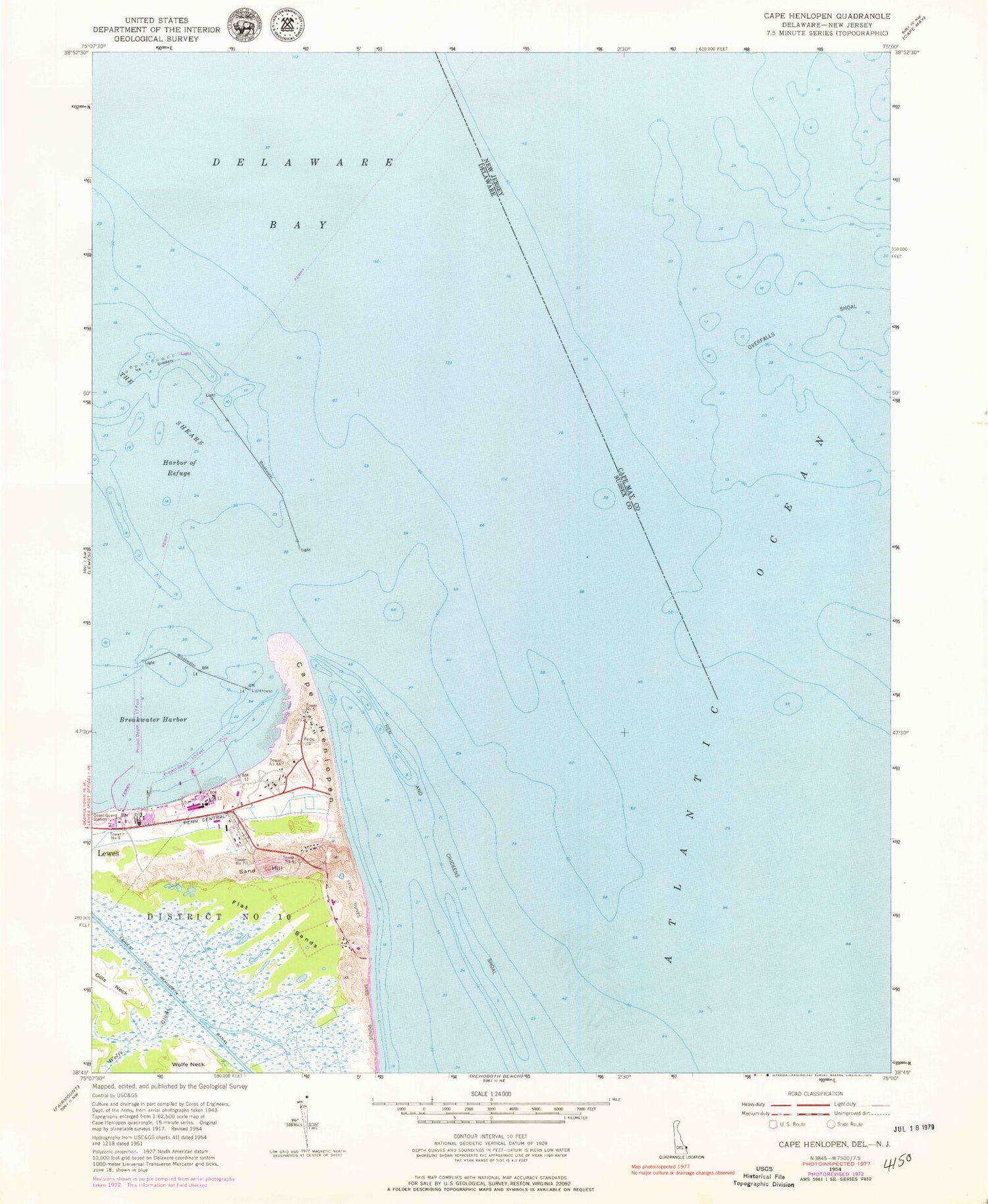
Historical USGS topographic quad map of Cape Henlopen in the states of Delaware, New Jersey. Typical map scale is 1:24,000, but may vary for certain years, if available. Print size: 24" x 27"
This quadrangle is in the following counties: Cape May, Sussex.
The map contains contour lines, roads, rivers, towns, and lakes. Printed on high-quality waterproof paper with UV fade-resistant inks, and shipped rolled.
Contains the following named places: Breakwater Harbor, Cape Henlopen, Flat Sands, Gills Neck, Harbor of Refuge, Hen and Chickens Shoal, Lewes and Rehoboth Canal, Rehoboth Flats, Sand Hill, Wolfe Neck, Tower Number Four, Tower Number Four A, Tower Number Five, Tower Number Seven, Tower Number Eight, Lewes-Cape May Ferry, University of Delaware College of Marine Studies, Wolfe Glade, Cape Henlopen State Park, Barcroft Airport (historical), Gordon Pond Wildlife Area, Fort Miles (historical), Delaware River and Bay Authority Police Station, Overfalls Shoal, Overfalls Shoal, Breakwater Harbor, Cape Henlopen, Flat Sands, Gills Neck, Harbor of Refuge, Hen and Chickens Shoal, Lewes and Rehoboth Canal, Rehoboth Flats, Sand Hill, Wolfe Neck, Tower Number Four, Tower Number Four A, Tower Number Five, Tower Number Seven, Tower Number Eight, Lewes-Cape May Ferry, University of Delaware College of Marine Studies, Wolfe Glade, Cape Henlopen State Park, Barcroft Airport (historical), Gordon Pond Wildlife Area, Fort Miles (historical), Delaware River and Bay Authority Police Station, Overfalls Shoal, Overfalls Shoal, Breakwater Harbor, Cape Henlopen, Flat Sands, Gills Neck, Harbor of Refuge, Hen and Chickens Shoal, Lewes and Rehoboth Canal, Rehoboth Flats, Sand Hill, Wolfe Neck, Tower Number Four, Tower Number Four A, Tower Number Five, Tower Number Seven, Tower Number Eight, Lewes-Cape May Ferry, University of Delaware College of Marine Studies, Wolfe Glade, Cape Henlopen State Park, Barcroft Airport (historical), Gordon Pond Wildlife Area, Fort Miles (historical), Delaware River and Bay Authority Police Station, Overfalls Shoal, Overfalls Shoal, Breakwater Harbor, Cape Henlopen, Flat Sands, Gills Neck, Harbor of Refuge, Hen and Chickens Shoal, Lewes and Rehoboth Canal, Rehoboth Flats, Sand Hill, Wolfe Neck, Tower Number Four, Tower Number Four A, Tower Number Five, Tower Number Seven, Tower Number Eight, Lewes-Cape May Ferry, University of Delaware College of Marine Studies, Wolfe Glade, Cape Henlopen State Park, Barcroft Airport (historical), Gordon Pond Wildlife Area, Fort Miles (historical), Delaware River and Bay Authority Police Station, Overfalls Shoal, Overfalls Shoal