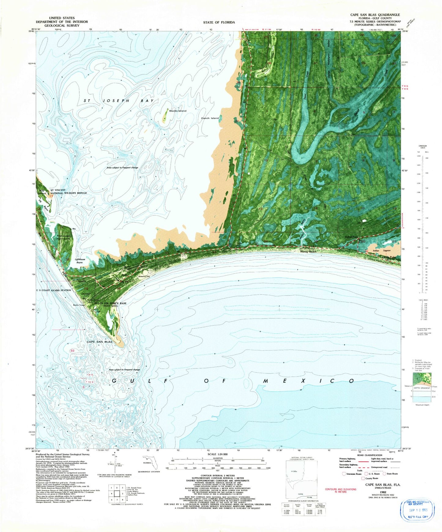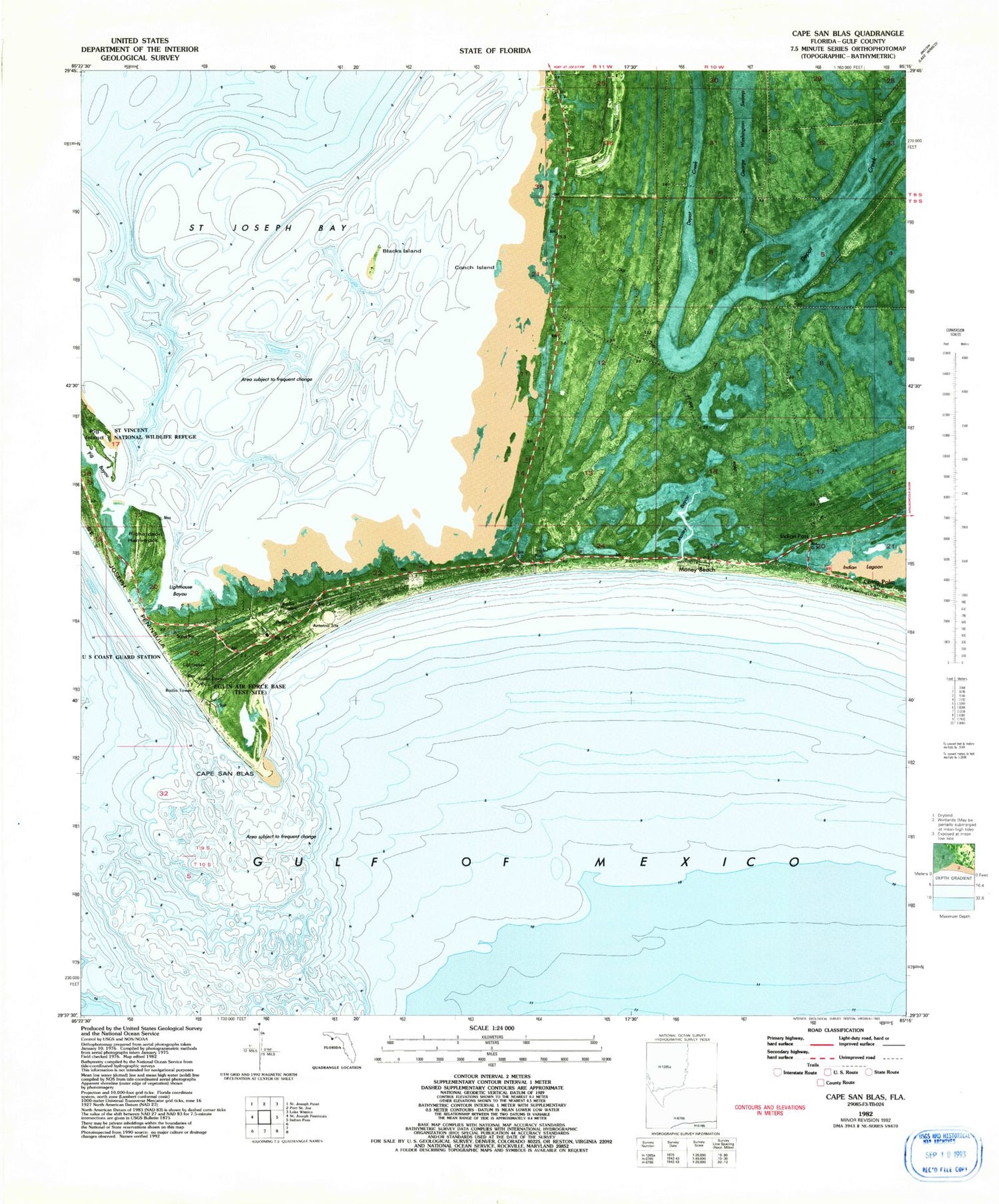
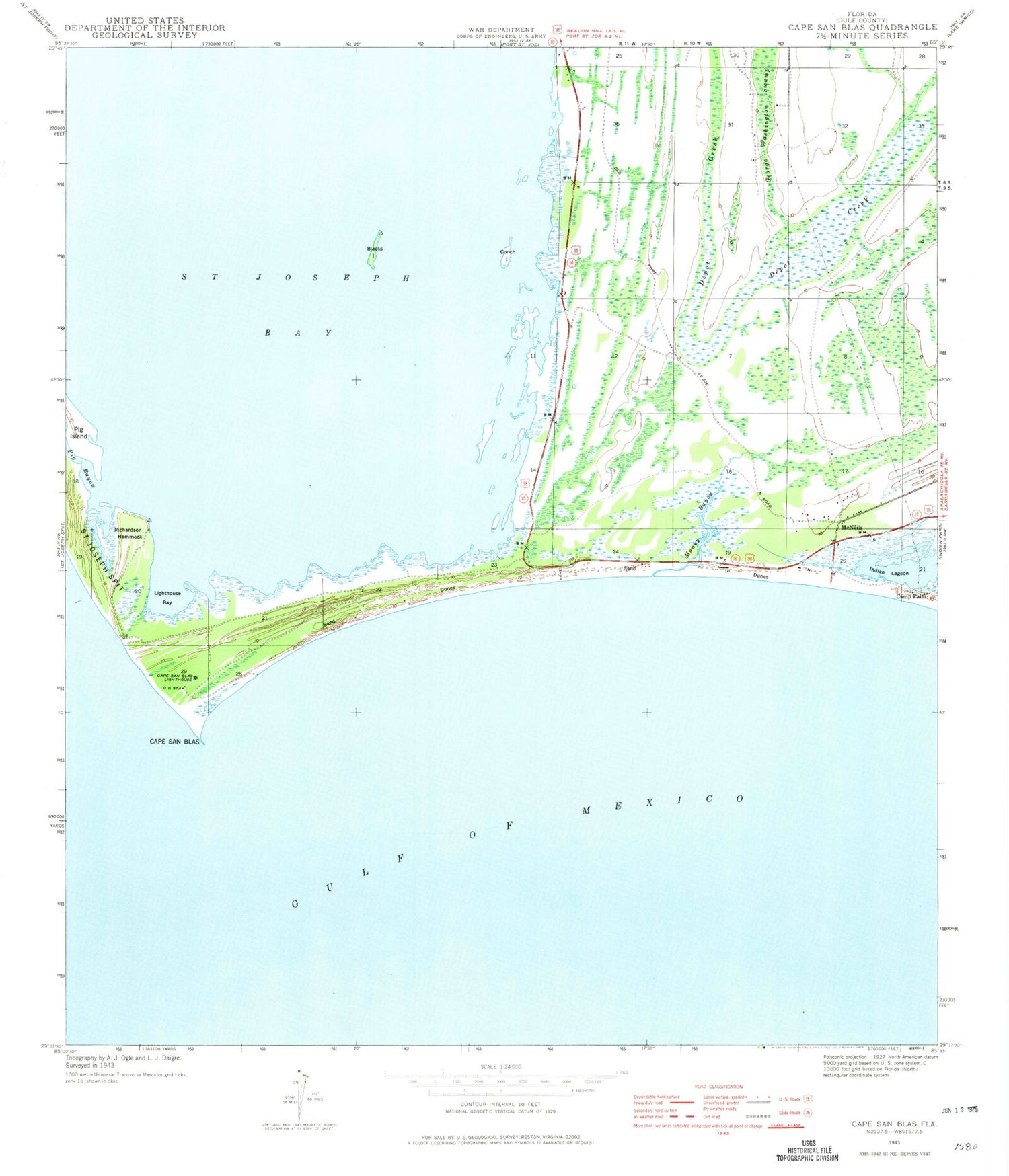
MyTopo
Classic USGS Cape San Blas Florida 7.5'x7.5' Topo Map
Regular price
$16.95
Regular price
Sale price
$16.95
Unit price
per
Couldn't load pickup availability
Historical USGS topographic quad map of Cape San Blas in the state of Florida. Map scale may vary for some years, but is generally around 1:24,000. Print size is approximately 24" x 27"
This quadrangle is in the following counties: Gulf.
The map contains contour lines, roads, rivers, towns, and lakes. Printed on high-quality waterproof paper with UV fade-resistant inks, and shipped rolled.
Contains the following named places: Bay San Blas, Blacks Island, Camp Palm, Cape San Blas, Cape San Blas Lighthouse, Cape San Blas Shoals, Conch Island, Indian Pass, Lighthouse Bayou, Money Bayou, Money Beach, Pig Bayou, Pig Island, Richardson Hammock, South Gulf County Volunteer Fire Department Station 1