MyTopo
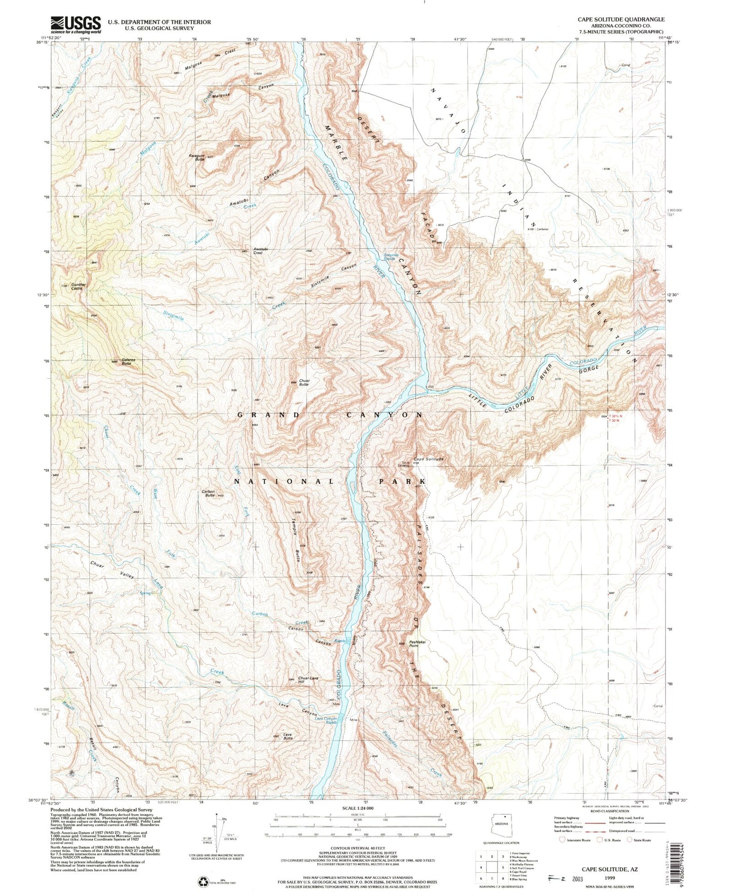
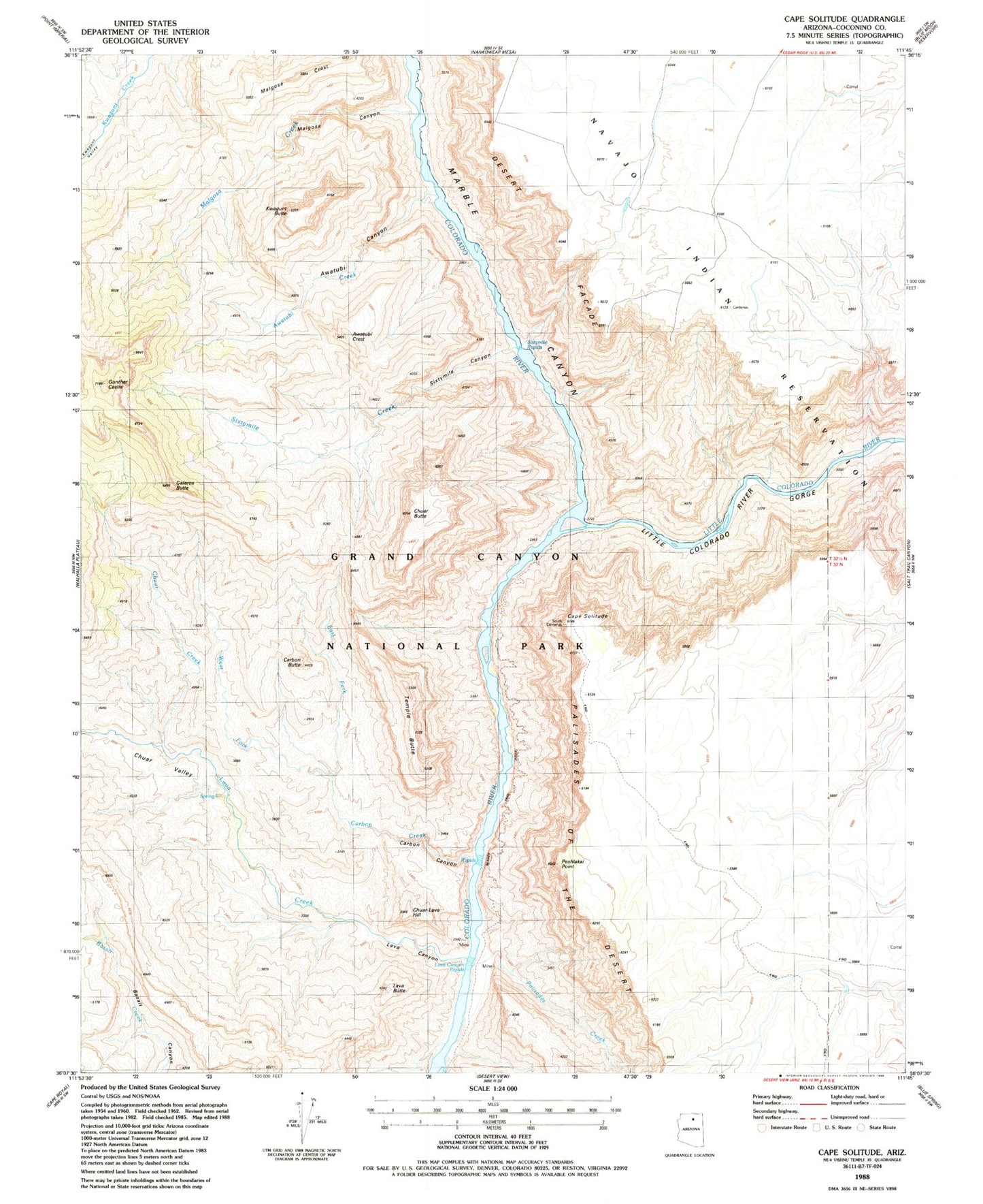
Classic USGS Cape Solitude Arizona 7.5'x7.5' Topo Map
Couldn't load pickup availability
Historical USGS topographic quad map of Cape Solitude in the state of Arizona. Typical map scale is 1:24,000, but may vary for certain years, if available. Print size: 24" x 27"
This quadrangle is in the following counties: Coconino.
The map contains contour lines, roads, rivers, towns, and lakes. Printed on high-quality waterproof paper with UV fade-resistant inks, and shipped rolled.
Contains the following named places: Awatubi Creek, Awatubi Crest, Cape Solitude, Carbon Butte, Carbon Creek, Chuar Butte, Chuar Creek, Chuar Lava Hill, Chuar Valley, Desert Facade, East Fork Carbon Creek, Galeros Butte, Gunther Castle, Kwagunt Butte, Lava Butte, Lava Canyon, Lava Canyon Rapids, Lava Creek, Little Colorado River Gorge, Malgosa Canyon, Malgosa Creek, Malgosa Crest, Marble Canyon, Palisades Creek, Sixtymile Canyon, Sixtymile Creek, Sixtymile Rapids, Temple Butte, West Fork Carbon Creek, Awatubi Canyon, Peshlakai Point, Carbon Canyon, Little Colorado River