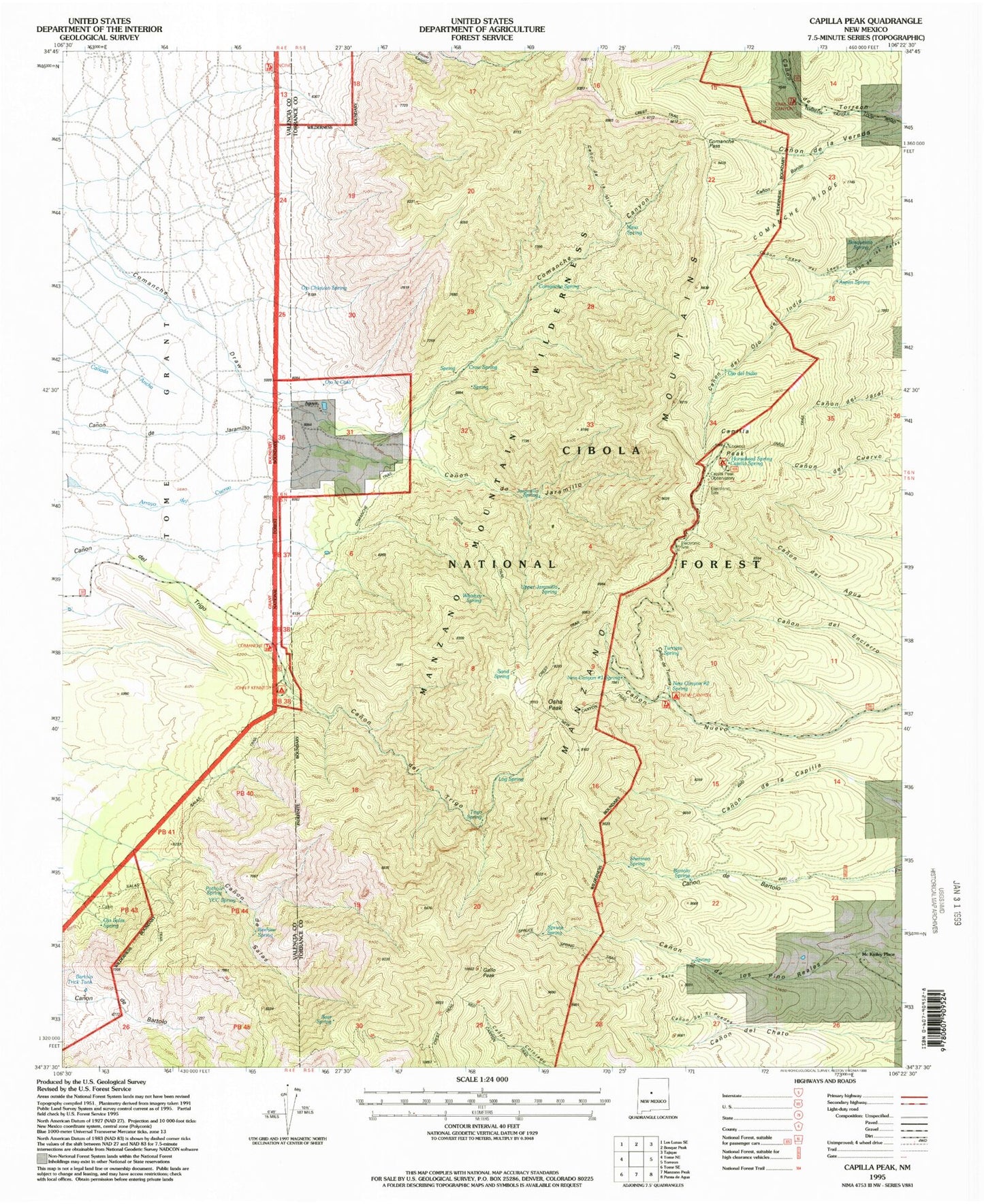
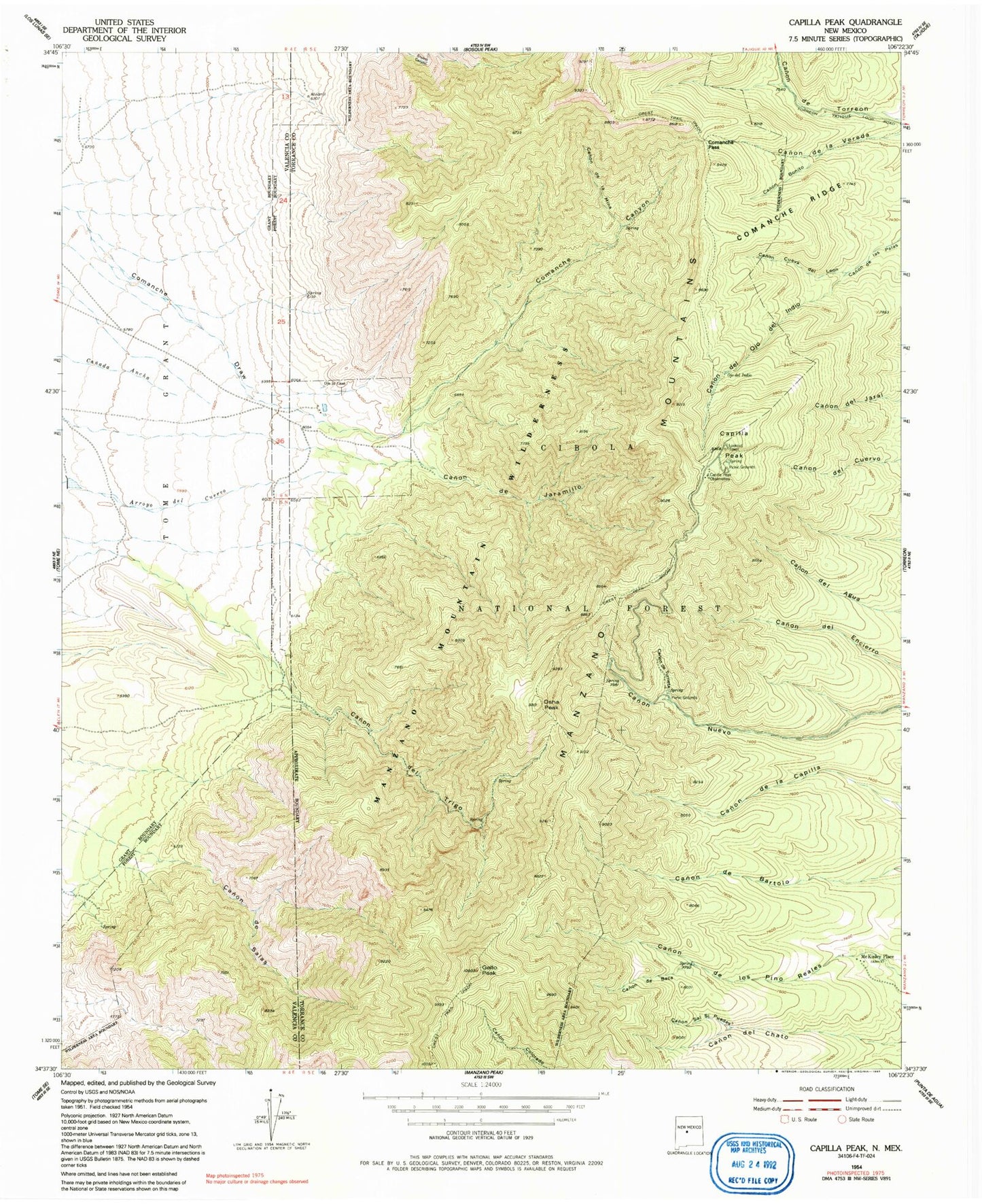
MyTopo
Classic USGS Capilla Peak New Mexico 7.5'x7.5' Topo Map
Couldn't load pickup availability
Historical USGS topographic quad map of Capilla Peak in the state of New Mexico. Typical map scale is 1:24,000, but may vary for certain years, if available. Print size: 24" x 27"
This quadrangle is in the following counties: Torrance, Valencia.
The map contains contour lines, roads, rivers, towns, and lakes. Printed on high-quality waterproof paper with UV fade-resistant inks, and shipped rolled.
Contains the following named places: New Canyon Spring, Canon de la Mina, Canon de Baca, Canon de Jaramillo, Canon de Salas, Canon de Turieta, Canon del Ojo del Indio, Canon del Trigo, Canon Bonito, Canon Cueva del Leon, Canon Sal Si Puedes, Capilla Peak, Comanche Canyon, Crest Trail, McKinley Place, Ojo del Indio, Ojo la Casa, Gallo Peak, Comanche Pass, Osha Peak, Salas Forest Service Facility, Pothole Spring, Ojo Salas, Bartolo Trick Tank, Ojo Chiquito, Aguya, Bosquesito Spring, Aspen Spring, Jaramillo Spring, Horsehead Spring, John F Kennedy Campground, Whisky Spring, Upper Jaramillo Spring, New Canyon Campground, Log Spring, Spruce Spring, Manzano Mountains, Capilla Peak Observatory, Ojo la Casa Lake, Manzano Mountain Wilderness, Capilla Peak Campground, Sand Spring, YCC Spring, Beehive Spring, Trigo Spring, Comanche Spring, Crow Spring, Bear Spring, Mina Spring, Sherman Spring, Bartolo Spring, Turrieta Spring, New Canyon Number One Spring, New Canyon Number Two Spring, Capilla Spring, Encino Trailhead, Commanche Trailhead, Trail Canyon Trailhead, Commanche Trail, Salas Trail, Jaral Trail, Osha Trail, New Canyon Trail, New Canyon Trailhead