MyTopo
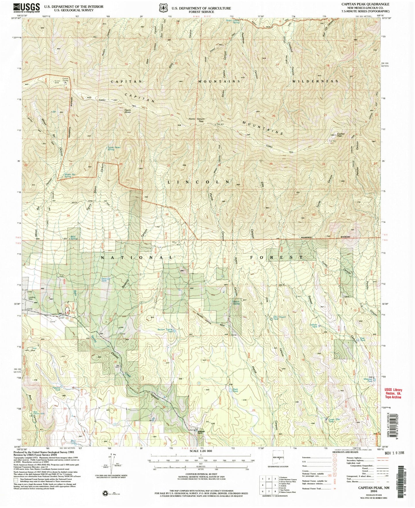
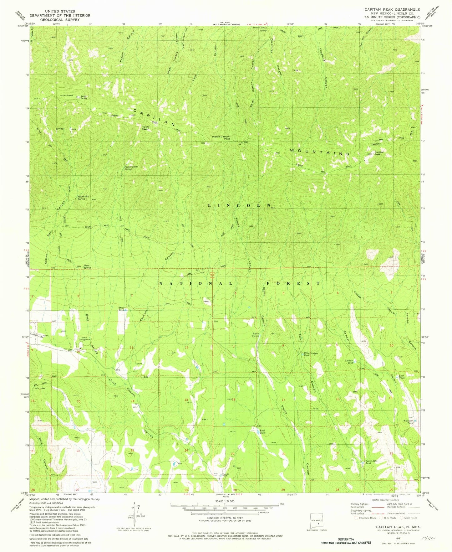
Classic USGS Capitan Peak New Mexico 7.5'x7.5' Topo Map
Couldn't load pickup availability
Historical USGS topographic quad map of Capitan Peak in the state of New Mexico. Typical map scale is 1:24,000, but may vary for certain years, if available. Print size: 24" x 27"
This quadrangle is in the following counties: Lincoln.
The map contains contour lines, roads, rivers, towns, and lakes. Printed on high-quality waterproof paper with UV fade-resistant inks, and shipped rolled.
Contains the following named places: Camp Capitan, Capitan Mountains, Capitan Peak, Dean Ranch, Mitt and Bar Ranch (historical), McDaniel Ranch, Pierce Canyon Pass, Raton Ranch (historical), Sawmill Canyon, Mitten Bar Spring, Capitan Mountains Wilderness, Joe Hill, Section Twelve Tank, Baca Tank, Baca Forest Service Station, Pipline Tank, Baca Canyon Well, Alice Spring, Figure Seven Canyon, Baca (historical), Bearcat Mine, Bumble Bee Mine, Seven Cabins Spring, Summit Trail, Seven Cabins Canyon, Capitan Peak Trail, Figure Seven Spring, Mitten Bar Trail, Baca Spring, Baca Campground, Dean Tank, Raton Canyon, Torrez Canyon, Raton Spring, Ellis Canyon Tank, Latham Tank, East Tank, Whitaker Tank, Rock Tank, Lower Ellis Tank