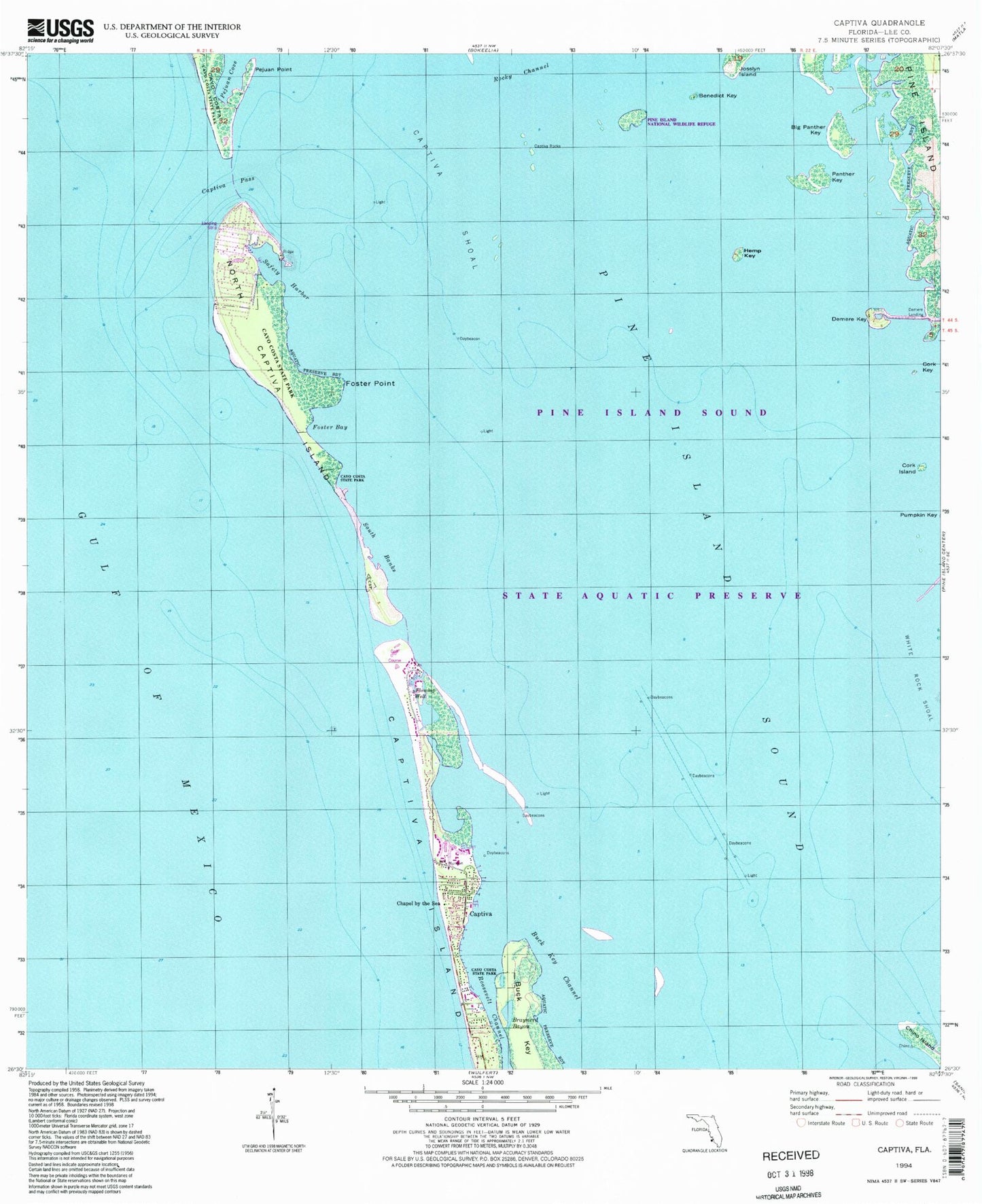
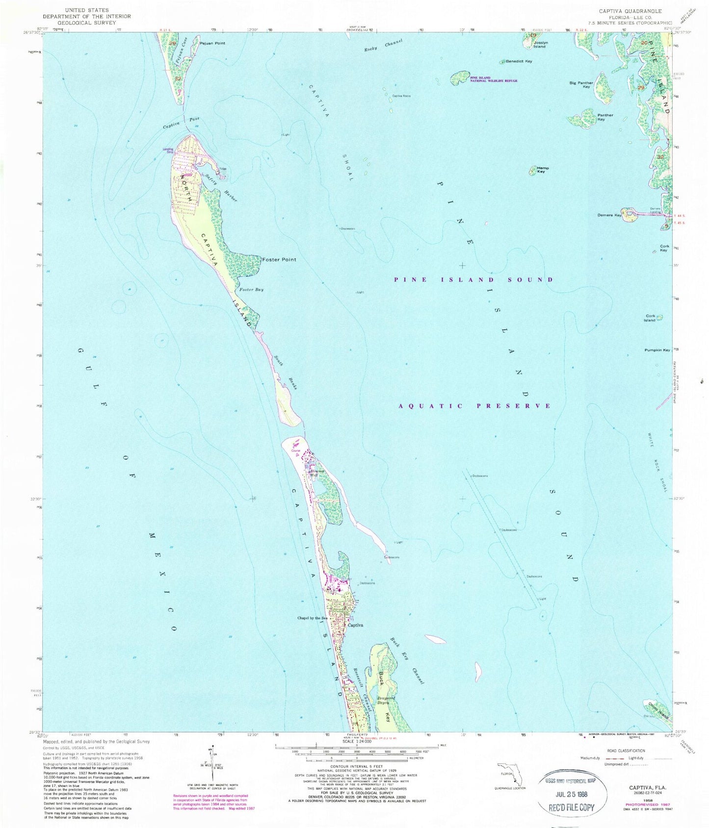
MyTopo
Classic USGS Captiva Florida 7.5'x7.5' Topo Map
Couldn't load pickup availability
Historical USGS topographic quad map of Captiva in the state of Florida. Map scale may vary for some years, but is generally around 1:24,000. Print size is approximately 24" x 27"
This quadrangle is in the following counties: Lee.
The map contains contour lines, roads, rivers, towns, and lakes. Printed on high-quality waterproof paper with UV fade-resistant inks, and shipped rolled.
Contains the following named places: Benedict Key, Big Bird Rookery, Big Panther Key, Braynerd Bayou, Buck Key, Buck Key Channel, Captiva, Captiva Fire Control District Fire Station, Captiva Helistop, Captiva Island, Captiva Pass, Captiva Post Office, Captiva Rocks, Captiva Shoal, Cayo Costa, Chadwick Bayou, Chapel by the Sea, Cork Island, Cork Key, Demere Key, Demere Landing, Foster Bay, Foster Point, Hemp Key, Henderson Heliport, North Captiva Island, Panther Key, Pejuan Cove, Pejuan Point, Pine Island Division, Pine Island Sound, Redfish Pass, Roosevelt Channel, Safety Harbor, Salty Approach Airport, Sanibel Island Division, South Banks, Upper Captiva, Upper Captiva Fire and Rescue District, White Rock Shoal, ZIP Codes: 33924, 33945, 33956