MyTopo
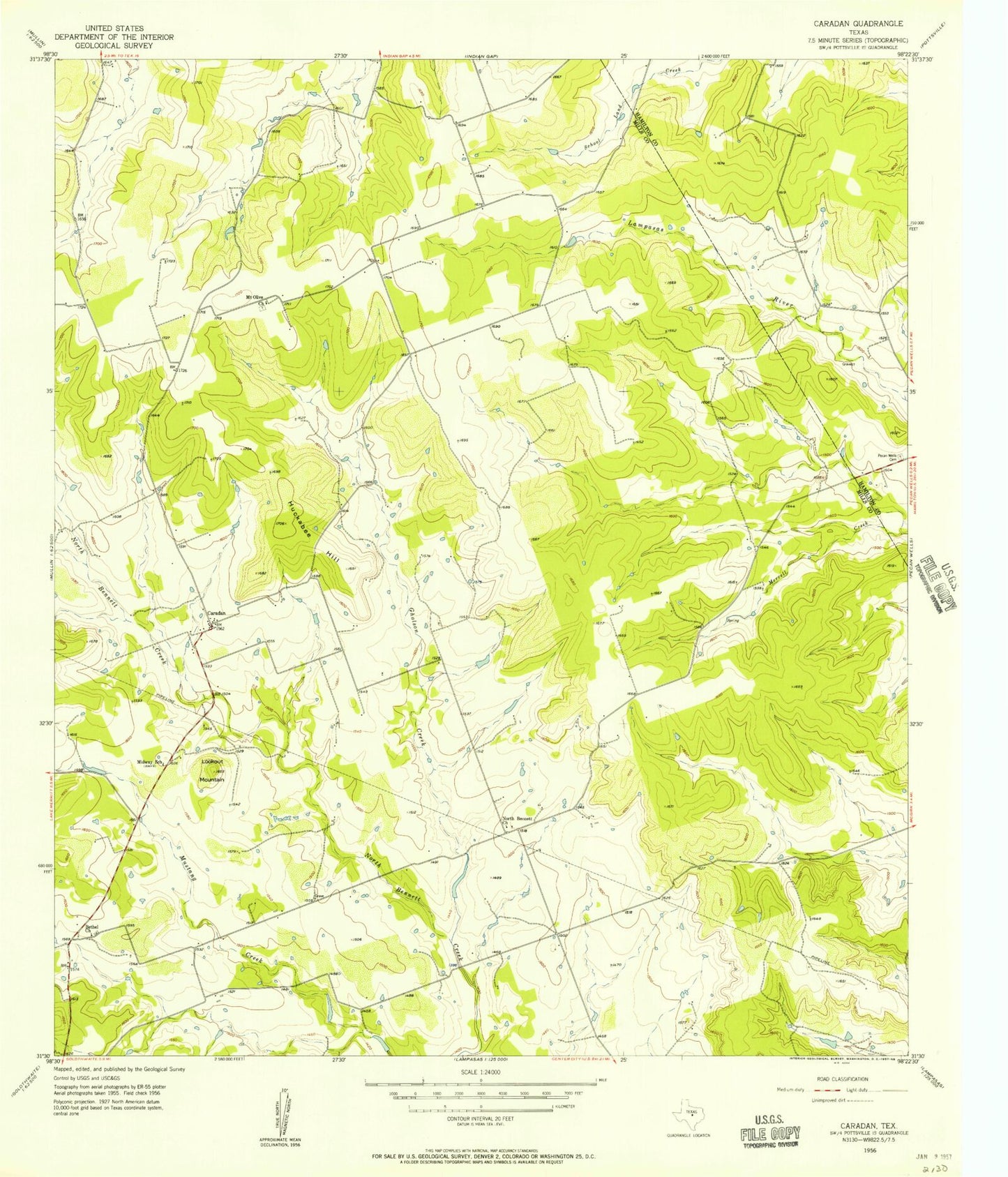
Classic USGS Caradan Texas 7.5'x7.5' Topo Map
Couldn't load pickup availability
Historical USGS topographic quad map of Caradan in the state of Texas. Map scale may vary for some years, but is generally around 1:24,000. Print size is approximately 24" x 27"
This quadrangle is in the following counties: Hamilton, Mills.
The map contains contour lines, roads, rivers, towns, and lakes. Printed on high-quality waterproof paper with UV fade-resistant inks, and shipped rolled.
Contains the following named places: Bethel Church, Caradan, Gholson Creek, Graves Lake, Graves Lake Dam, Huckabee Hill, Lookout Mountain, McCasland Lake Number 1, McCasland Lake Number 1 Dam, McCasland Lake Number 2, McCasland Lake Number 2 Dam, McCasland Lake Number 3, McCasland Lake Number 3 Dam, Midway School, Mount Olive Church, North Bennett Church, Parker Lake, Parker Lake Dam, Pecan Wells Cemetery, Soil Conservation Service Site 3 Dam, Soil Conservation Service Site 3 Reservoir, Soil Conservation Service Site 4 Dam, Soil Conservation Service Site 4 Reservoir, Stillwell Lake, Stillwell Lake Dam