MyTopo
Classic USGS Caraway Lake Louisiana 7.5'x7.5' Topo Map
Regular price
$16.95
Regular price
Sale price
$16.95
Unit price
per
Couldn't load pickup availability
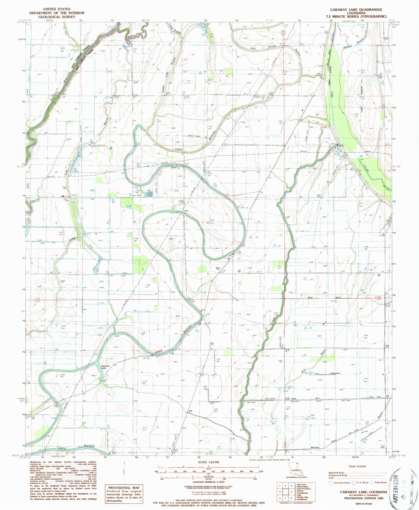
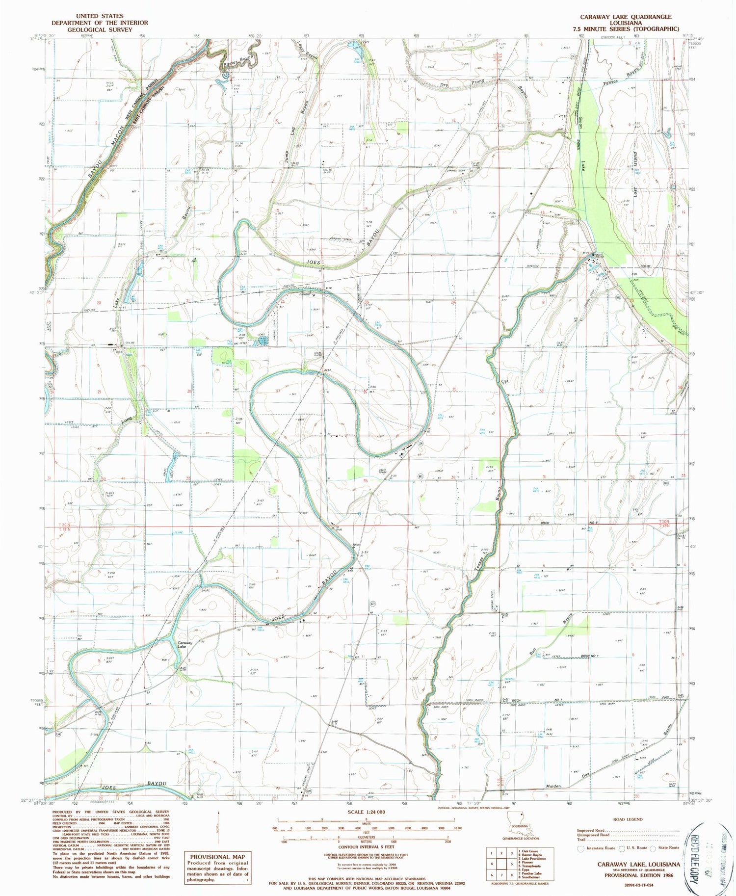
Historical USGS topographic quad map of Caraway Lake in the state of Louisiana. Map scale may vary for some years, but is generally around 1:24,000. Print size is approximately 24" x 27"
This quadrangle is in the following counties: East Carroll, West Carroll.
The map contains contour lines, roads, rivers, towns, and lakes. Printed on high-quality waterproof paper with UV fade-resistant inks, and shipped rolled.
Contains the following named places: Adams School, Baxter Bayou, Bull Bayou, Caraway Lake, Dry Prong Bayou, East Carroll Prison Farm, Elmwood Church, Evening Star Number 2 Church, Jump Log Bayou, Lost Island, New Light Church, Swan Lake, Tensas Ditch, Ward Six