MyTopo
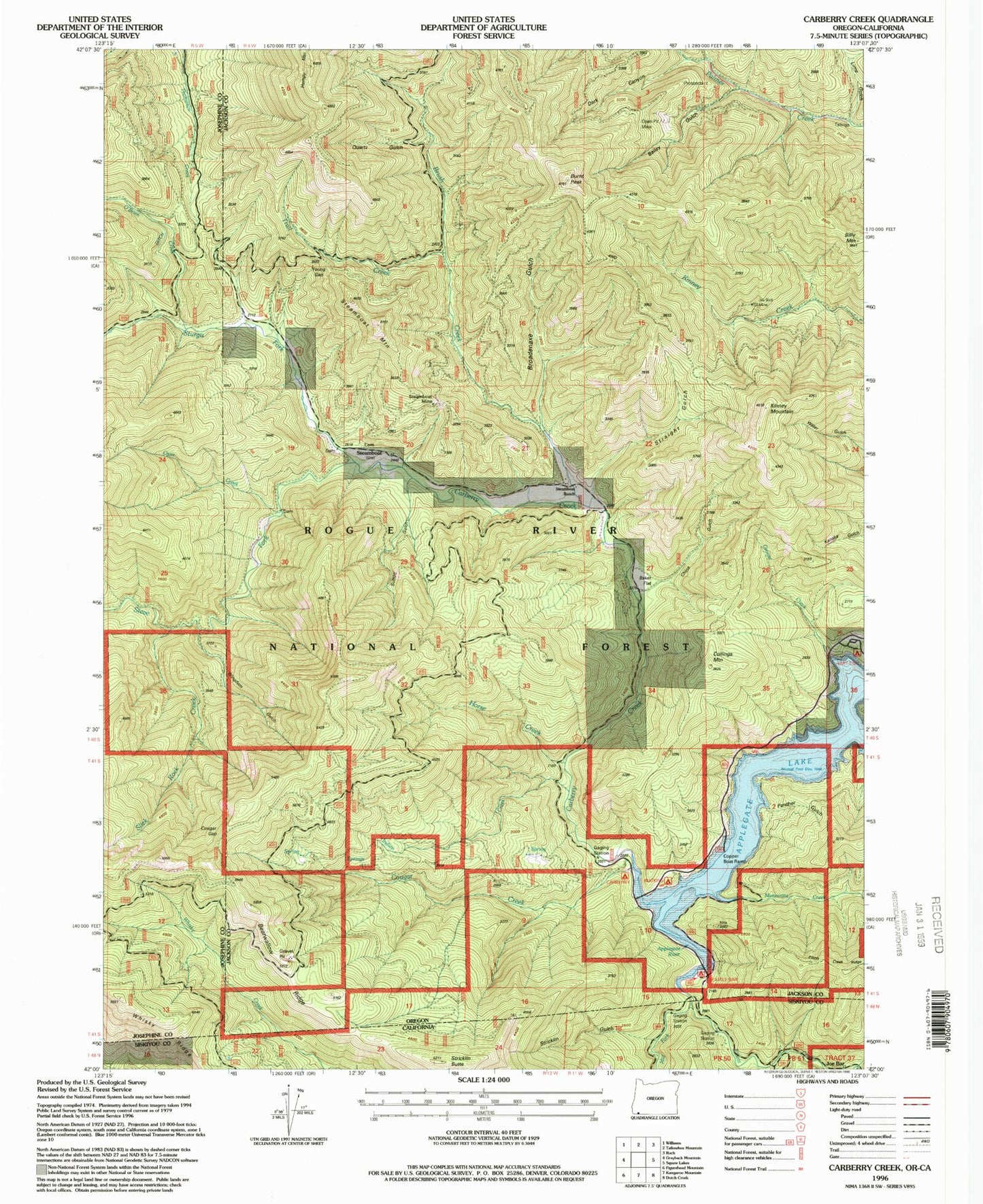
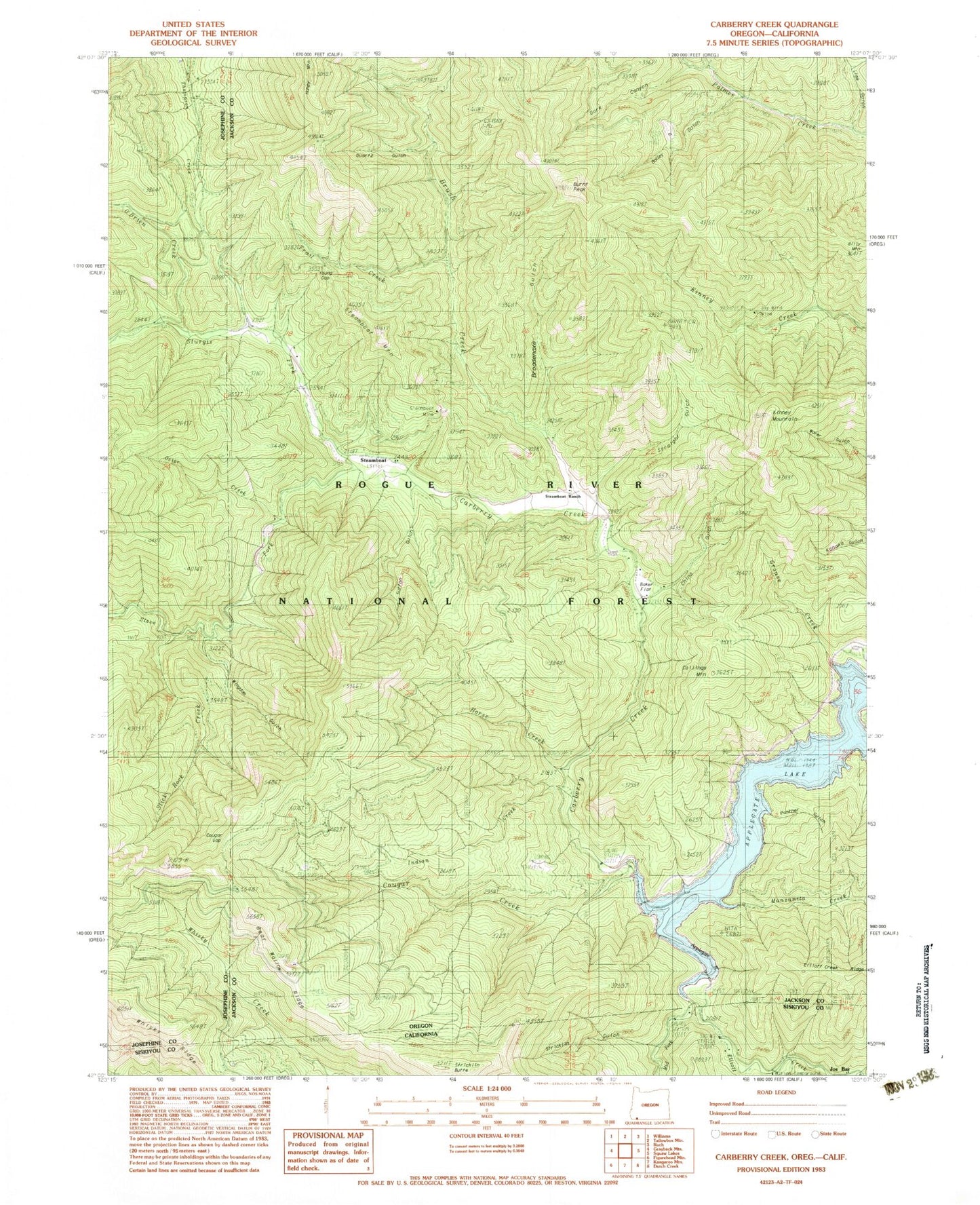
Classic USGS Carberry Creek Oregon 7.5'x7.5' Topo Map
Couldn't load pickup availability
Historical USGS topographic quad map of Carberry Creek in the states of Oregon, California. Map scale may vary for some years, but is generally around 1:24,000. Print size is approximately 24" x 27"
This quadrangle is in the following counties: Jackson, Josephine, Siskiyou.
The map contains contour lines, roads, rivers, towns, and lakes. Printed on high-quality waterproof paper with UV fade-resistant inks, and shipped rolled.
Contains the following named places: Applegate Lake, Bailey Gulch, Baker Flat, Bearwallow Ridge, Billy Mountain, Bobbit Mine, Broadenaxe Gulch, Brush Creek, Burnt Peak, Carberry Creek, Carberry Recreation Site, China Gulch, Collings Mountain, Copper, Copper Post Office, Copper Recreation Site, Cougar Creek, Cougar Gap, Dark Canyon, Elliott Creek, Grouse Creek, Hacker Gulch, Hart-Tish Recreation Site, Horse Creek, Humpy Mountain, Hutton Campground, Hutton Guard Station, Indian Creek, Jay Bird Mine, Joe Bar, Joe Gulch, Kinney Mountain, Lime Gulch, Manzanita Creek, Manzanita Trailhead, Mocks Gulch, Nine Dollar Gulch, O'Brien Creek, Osier Creek, Panther Gulch, Quartz Gulch, Saw Pit Gulch, Sawmill Gulch, Seattle Bar, Seattle Bar Recreation Site, Seattle Bar Trailhead, Slick Rock Creek, Steamboat, Steamboat Cemetery, Steamboat Mine, Steamboat Mountain, Steamboat Post Office, Steamboat Ranch, Steve Fork, Straight Gulch, Stricklin Butte, Stricklin Gulch, Sturgis Fork, Sturgis Guard Station, Sutton Gulch, Thompson Creek Forest Camp, Trail Creek, United States Forest Service Copper Boat Ramp, United States Forest Service Hart - Tish Boat Ramp, Watkins, Watkins Post Office, Watkins Recreation Site, Wingdam Gulch, Young Gap