MyTopo
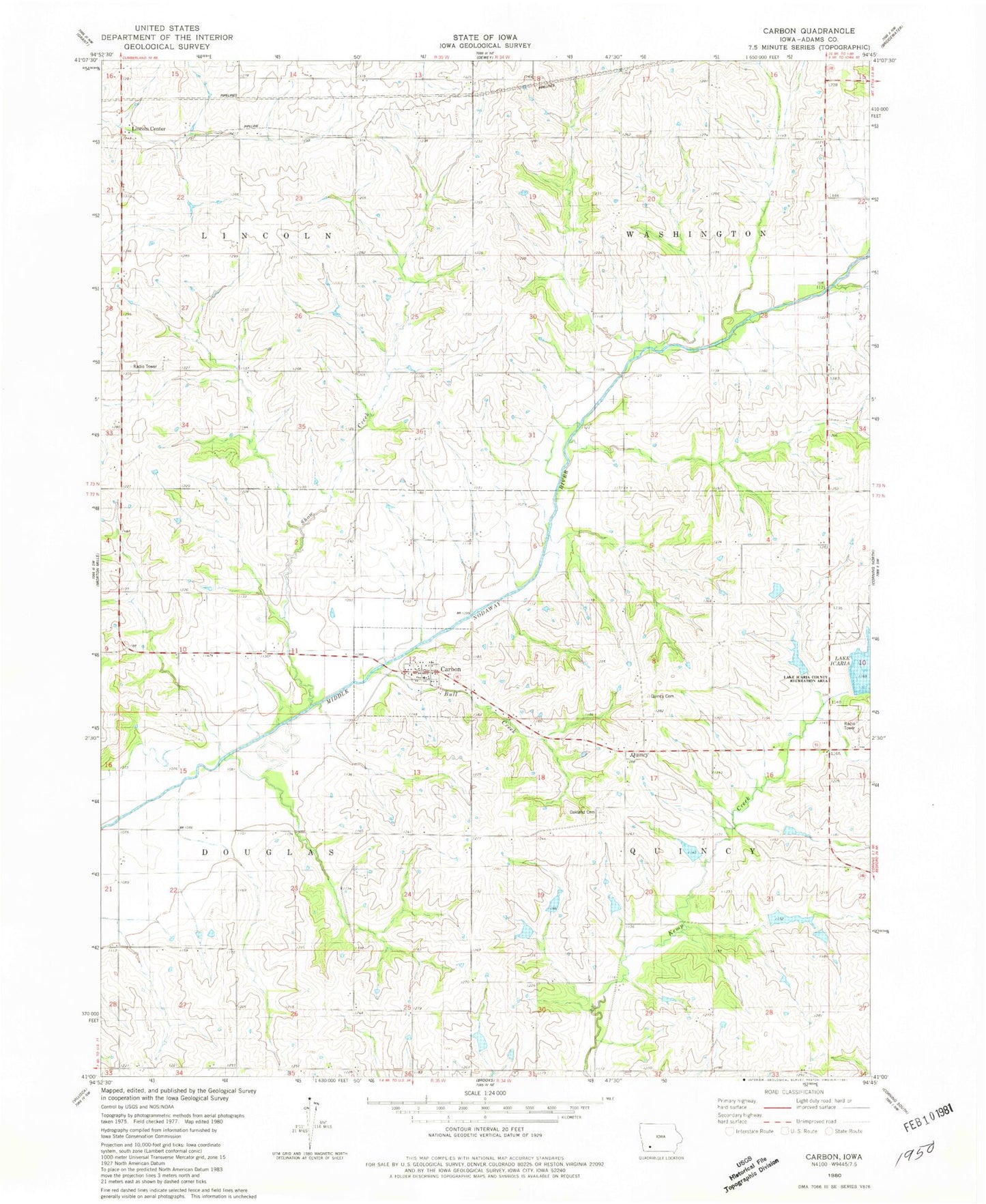
Classic USGS Carbon Iowa 7.5'x7.5' Topo Map
Couldn't load pickup availability
Historical USGS topographic quad map of Carbon in the state of Iowa. Map scale may vary for some years, but is generally around 1:24,000. Print size is approximately 24" x 27"
This quadrangle is in the following counties: Adams.
The map contains contour lines, roads, rivers, towns, and lakes. Printed on high-quality waterproof paper with UV fade-resistant inks, and shipped rolled.
Contains the following named places: Bull Creek, Carbon, Carbon Methodist Church, Carbon Post Office, City of Carbon, Eureka Post Office, Hayes Post Office, Hoyt Post Office, Lake Icaria Dam, Lincoln Center, Lincoln Center United Methodist Church, Oakland Cemetery, Quincy, Quincy Cemetery, Quincy Post Office, Show Creek, Township of Douglas, Township of Lincoln, Township of Quincy, Township of Washington, ZIP Codes: 50839, 50841