MyTopo
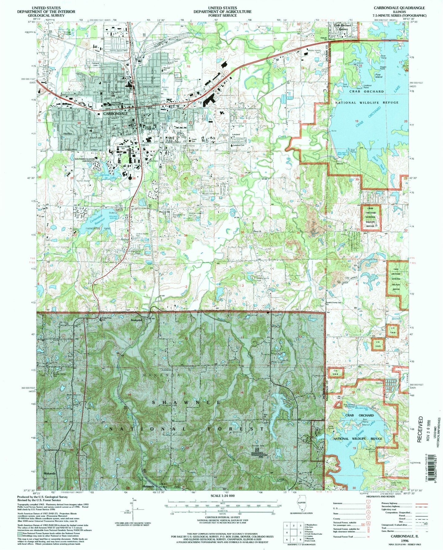
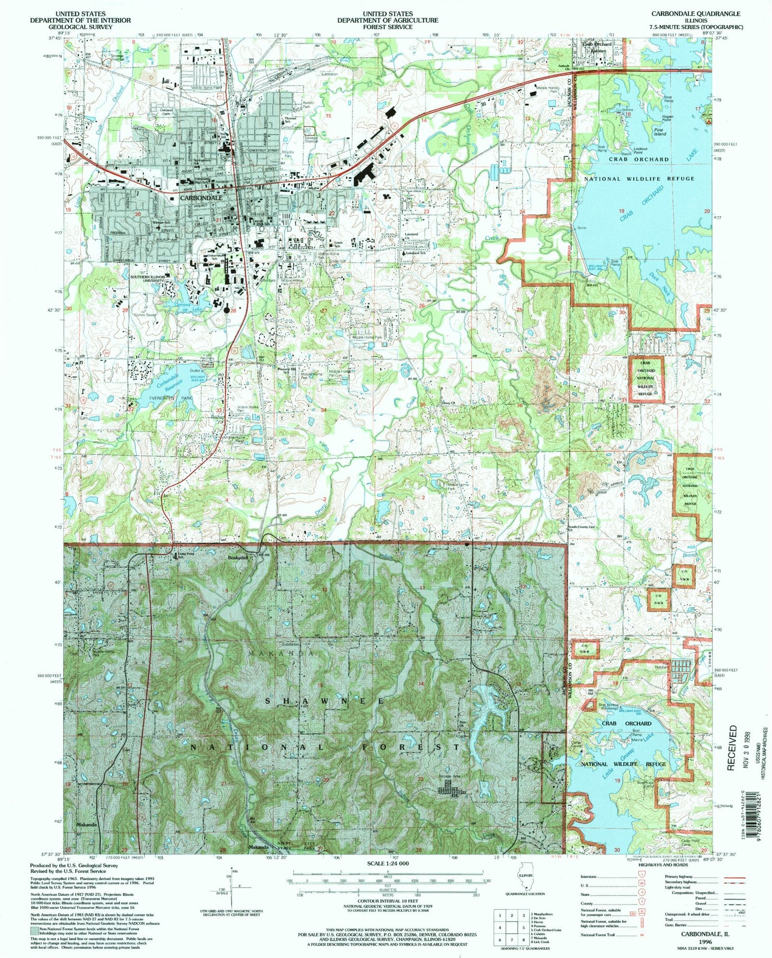
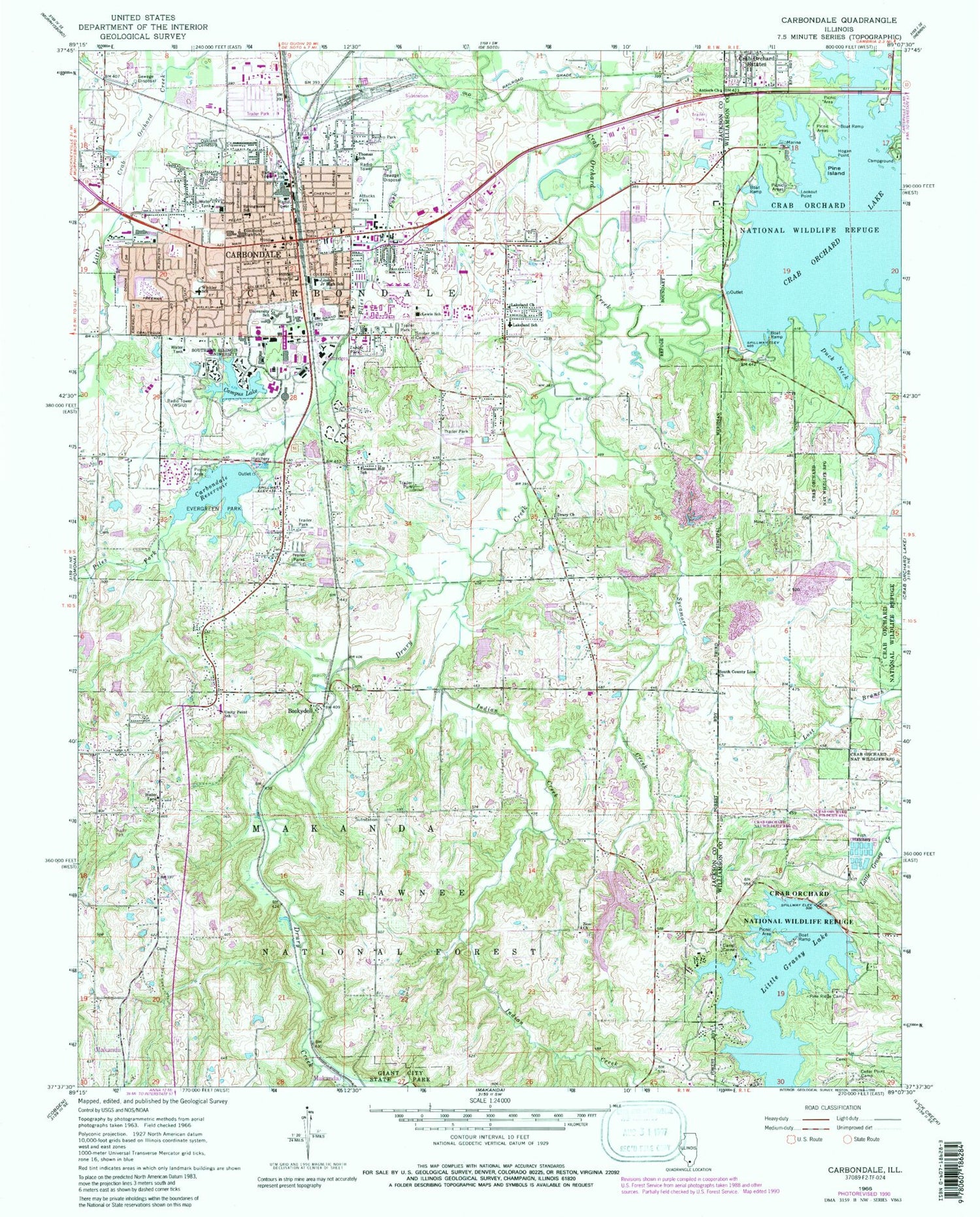
Classic USGS Carbondale Illinois 7.5'x7.5' Topo Map
Couldn't load pickup availability
Historical USGS topographic quad map of Carbondale in the state of Illinois. Typical map scale is 1:24,000, but may vary for certain years, if available. Print size: 24" x 27"
This quadrangle is in the following counties: Jackson, Williamson.
The map contains contour lines, roads, rivers, towns, and lakes. Printed on high-quality waterproof paper with UV fade-resistant inks, and shipped rolled.
Contains the following named places: Antioch Church, Attucks Park, Boskydell, Camp Carew, Campus Lake, Carbondale, Carbondale Reservoir, Cedar Point Camp, Crab Orchard Estates, Drury Christian Church, Drury Creek, Duck Neck, Evergreen Park, Hogan Point, Holden Hospital, Indian Creek, Lakeland Baptist Church, Lakeland Elementary School, Lewis Elementary School, Lincoln Middle School, Little Grassy Lake, Long View Park, Oakland Cemetery, Piles Fork, Pine Island, Pine Ridge Camp, Pleasant Hill School, Renfro Park, Snider Hill Cemetery, South County Line Christian Church, Southern Illinois University, Springmore School, Sycamore Creek, Thomas Elementary School, Unity Point Elementary School, Southern Illinois University Carbondale, Zion Church, Memorial Hospital of Carbondale Heliport, WSIU-FM (Carbondale), Township of Carbondale, Township of Makanda, Carbondale Reservoir Dam, Campus Lake Dam, Sycamore Creek Dam, Spring Arbor Lake, Crab Orchard Dam, Little Grassy Dam, Prairie Creek (historical), Stone School (historical), Freewill Church (historical), New Hope Church (historical), New Hope School (historical), North School (historical), Brierpath School (historical), Carbondale City Hall, Downtown Carbondale Post Office, Covered Bridge School (historical), Crowell School (historical), Hastings School (historical), North County Line Church (historical), Pomona School (historical), Rock Spring School (historical), Wagner School (historical), Zion School (historical), Brehm Preparatory School, Carbondale Community High School Central Campus, Carbondale Community High School East Campus, Carbondale Public Library, Doug Lee Park, Eastgate Shopping Center, Evergreen Terrace, First Baptist Church, First United Methodist Church, Giant City Elementary School, Lenus Turley Park, Marberry Arboretum, Memorial Hospital of Carbondale, Oakdale Park, Oakland Field, Parrish Park, Southern Hills, Tatum Heights Park, University Mall Shopping Center, West Walnut Street Historic District, Winkler Elementary School, Woodlawn Cemetery, Boskydell Cemetery, Hilton Cemetery, North County Line Cemetery, South County Line Cemetery, Stearns Cemetery, Winchester Cemetery, Zion Methodist Cemetery, Little Grassy Fish Hatchery, City of Carbondale, Makanda Township Volunteer Fire Department Station 2, Carbondale Fire Department Station 1, Carbondale Fire Department Station 2, Carbondale Township Fire Department, Makanda Township Volunteer Fire Department Station 1, Jackson County Ambulance Service, Carbondale Police Department, Carbondale Post Office