
MyTopo
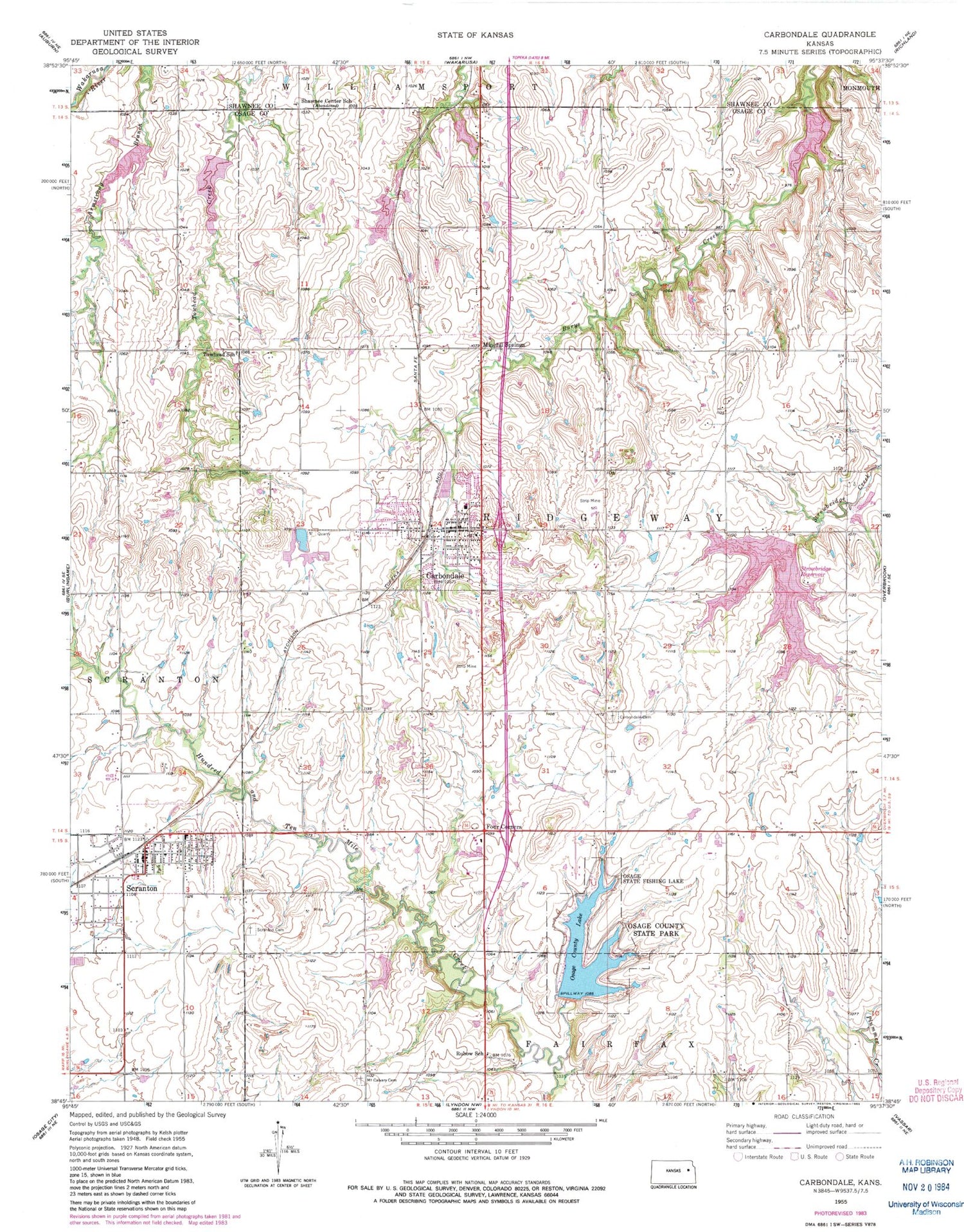
Classic USGS Carbondale Kansas 7.5'x7.5' Topo Map
Couldn't load pickup availability
Historical USGS topographic quad map of Carbondale in the state of Kansas. Map scale may vary for some years, but is generally around 1:24,000. Print size is approximately 24" x 27"
This quadrangle is in the following counties: Osage, Shawnee.
The map contains contour lines, roads, rivers, towns, and lakes. Printed on high-quality waterproof paper with UV fade-resistant inks, and shipped rolled.
Contains the following named places: Carbon Hill, Carbondale, Carbondale Attendance Center School, Carbondale Cemetery, Carbondale Church of Christian Fellowship, Carbondale City Hall, Carbondale City Library, Carbondale Community United Church of Christ, Carbondale Police Department, Carbondale Post Office, Carbondale Wastewater Facility, Carbondale Water Tower, City of Carbondale, City of Scranton, Crossroad Community Church, Four Corners, Lighthouse Assembly of God Church, Mineral Springs, Mount Calvary Cemetery, New Life Wesleyan Church, Osage County Fire Station District 1 Carbondale, Osage County Lake, Osage County State Lake Dam, Osage County State Park, Osage State Fishing Lake, Rubow School, Saint Patrick Church, Santa Fe Trail High School, Santa Fe Trail Unified School District, Scranton, Scranton Attendance Center, Scranton Cemetery, Scranton City Dam, Scranton City Hall, Scranton Fire Department, Scranton Municipal Wastewater Treatment Plant, Scranton Police Department, Scranton Post Office, Scranton United Methodist Church, Scranton Water Tower, Shawnee Center School, Strowbridge Dam, Strowbridge Reservoir, Towhead School, Township of Ridgeway, ZIP Codes: 66414, 66537


