MyTopo
Classic USGS Card Sound Florida 7.5'x7.5' Topo Map
Couldn't load pickup availability
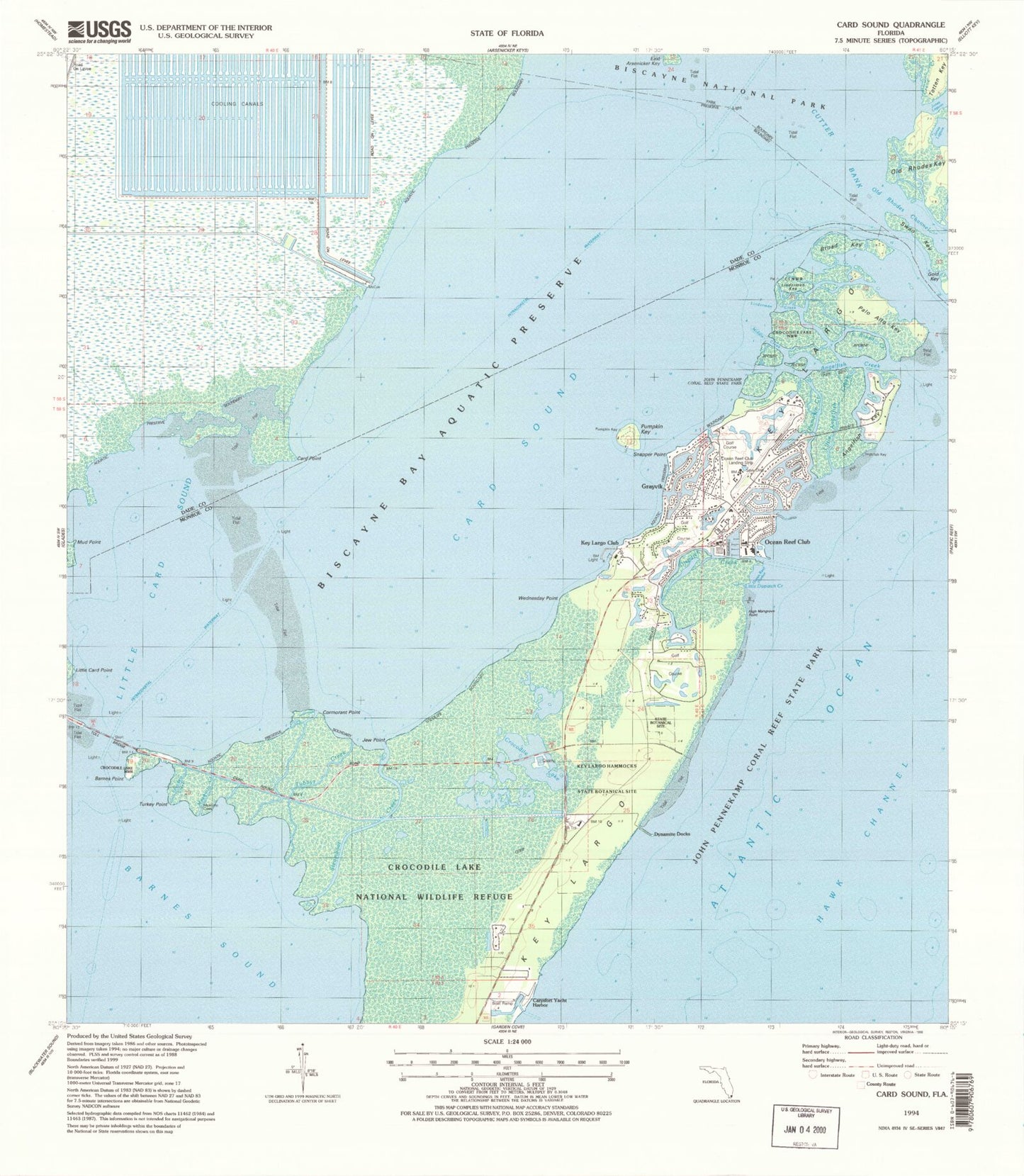
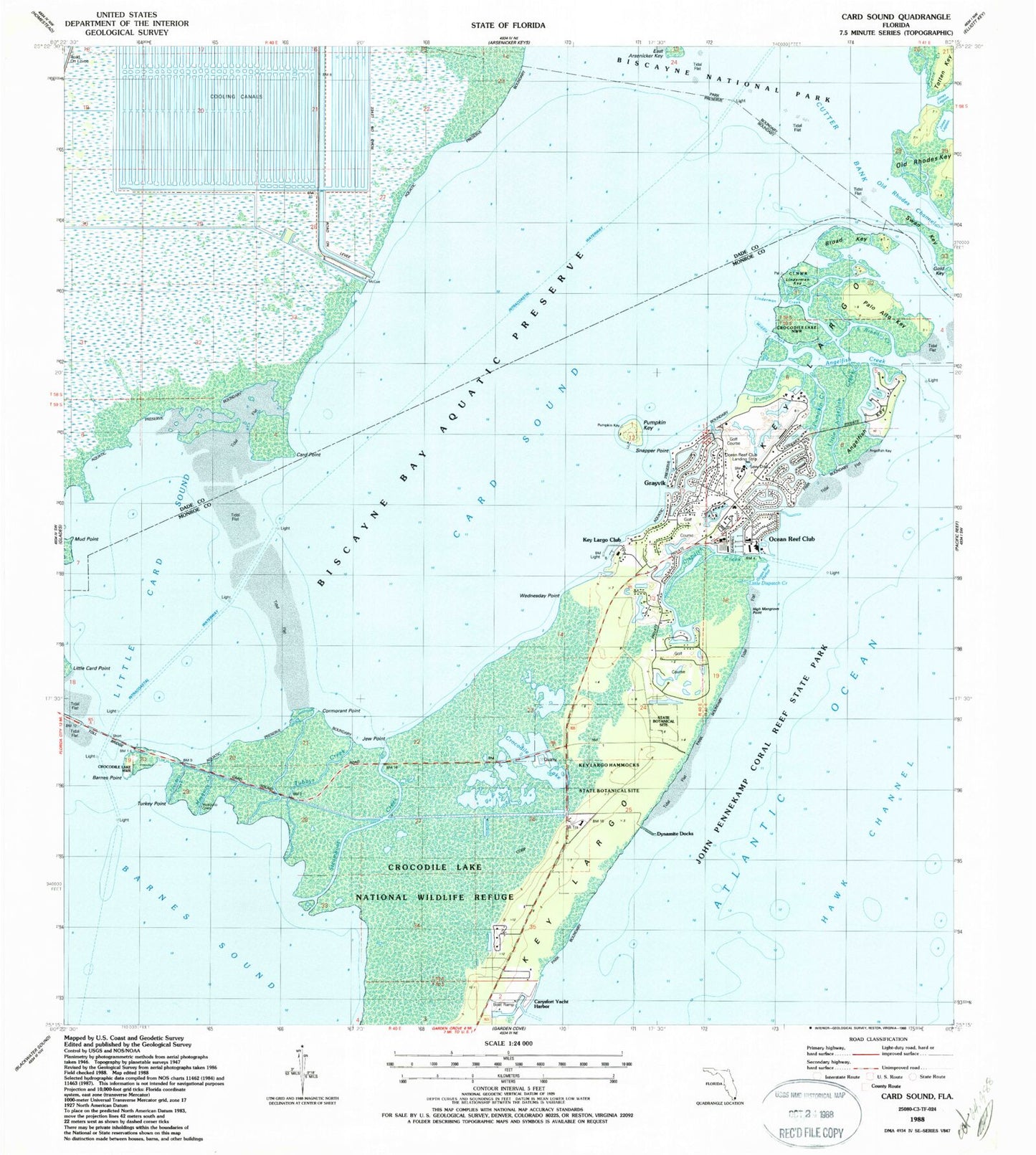
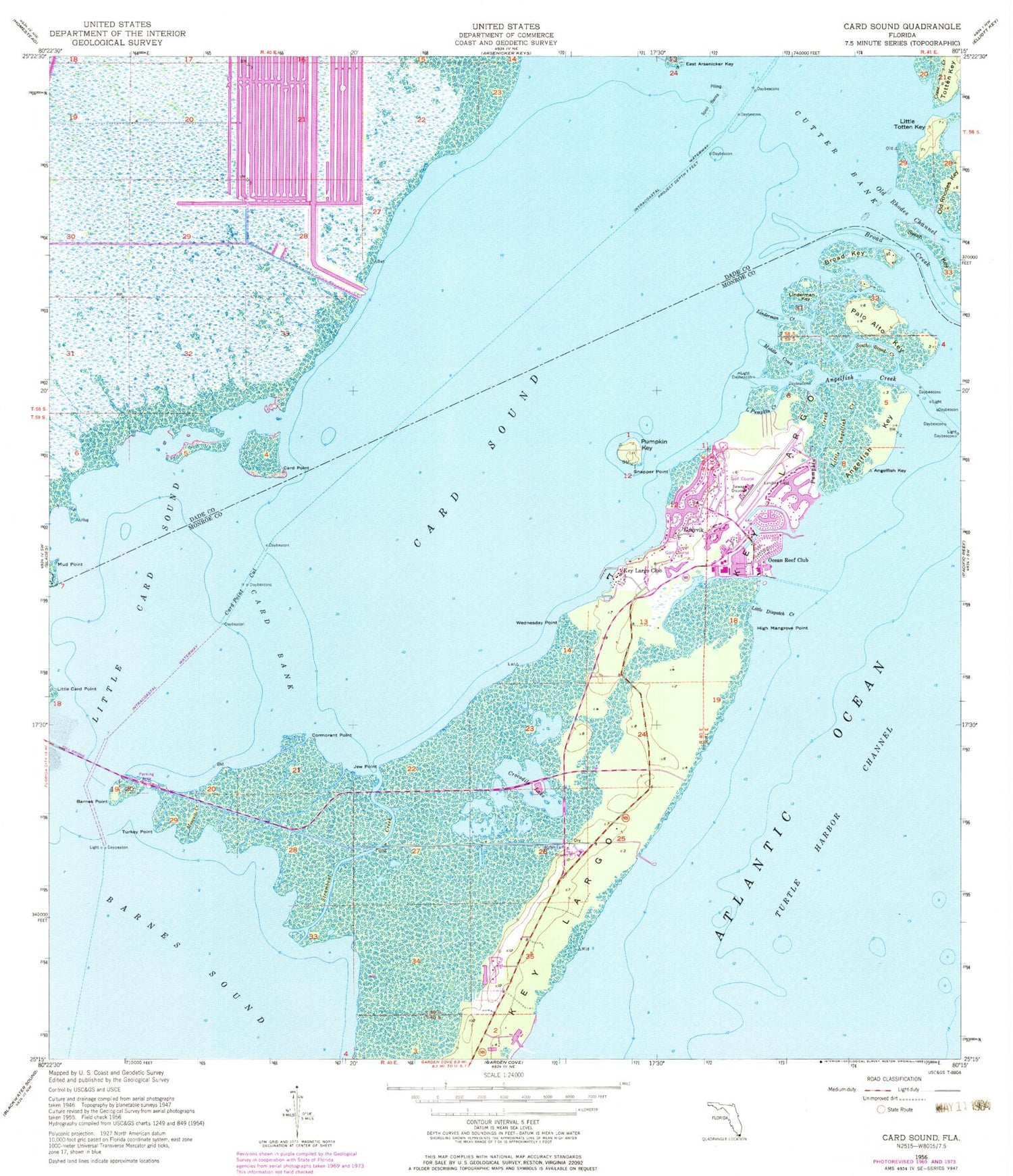
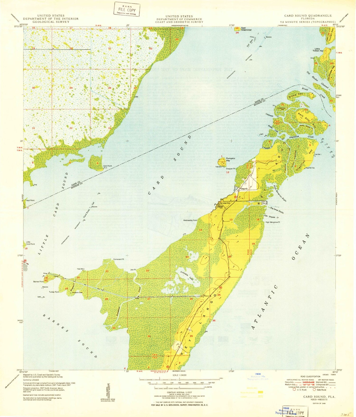
Historical USGS topographic quad map of Card Sound in the state of Florida. Map scale may vary for some years, but is generally around 1:24,000. Print size is approximately 24" x 27"
This quadrangle is in the following counties: Miami-Dade, Monroe.
The map contains contour lines, roads, rivers, towns, and lakes. Printed on high-quality waterproof paper with UV fade-resistant inks, and shipped rolled.
Contains the following named places: Angelfish Creek, Angelfish Key, Barnes Point, Broad Creek, Broad Key, Card Bank, Card Point, Card Point Cut, Card Sound, Carysfort Yacht Harbor, Cormorant Point, Crane Creek, Crocodile Lake, Cutter Bank, Dispatch Creek, Dynamite Docks, Gold Key, Grayvik, High Mangrove Point, Hunter's Creek Golf Course, Hunters Ridge Country Club, Jew Point, Kendall Mall, Key Largo Anglers Club Pier Light, Key Largo Club, Key Largo Hammocks Botanical State Park, Linderman Creek, Linderman Key, Little Angelfish Creek, Little Card Point, Little Card Sound, Little Dispatch Creek, Little Pumpkin Creek, Little Totten Key, Middle Creek, Mosquito Creek, Mud Point, New Mahogany Hammock State Botanical Site, North Key Largo, North Key Largo Census Designated Place, Ocean Reef Club, Ocean Reef Club Airport, Ocean Reef Club Marina, Ocean Reef Harbor, Ocean Reef Public Safety Department and Fire Station, Old Rhodes Channel, Palo Alto Key, Pumpkin Creek, Pumpkin Key, Rose Key, Saunders Creek, Snapper Point, South Broad Creek, Steamboat Creek, Tubbys Creek, Turkey Point, Wednesday Point