MyTopo
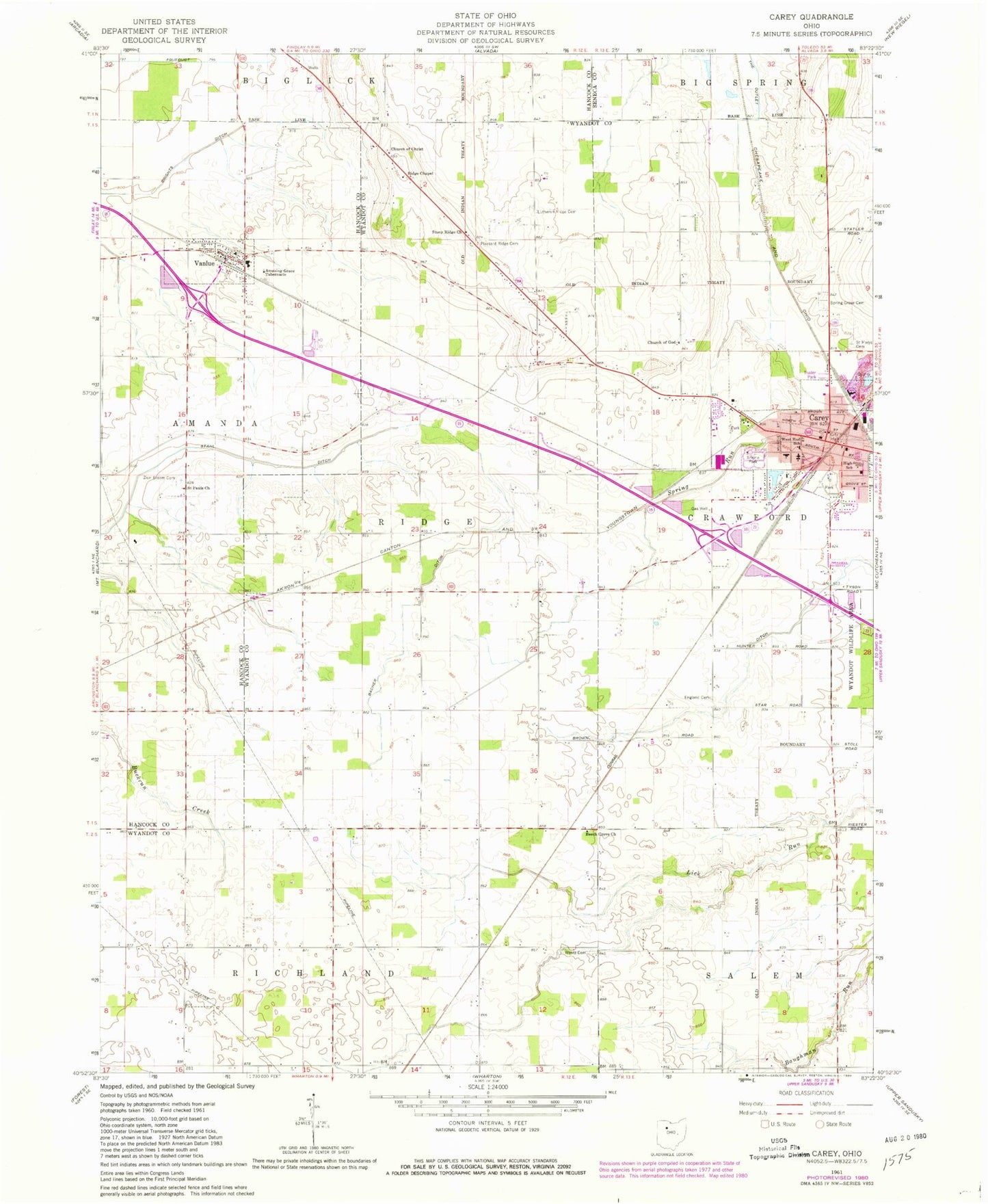
Classic USGS Carey Ohio 7.5'x7.5' Topo Map
Couldn't load pickup availability
Historical USGS topographic quad map of Carey in the state of Ohio. Map scale may vary for some years, but is generally around 1:24,000. Print size is approximately 24" x 27"
This quadrangle is in the following counties: Hancock, Seneca, Wyandot.
The map contains contour lines, roads, rivers, towns, and lakes. Printed on high-quality waterproof paper with UV fade-resistant inks, and shipped rolled.
Contains the following named places: Amazing Grace Tabernacle, Bacher Ditch, Beech Grove Church, Carey, Carey Association Cemetery, Carey City Hall, Carey High School, Carey Mobile Home Park, Carey Police Department, Carey Post Office, Carey Volunteer Fire Department, Carey Water Works, Christ Lutheran Church, Church of Christ, Church of God, Cole Cemetery, Colonel Crawford Elementary School, Dorcas Carey Public Library, England Cemetery, Faith Christian Fellowship Church, Grace Chapel, Grace United Methodist Church, Hebron Church, Lutheran Ridge Cemetery, Memorial Park, Memorial United Methodist Church, North Ridge, Number Thirtytwo Ditch, Nye School, Old Lutheran Ridge Cemetery, Otter School, Our Lady of Carey Seminary, Our Lady of Consolation Catholic Church, Our Lady of Consolation Parochial Hall, Our Lady of Consolation School, Pleasant Ridge Cemetery, Port Royal School, Redoak School, Ridge Chapel, Ridge School, Saint Marys Cemetery, Saint Pauls Church, Shrine Park, Spring Grove Cemetery, Stony Ridge Church, Texas School, Tong Farm Airport, Township of Ridge, Vanlue, Vanlue Elementary School, Vanlue Fire Department, Vanlue High School, Vanlue Post Office, Village of Carey, Village of Vanlue, Wentz Cemetery, West End Elementary School, Wyandot County Emergency Medical Services Satellite Station, Wyandot Wildlife Area, Zion Bloom Cemetery, ZIP Codes: 43316, 45890