
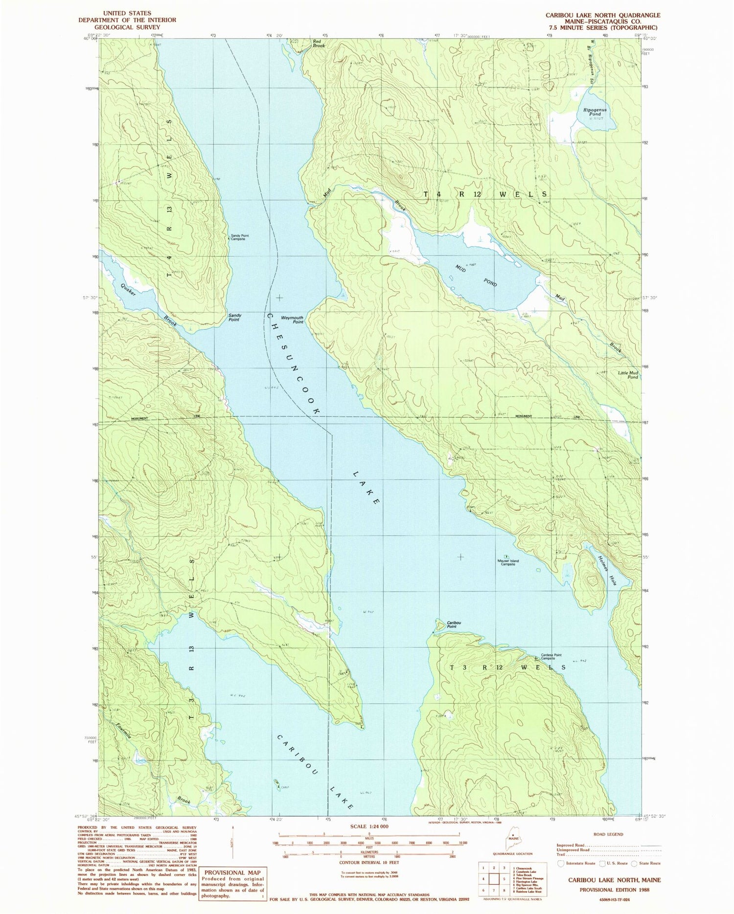
MyTopo
Classic USGS Caribou Lake North Maine 7.5'x7.5' Topo Map
Regular price
$16.95
Regular price
Sale price
$16.95
Unit price
per
Couldn't load pickup availability
Historical USGS topographic quad map of Caribou Lake North in the state of Maine. Typical map scale is 1:24,000, but may vary for certain years, if available. Print size: 24" x 27"
This quadrangle is in the following counties: Piscataquis.
The map contains contour lines, roads, rivers, towns, and lakes. Printed on high-quality waterproof paper with UV fade-resistant inks, and shipped rolled.
Contains the following named places: Caribou Point, Chesuncook Lake, Fourmile Brook, Holmes Hole, Mud Brook, Mud Pond, Otter Brook, Quaker Brook, Red Brook, Ripogenus Pond, Sandy Point, Weymouth Point, Cardesa Point Campsite, Mauser Island Campsite, T4 R12 WELS, T3 R12 WELS


