MyTopo
Classic USGS Carlin Flat South Dakota 7.5'x7.5' Topo Map
Regular price
$16.95
Regular price
Sale price
$16.95
Unit price
per
Couldn't load pickup availability
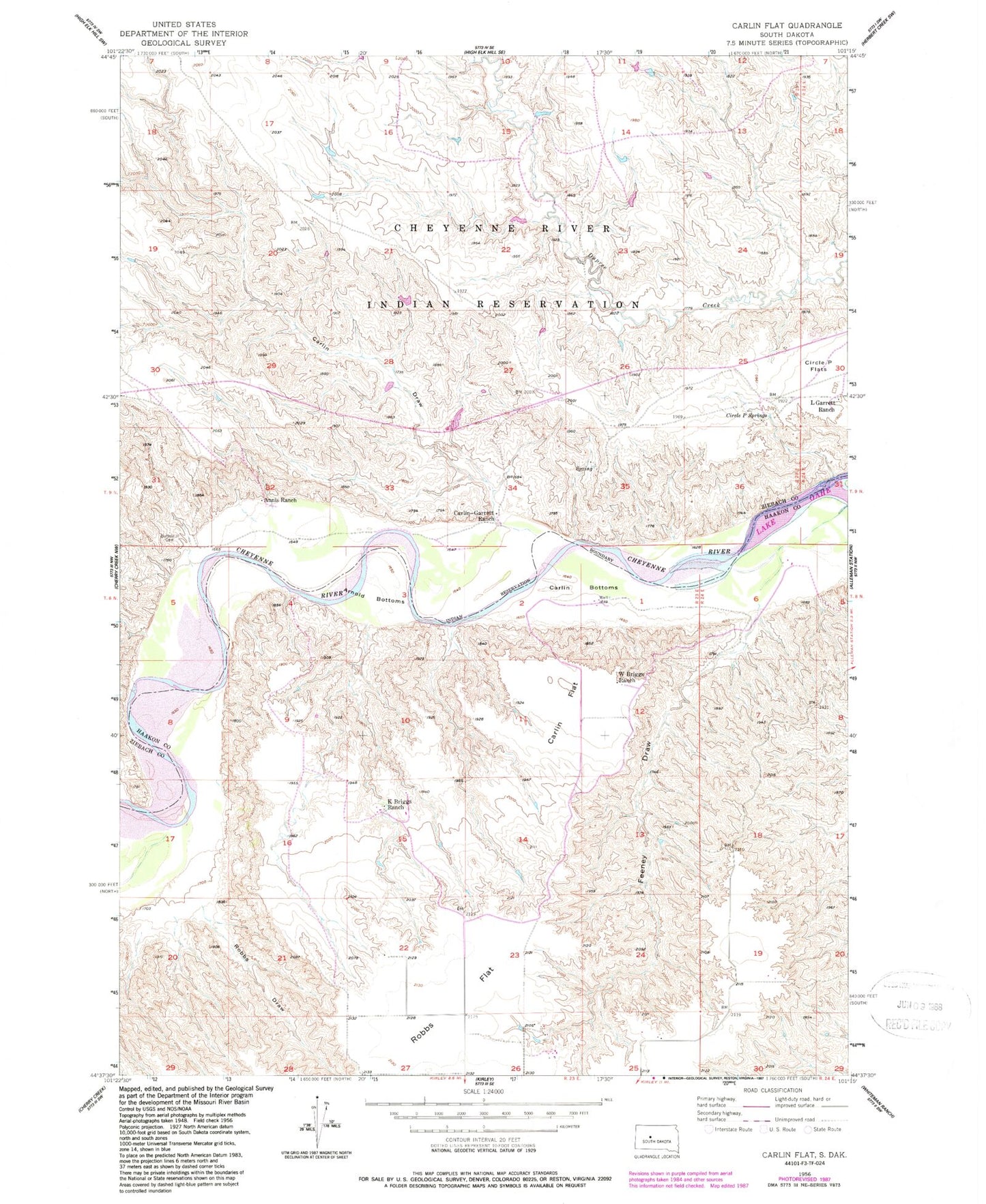
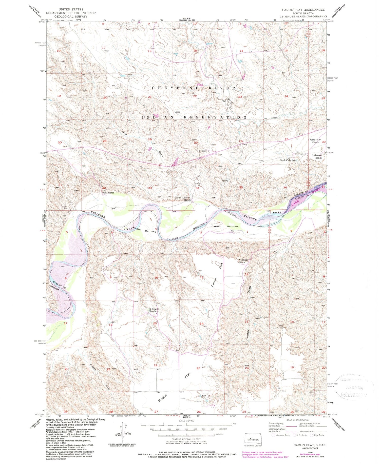
Historical USGS topographic quad map of Carlin Flat in the state of South Dakota. Map scale may vary for some years, but is generally around 1:24,000. Print size is approximately 24" x 27"
This quadrangle is in the following counties: Haakon, Ziebach.
The map contains contour lines, roads, rivers, towns, and lakes. Printed on high-quality waterproof paper with UV fade-resistant inks, and shipped rolled.
Contains the following named places: Annis Ranch, Arnold Bottoms, Buffalo Cemetery, Carlin, Carlin Bottoms, Carlin Draw, Carlin Flat, Carlin School, Carlin-Garrett Ranch, Circle P Springs, Feeney Draw, Hamilton Airstrip, K Briggs Ranch, L Garrett Ranch, Robbs Draw, W Briggs Ranch