MyTopo
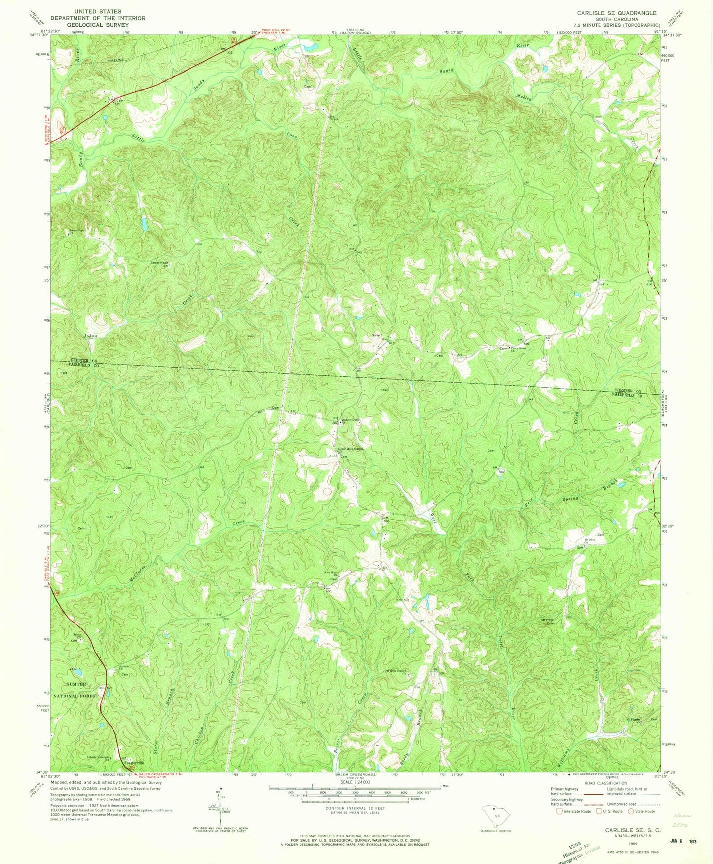
Classic USGS Carlisle SE South Carolina 7.5'x7.5' Topo Map
Couldn't load pickup availability
Historical USGS topographic quad map of Carlisle SE in the state of South Carolina. Map scale may vary for some years, but is generally around 1:24,000. Print size is approximately 24" x 27"
This quadrangle is in the following counties: Chester, Fairfield.
The map contains contour lines, roads, rivers, towns, and lakes. Printed on high-quality waterproof paper with UV fade-resistant inks, and shipped rolled.
Contains the following named places: Antioch Cemetery, Antioch Church, Beaver Creek Cemetery, Beaver Creek Church, Castles - Stevenson Cemetery, Charles Cemetery, Coleman Cemetery, Coon Creek, Dennis Crosby Cemetery, Fairfield County Fire Department Feasterville, Feasterville, Featerville Academy Historic District, Featerville Community Center, Featerville Male and Female Academy, Hope Station School, Liberty Universal Church, Little Sandy River, Mizpah Presbyterian Church, Mobley Creek, Momans Mill, Mount Olive Cemetery, Mount Olive Church, Mount Olive School, Mount Pilgrim Church, Mount Pilgrim School, New Hope Church, Old Hope Station Church, Piney Grove Church, Purity Church, Purity School, Roberts Cemetery, Spring Branch, Sweet Hope Cemetery, Sweet Hope Church, Upper Hope Station Church, Weir Creek, Wiley Coleman Cemetery