MyTopo
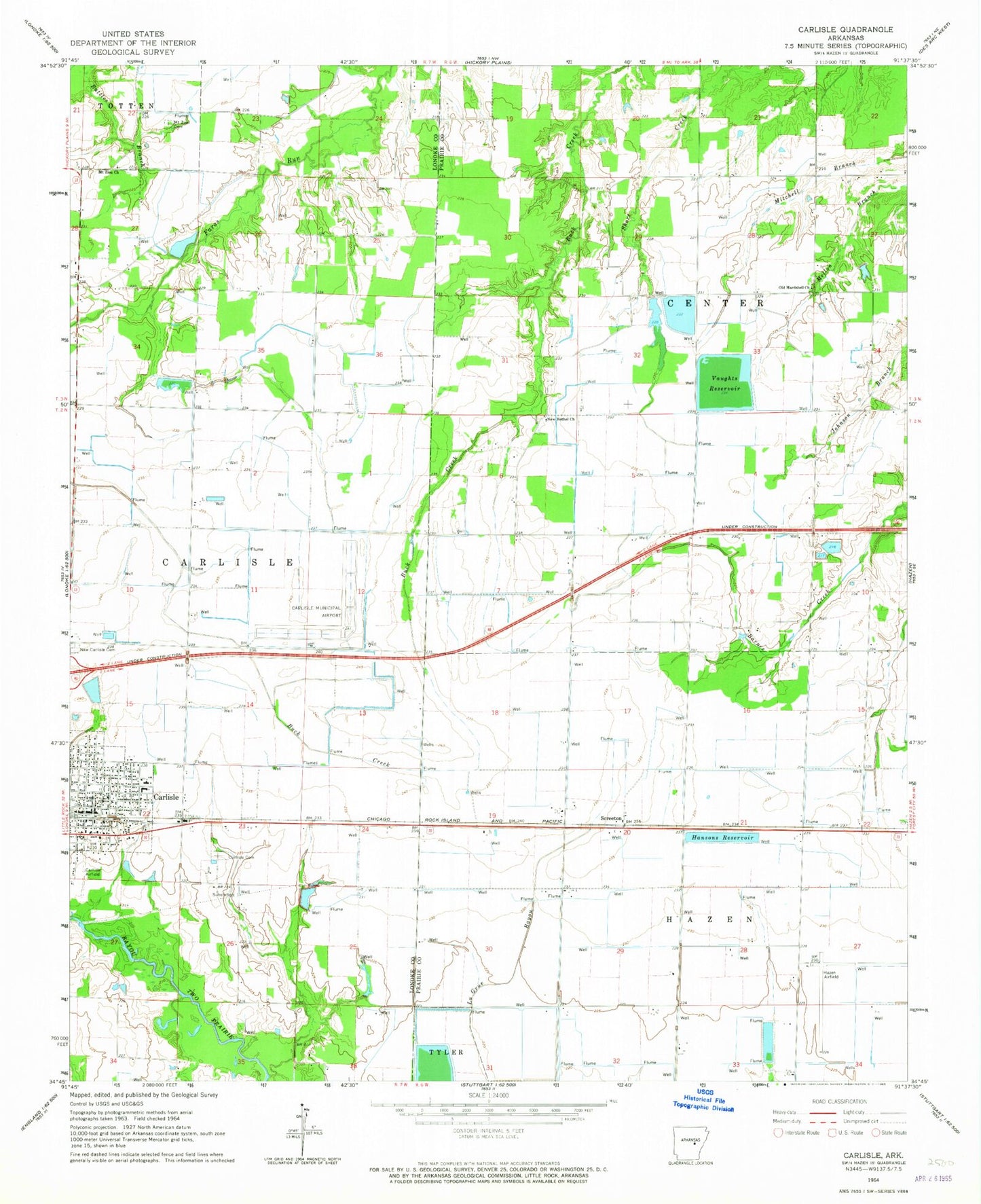
Classic USGS Carlisle Arkansas 7.5'x7.5' Topo Map
Couldn't load pickup availability
Historical USGS topographic quad map of Carlisle in the state of Arkansas. Map scale may vary for some years, but is generally around 1:24,000. Print size is approximately 24" x 27"
This quadrangle is in the following counties: Lonoke, Prairie.
The map contains contour lines, roads, rivers, towns, and lakes. Printed on high-quality waterproof paper with UV fade-resistant inks, and shipped rolled.
Contains the following named places: Anderson School, Barretsville School, Barrettsville, Battles Branch, Carlisle, Carlisle Cemetery, Carlisle Elementary School, Carlisle High School, Carlisle Municipal Airport, Carlisle Police Department, Carlisle Post Office, Carlisle Volunteer Fire Department, Center Point Fire Department, City of Carlisle, Cuneo, Cuneo School, Hansons Reservoir, Hazen Municipal Airport, Immanuel Baptist Church, Lake Treadway, Lake Treadway Dam, Mount Pleasant Cemetery, Mount Pleasant Church, Mount Zion Cemetery, Mount Zion Church, New Bethel Church, New Bethel School, Old Hardshell Church, Paradise School, Prairie Center, Saint Rose Catholic Church, Screeton, Southern Care Carlisle, Tittler School, Township of Carlisle, Township of Center, Vaughts Reservoir, Zion Hill Church, Zion Hill School, ZIP Code: 72024