MyTopo
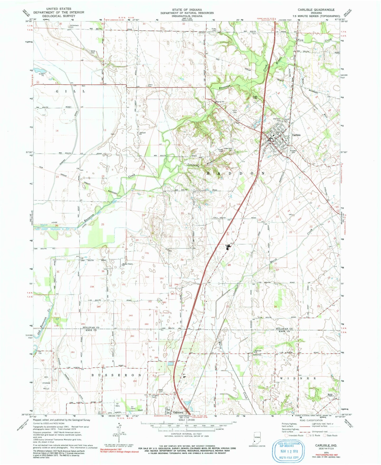
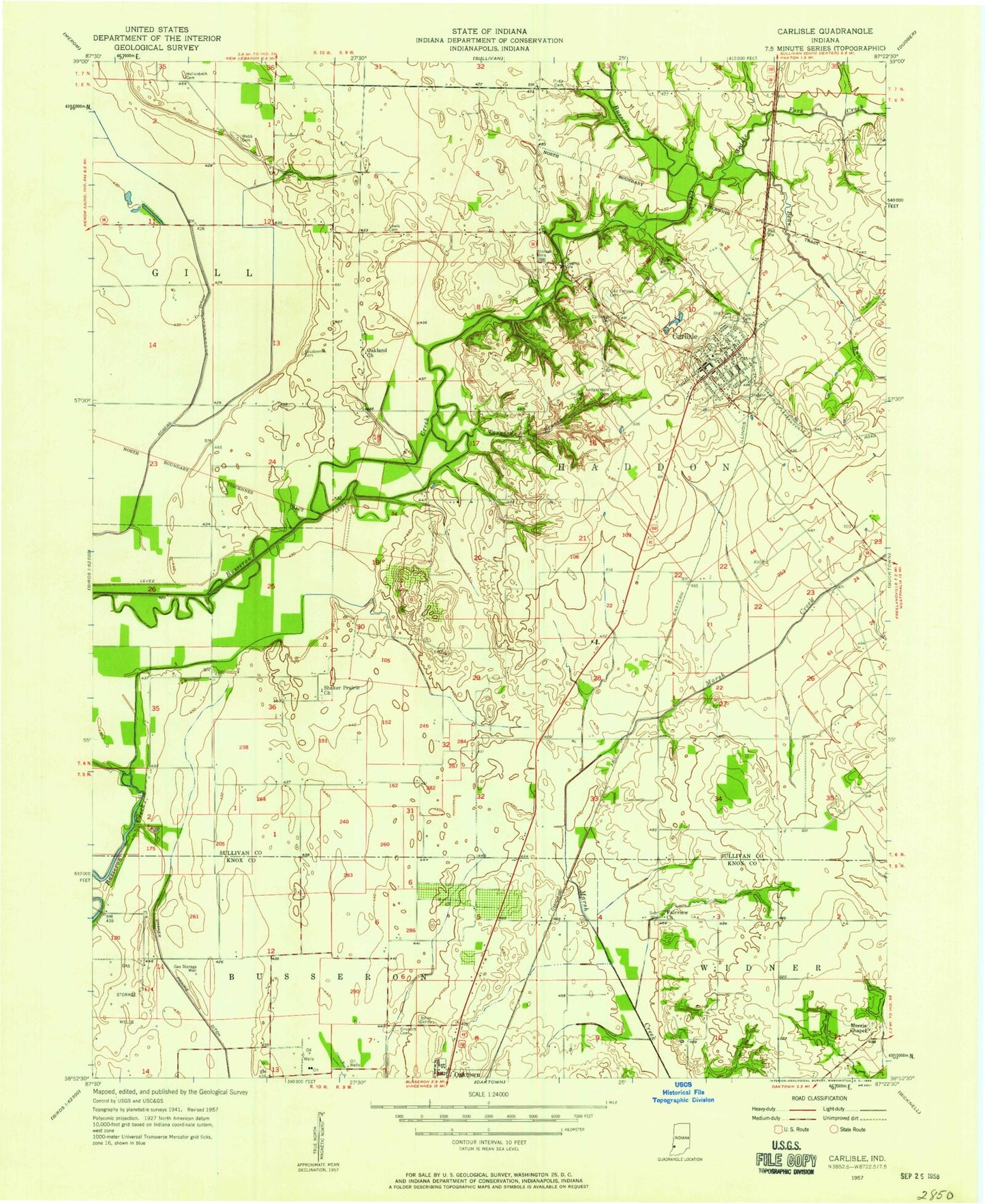
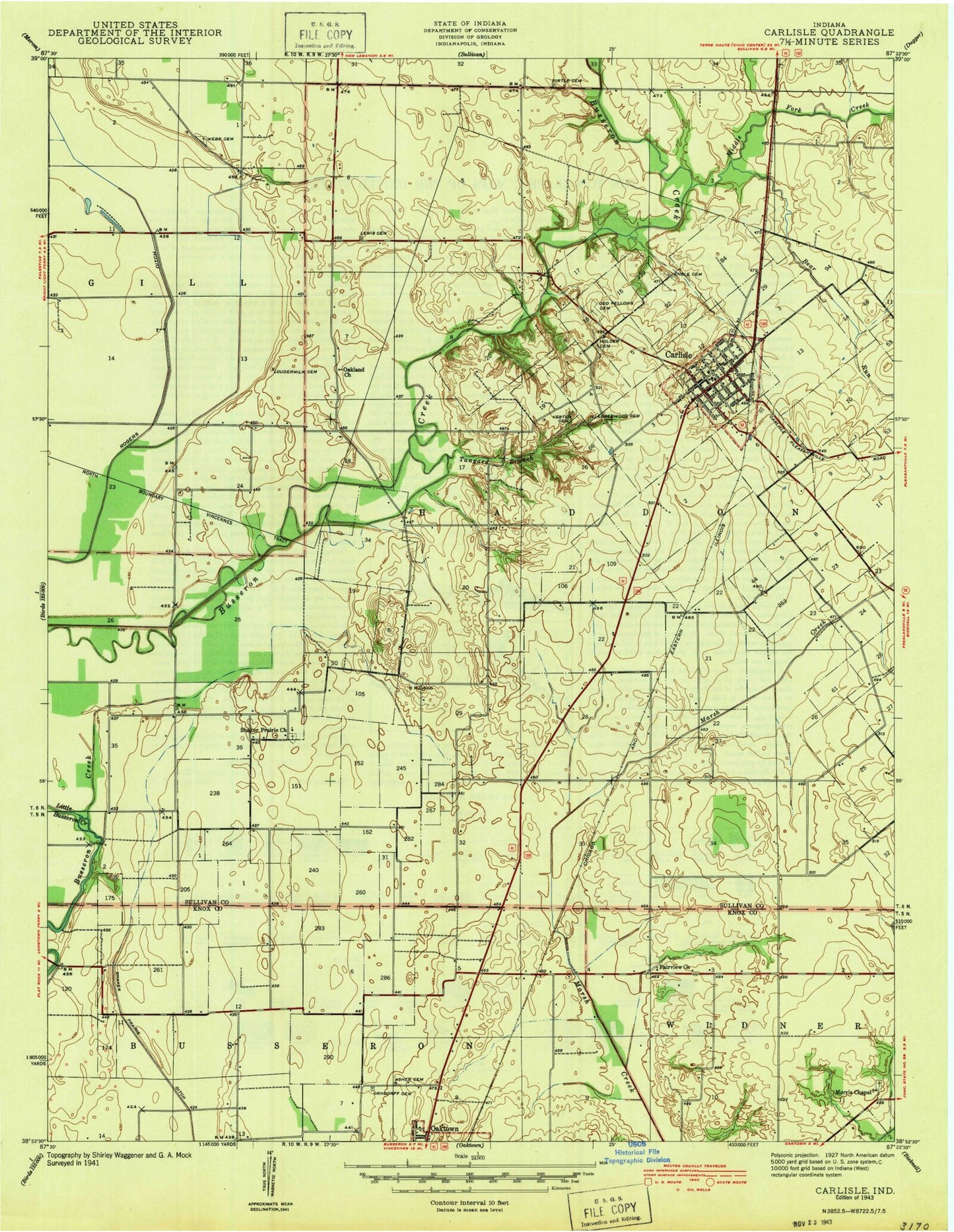
Classic USGS Carlisle Indiana 7.5'x7.5' Topo Map
Couldn't load pickup availability
Historical USGS topographic quad map of Carlisle in the state of Indiana. Map scale may vary for some years, but is generally around 1:24,000. Print size is approximately 24" x 27"
This quadrangle is in the following counties: Knox, Sullivan.
The map contains contour lines, roads, rivers, towns, and lakes. Printed on high-quality waterproof paper with UV fade-resistant inks, and shipped rolled.
Contains the following named places: Bear Run, Carlisle, Carlisle - Haddon Township Fire Department, Carlisle Elementary and Junior High School, Carlisle Lions Community Ambulance Service, Carlisle Odd Fellows Cemetery, Carlisle Old Town Cemetery, Carlisle Post Office, Dooley Cemetery, Engle Cemetery, Fairview Church, Griswold Station, Haddon Cemetery, Hollenback Cemetery, Ledgerwood Cemetery, Lewis Cemetery, Marsh Creek, Middle Fork Creek, Morris Chapel, Oakland Church, Orndorff Cemetery, Pirtle Cemetery, Ridgway Flying Service, Rogers Ditch, Shaker Prairie Church, Tanyard Branch, Town of Carlisle, Township of Haddon, Vester Cemetery, Wabash Valley Correctional Facility, Webb Cemetery, ZIP Code: 47838